Just 30 Minutes From the Las Vegas Strip, These Red Rock Trails Feel a World Away
Just 30 minutes from the Las Vegas Strip, Red Rock National Conservation Area is an incredible desert gem. One minute you’re surrounded by casinos, neon lights, and traffic. The next, you’re driving into a quiet desert landscape filled with towering cliffs and wide open valleys.
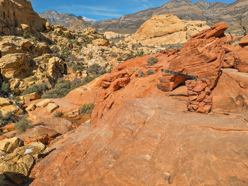
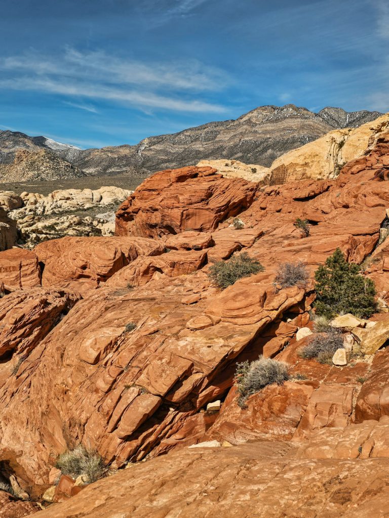
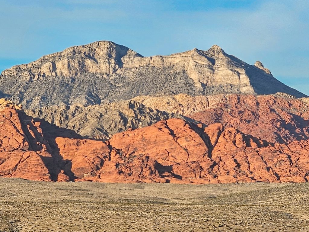
Red Rock is part of the Mojave Desert, the smallest and driest desert in North America. The scenery here is dramatic and actually quite varied. The eastern side of the park is famous for its deep red sandstone formations around the Calico Hills, while the northern and western areas transition into more muted gray and tan limestone mountains.
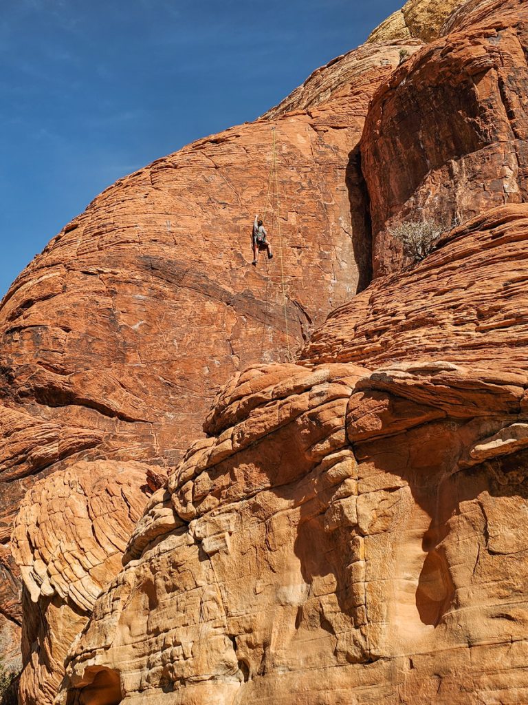
Those iconic red cliffs were originally formed from massive sand dunes about 180 million years ago. Over time, the sand hardened into sandstone, and the sweeping curves and layers you see today were shaped as the dunes shifted in the wind. Today, the rugged cliffs attract rock climbers from around the world.
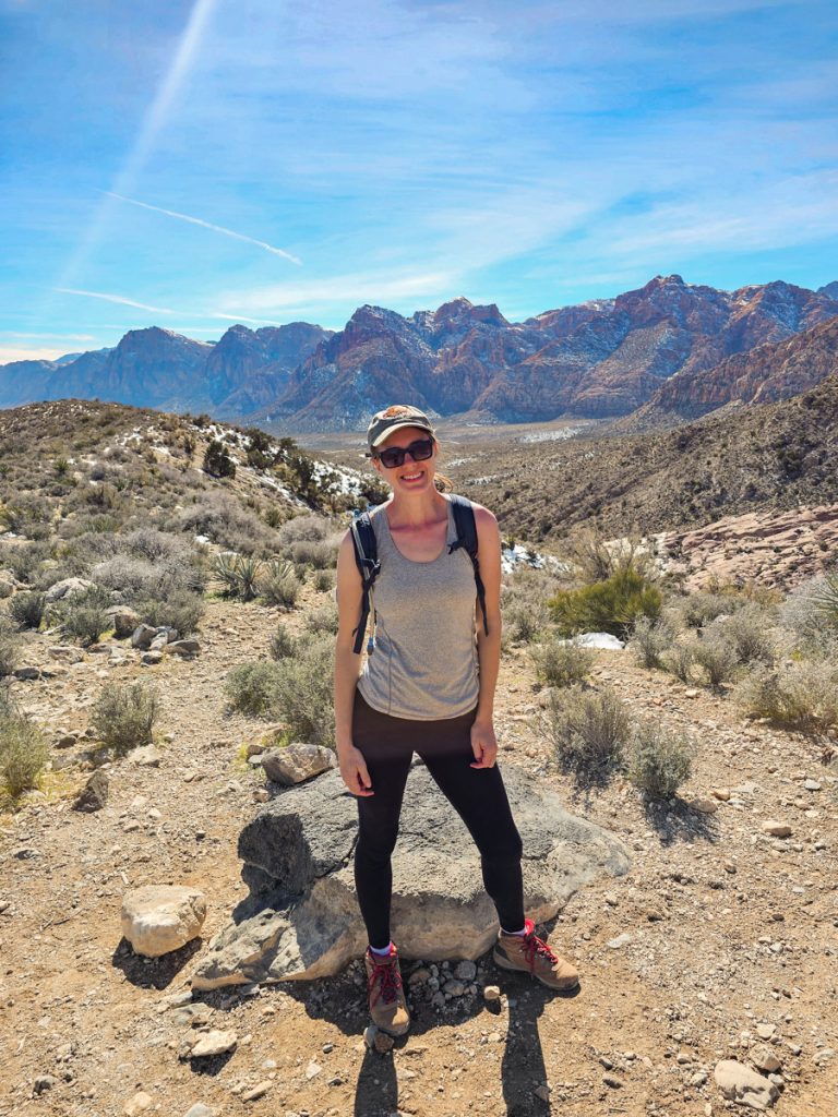
There is a lot to see and do in Red Rock NCA, but so far, I’ve just spent one day in the park. I absolutely loved my time here, though, it ended up being one of my favorite days of this hiking trip.
I managed to fit in five hikes along with several viewpoints, and the beautiful scenery and fun scrambling trails made it a truly such a delightful surprise.
The Day’s Itinerary
Red Rock is organized around a 13-mile one-way Scenic Drive, which means you’ll move through the park in order as you stop at trailheads and viewpoints. The Drive is shaped like a horseshoe that you move through counterclockwise, so you end up exiting just 1 mile southwest of where you start. Once you pass something, you can’t loop back without completing the full drive, so you definitely should have a plan and a map before starting.
I arrived at the park around 9:00am and stopped briefly at the Visitor Center to grab a map (I highly recommend you have a park map so you know exactly where you’re stopping). After getting some info, I was hiking my first trail by about 9:30 and finished the final stop of the day around 4:30pm. So all of this is definitely doable within the time frame of a single day.
The itinerary below follows the same order you’ll encounter these stops along the Scenic Drive.
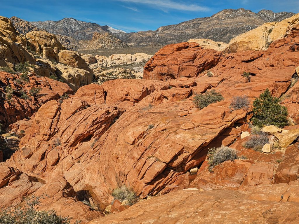
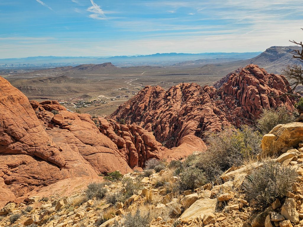
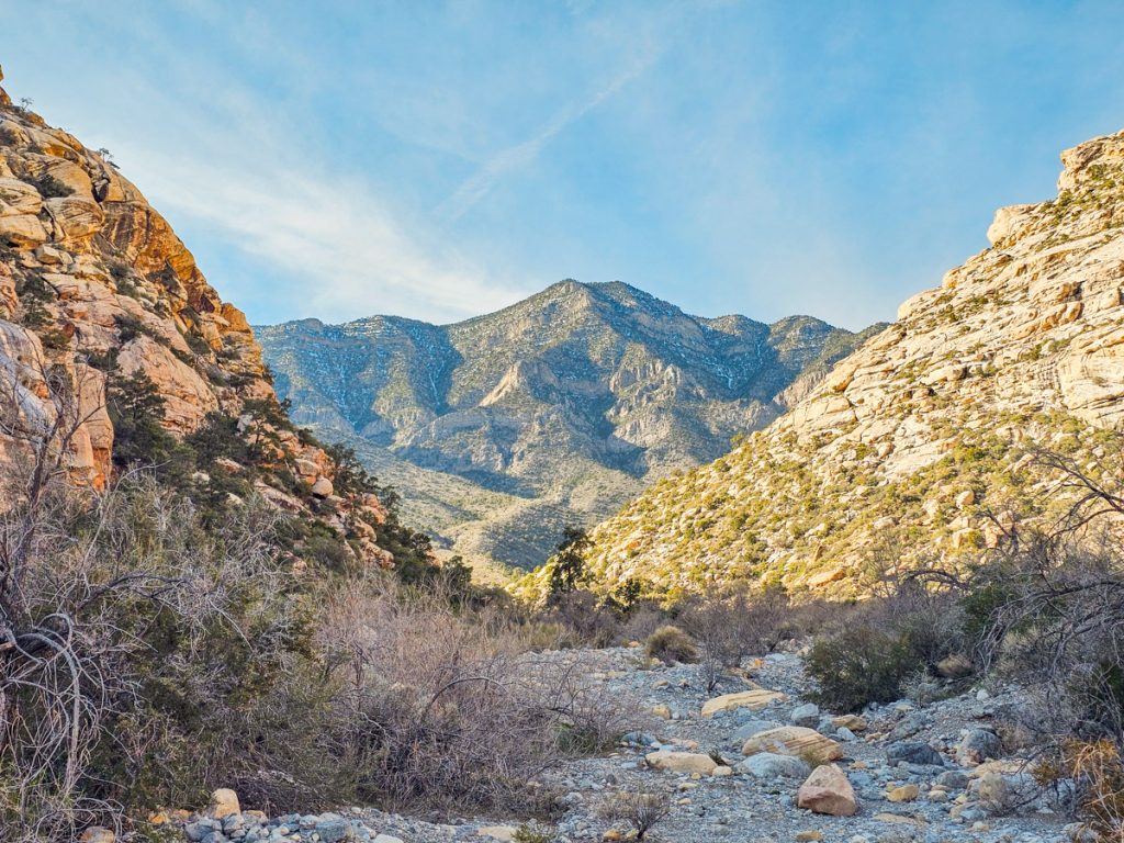
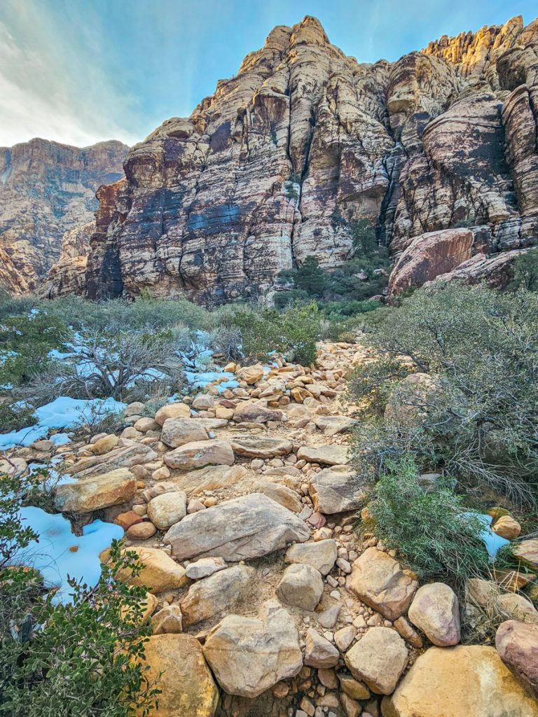
1. Calico Tanks
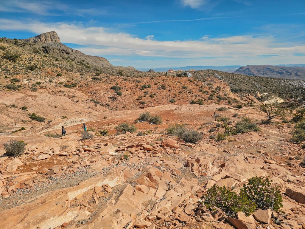
This was a 10/10 hike for me and had so many things I love about hiking in the Southwest. You’re surrounded by deep red Calico Hills sandstone, hiking through a canyon, scrambling over rock, and the views are dramatic and constantly changing. Seriously, a fantastic trail.
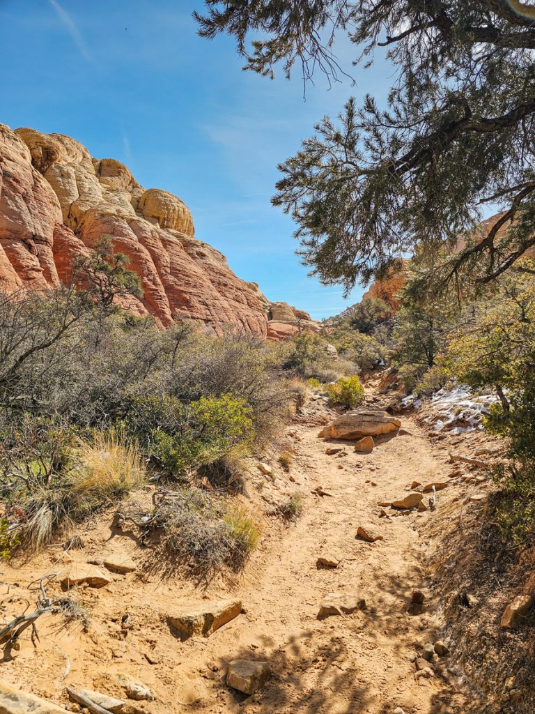
The parking lot is on the right side of the road, right up against the Calico Hills. The trail begins by wrapping around the end of the formation to the backside of the Calico Hills. This first section is pretty much just walking on flat ground through a sandy wash, but once you swing behind the mountains, the canyon narrows and the scrambling begins, and it gets so fun. Poles mark the route, but you’re essentially just working your way higher and deeper into the canyon.
There are ledges, slabs, rock piles, and natural stone “steps” to climb on as you gain elevation through the canyon. The sandstone is nice and grippy, which makes the scrambling feel secure, though I’d still recommend wearing hiking shoes if you have them.
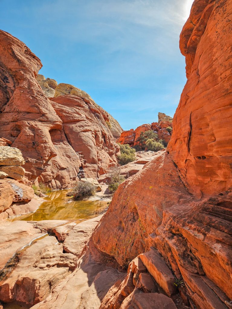
As you climb, you’ll get increasingly beautiful views looking back down the red and tan canyon, dotted with green desert shrubs and trees. This area is also popular with rock climbers, so you may see people scaling the cliffs as you hike.
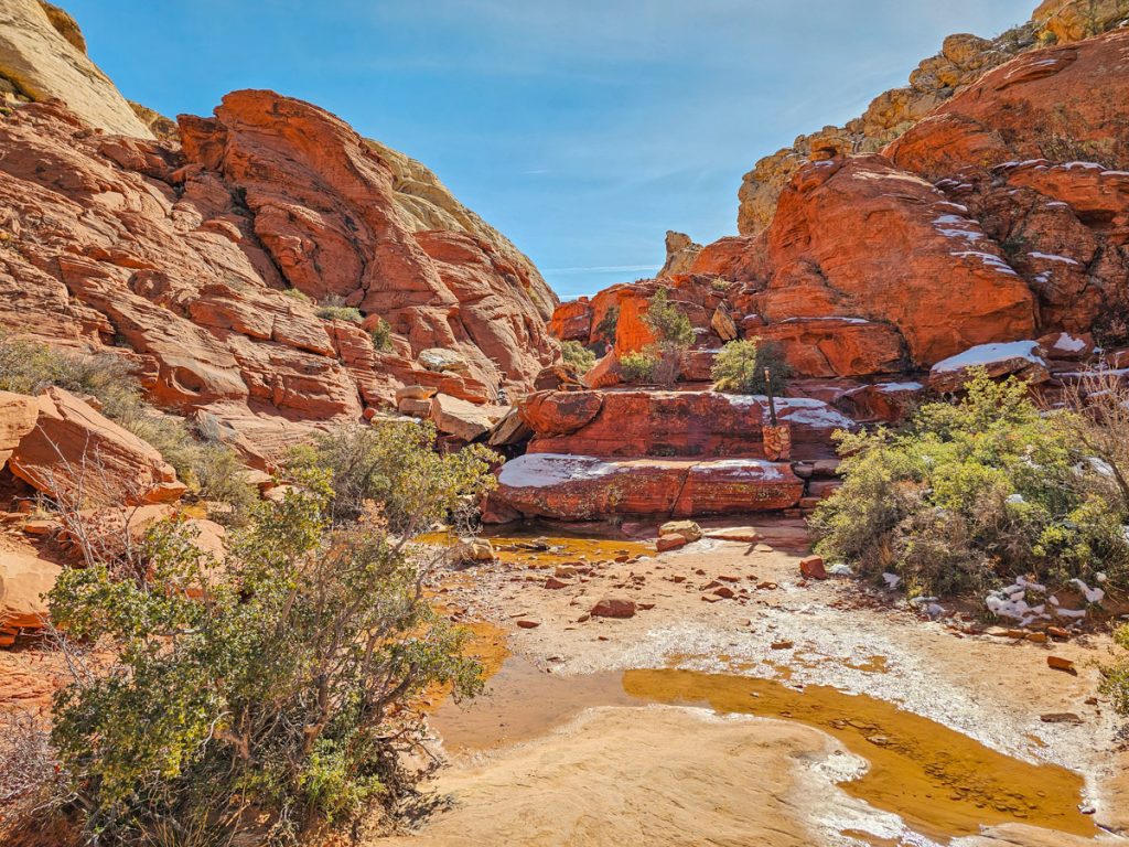
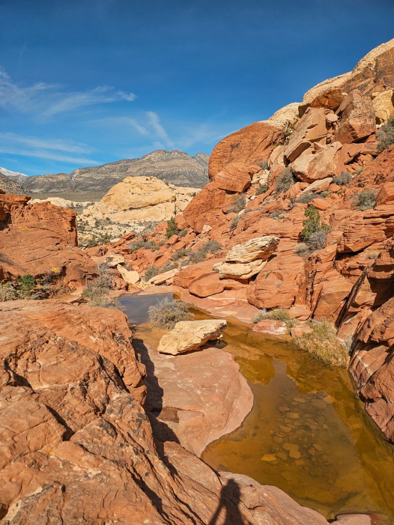
Depending on recent weather, you may also see small seasonal pools called tinajas along the route. There had been a big snowstorm the week before I visited, so several of the pools were full, which made the trail even more beautiful.
The trail ends at an incredible panoramic viewpoint overlooking the Calico Hills, the valley of Red Rock Canyon, and the Las Vegas Valley in the distance. On a clear day you can even spot the casinos on the Las Vegas Strip.

Trail Stats:
🚶♀️ Distance: 2.2 miles
📈 Elevation Gain: 400 feet
⏱️ Time: 1.5 – 2 hours (the scrambling slows things down)
🥾 Difficulty: Moderate
✍️ Tip: Don’t confuse this trail with Calico Hills, where you walk along the base of the red mountains
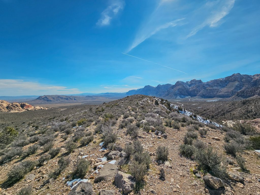
2. High Point Overlook
After hiking Calico Tanks, I’d recommend stopping at one of the named panoramic viewpoints in Red Rock Canyon: High Point Overlook. This overlook is located about a third of the way through the Drive, near the start of the horseshoe “curve” the road makes. It has a small parking area right along the Scenic Drive, and because it sits near the back side of the park, it offers wide, sweeping views across the entire valley.
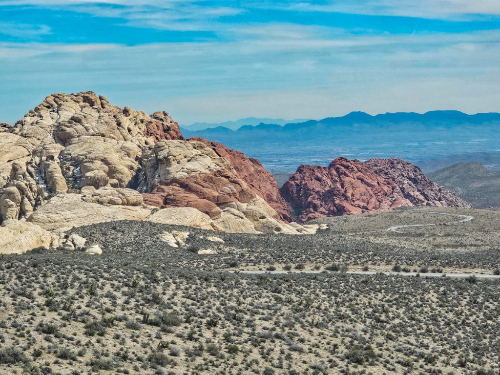
From here you can look out over the desert landscape, with the red sandstone formations to the left and the lighter sandstone mountains to the right. It’s a quick stop, but a nice place to take in the scale of the landscape before continuing along the scenic drive.
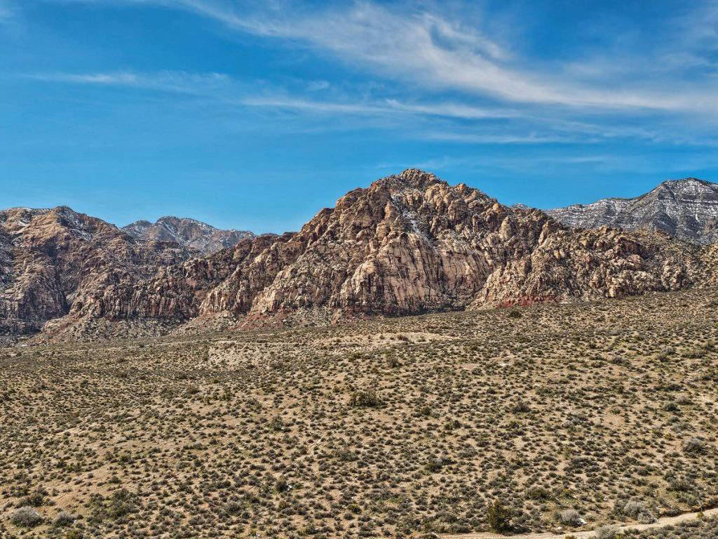
3. Keystone Thrust
This hike leads you to one of the most important geological features in Red Rock Canyon: the Keystone Thrust Fault. Along the trail you’ll see a contrast between the red sandstone that defines much of the park and the gray limestone layers that dominate this area (most of the hike is actually through the limestone).
The trail rolls gently up and down across several ridges, with gradual elevation changes for most of the route. As you hike, you’ll get nice views over the surrounding mountains and the desert valley below. It’s a pleasant walk with some interesting scenery, but overall it felt a bit less dramatic than some of the other hikes in the park.
The Keystone Thrust itself is part of a massive fault system that stretches all the way into Canada and began forming about 65 million years ago. Here, ancient gray limestone that once formed on the floor of an ocean was pushed up and over the younger red sandstone layers beneath it, creating one of the most visible examples of a thrust fault in the region.
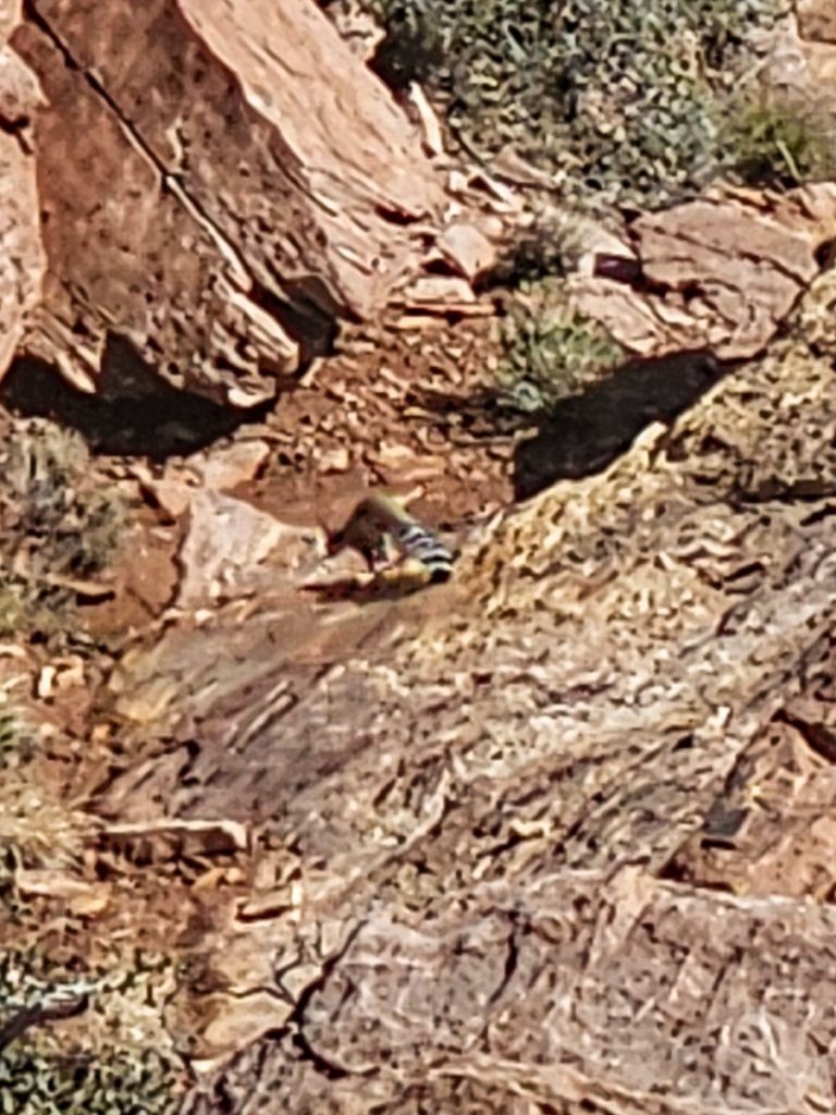
I enjoyed this hike and thought it was a nice, mostly easy experience. I also happened to see a ringtail cat here, which was a very fun surprise! That said, if you’re short on time, this would probably be the first trail I’d remove from the itinerary.

Trail Stats:
🚶♀️ Distance: 2.4 miles
🥾 Elevation Gain: 350 feet
⏱️ Time: 1–1.5 hours
📈 Difficulty: Easy, with a couple of moderate sections
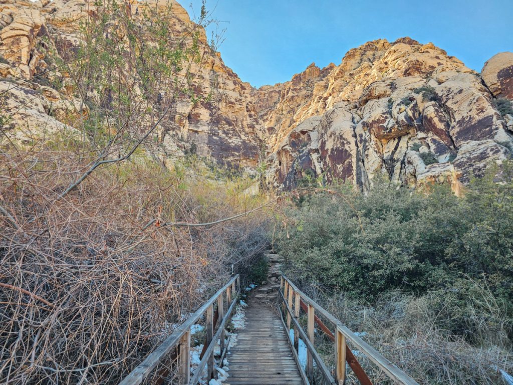
4. Lost Creek/Children’s Discovery Trail
This trail was a delightful surprise. I thought it was going to be more of a simple filler walk through the valley, but it actually ended up being one of my favorite spots of the day.
The hike starts as an easy, flat walk across the valley and then a boardwalk toward the canyon wall.
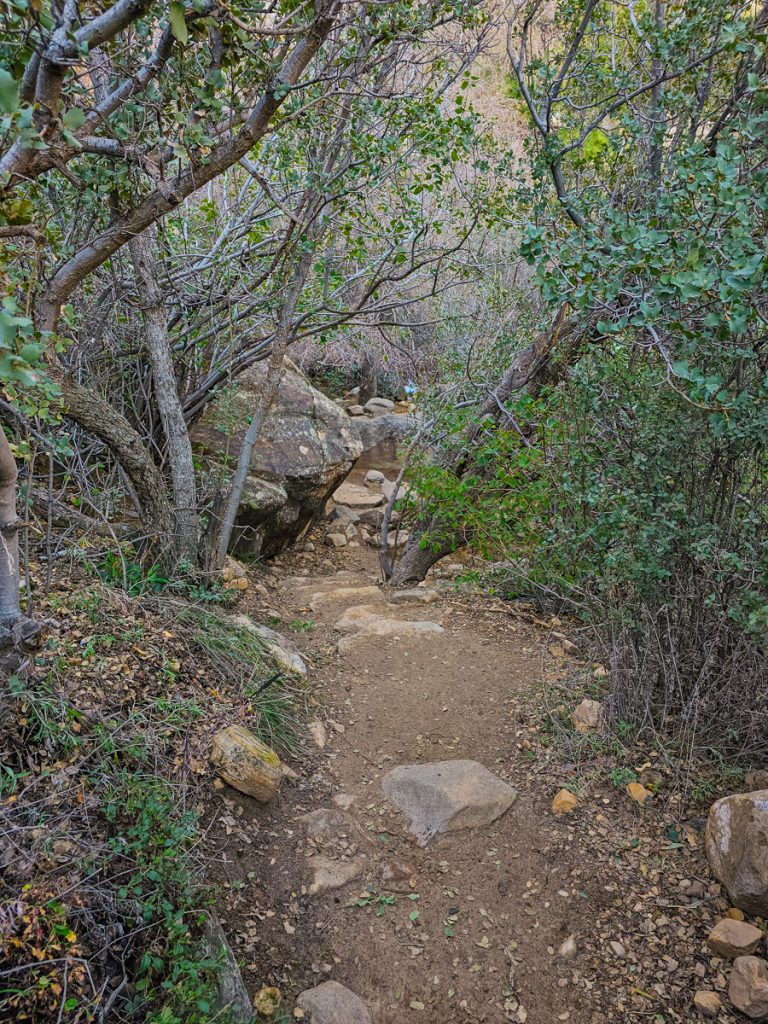
The path continues into a more shaded, almost forested area where you’ll cross a small stream by hopping across rocks. Soon you’ll reach the end of the dirt path at a spot where the stream cascades gently over some rocks into a shallow pool. It’s easy to think this is the destination since the dirt path stops, but the real highlight is just a little farther ahead.
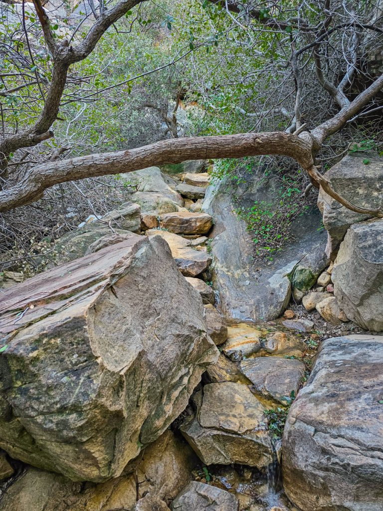
Look for the rocky “steps” on the left side of the trail and start climbing up. It isn’t an official staircase, just a series of rocks that naturally form steps leading upward. When I was here, there was a very shallow “stream” flowing over these rocks.
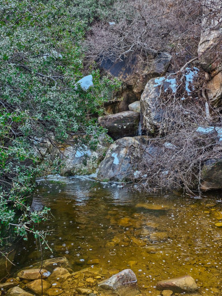
After a few minutes, you’ll emerge from the trees at a beautiful waterfall spilling over a curved cliff face into a calm pool of water. Seeing a waterfall tucked into the middle of the desert is a pretty incredible sight.
You can also scramble around the boulders near the pool and go behind the waterfall, which is very cool and definitely worth doing.
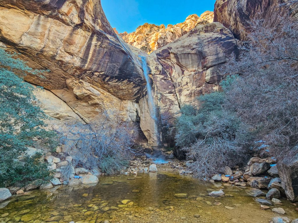
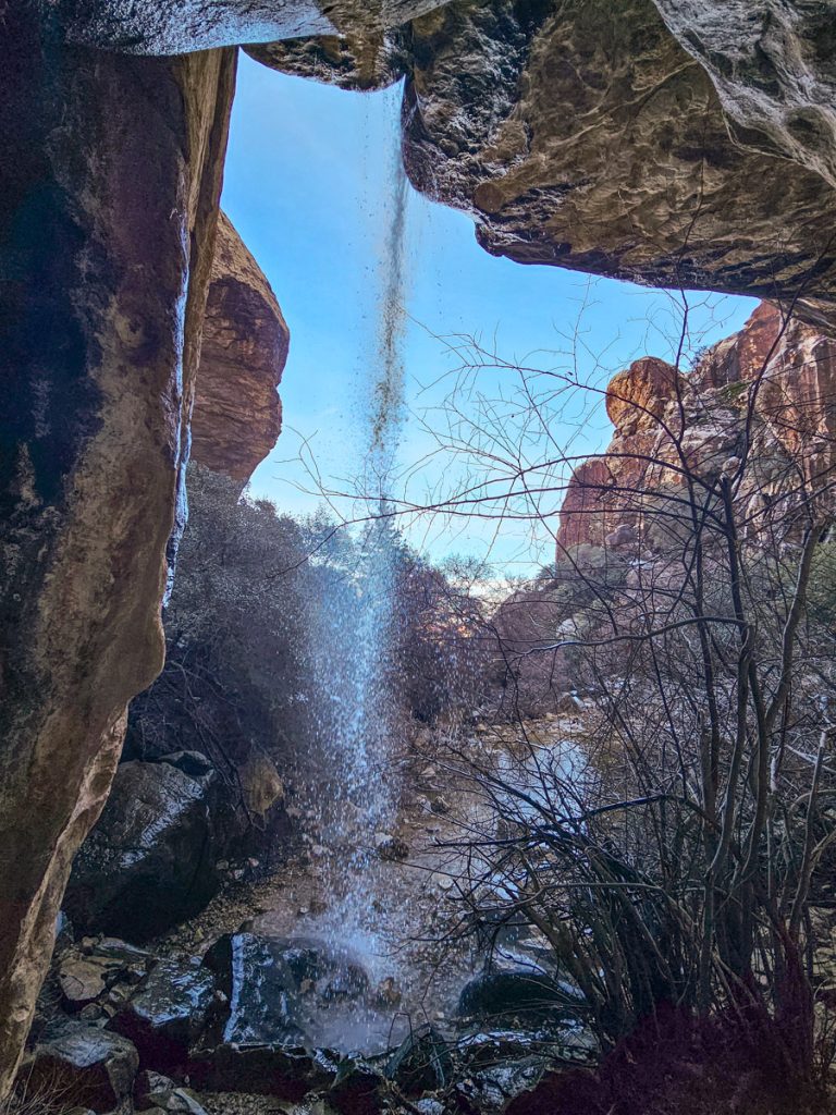
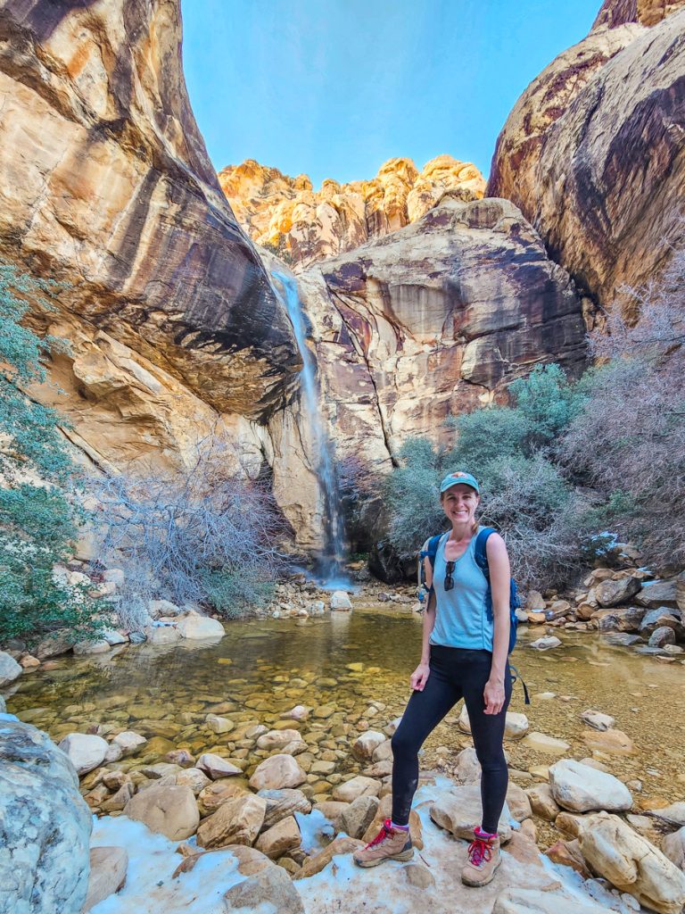
The waterfall is seasonal, typically flowing from December through April or after significant rain or snow. During the hotter summer months, it usually dries up.
Trail Stats:
🚶♀️ Distance: ~0.7 miles
🥾 Elevation Gain: 80 feet
⏱️ Time: 30-45 minutes
📈 Difficulty: Easy (with a slightly harder scramble near the end)
5. Petroglyph Trail
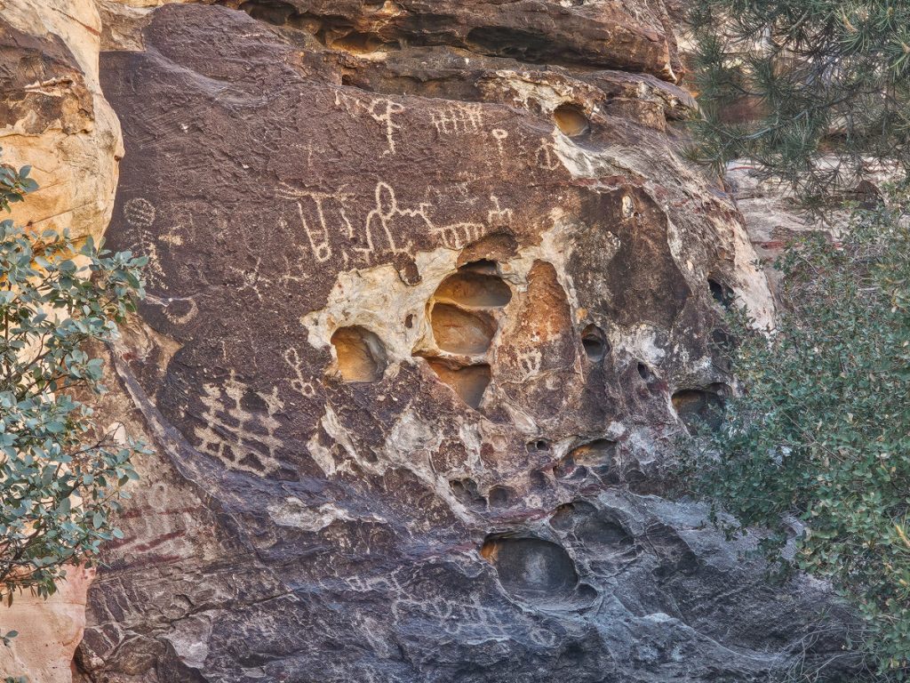
Just beyond the trailhead for Lost Creek is the Petroglyph Trail, an incredibly short 0.2-mile walk that leads to a small panel of Native American rock art on the canyon wall. Here you can see both petroglyphs (carvings etched into the rock) and pictographs (painted images).
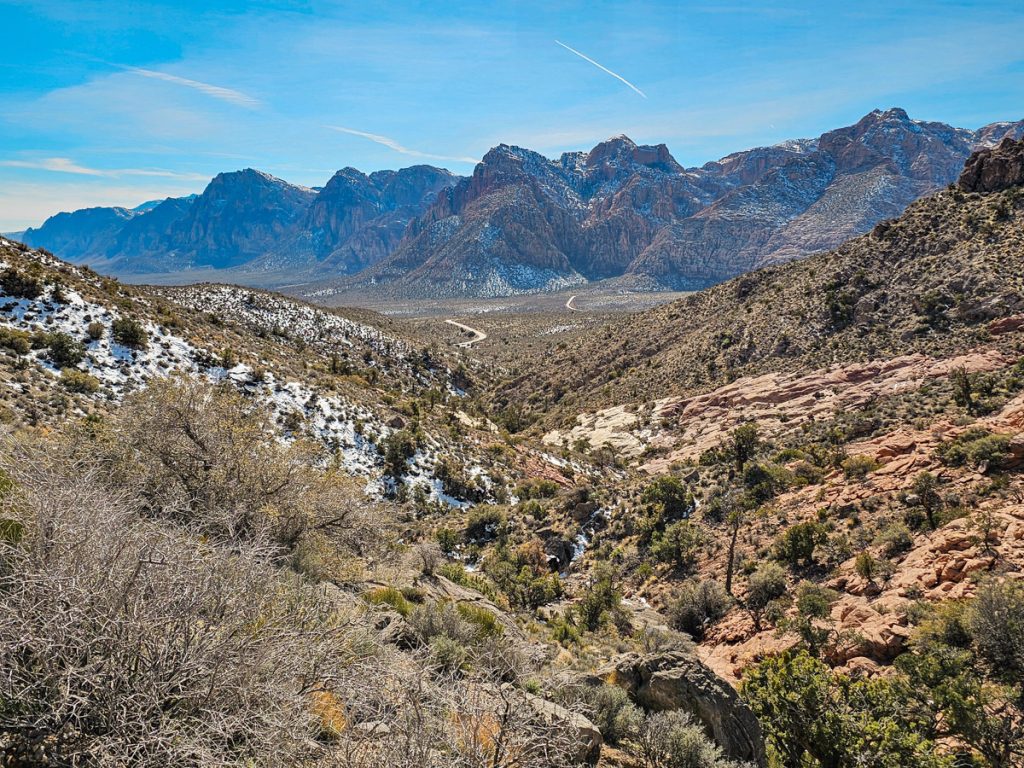
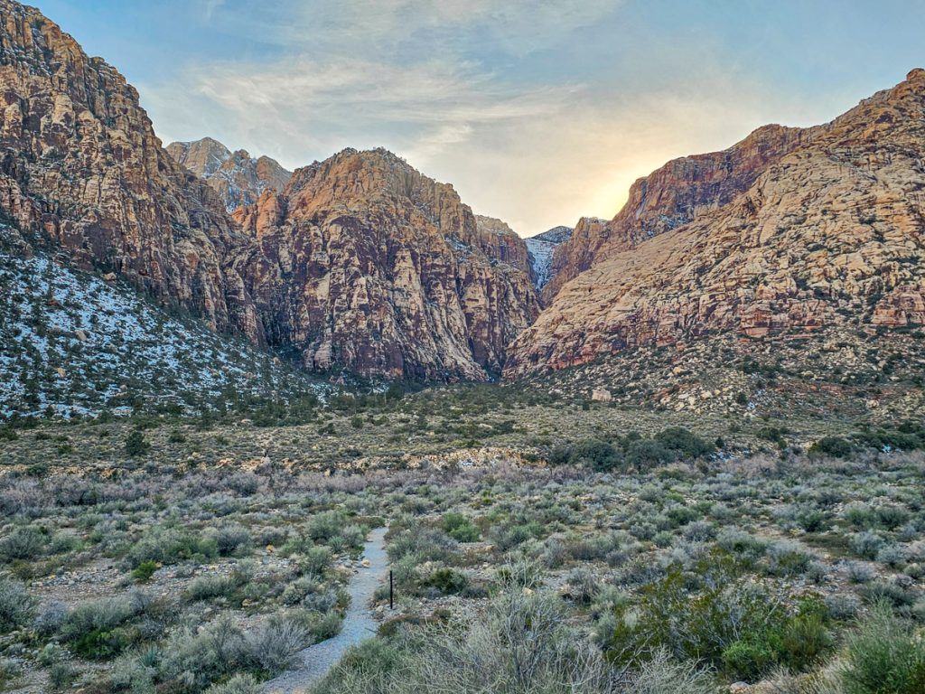
6. Ice Box Canyon
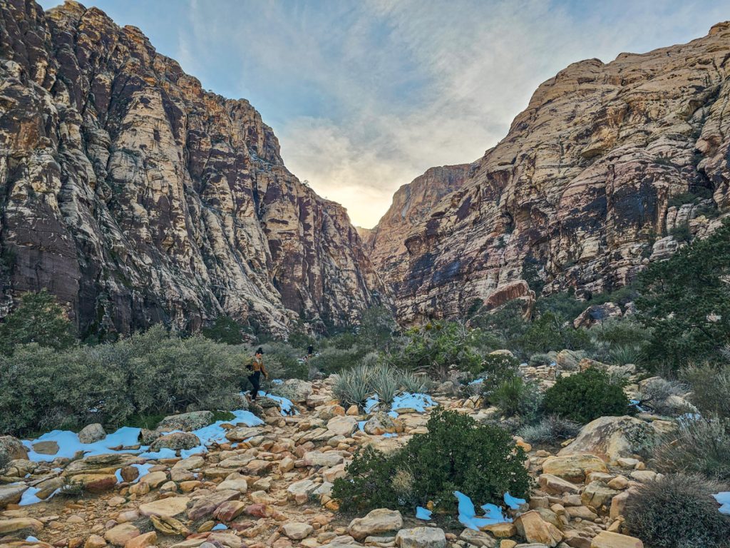
Ice Box Canyon is a fun and very scenic hike that takes you deep into one of the narrow canyons in Red Rock Canyon. Because of the tall canyon walls and the tight passage between them, this trail stays much cooler than the surrounding desert – thus the name. It’s actually one of the few hikes in Vegas that you can safely and comfortably do during the hotter summer months.
The hike is about 2 miles round trip, though you can easily turn around whenever you want since the trail simply follows the canyon upward. Even though the distance isn’t long, it gets more strenuous the farther you go because the terrain is uneven and gets pretty rocky.
The first part of the hike is a 1/3 mile walk across the mostly flat valley floor to reach the mouth of the canyon. Once you enter the canyon, the scenery becomes much more dramatic as the walls rise up around you and the trail grows rockier. Patches of greenery line the canyon floor, and a small stream sometimes flows through the wash below the trail. If you turn around as you climb, you’ll also get great views looking back out of the canyon toward the red Calico Hills across the valley.
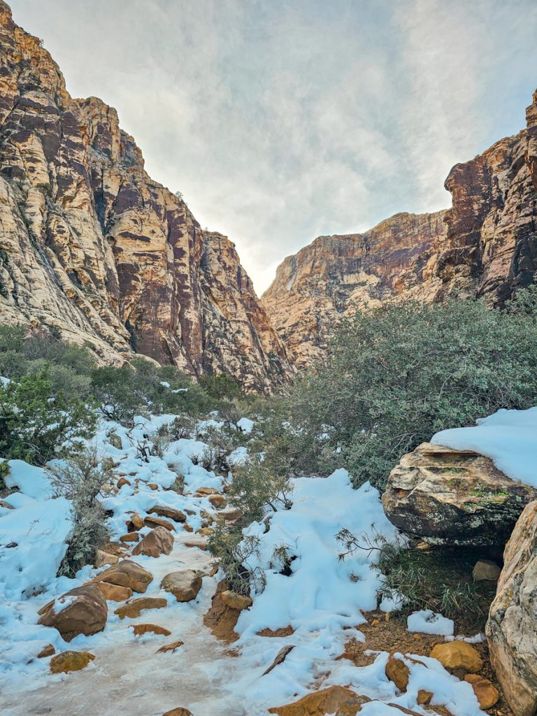
A good reminder of how shaded this canyon can be: as mentioned previously, Red Rock got quite a bit of snow a week before my visit. The other trails I did had little or no snow left, but Ice Box Canyon still had quite a bit of snow and ice as I went farther in.
About halfway through the canyon, the route drops from the higher riverbank down to the rocky creek bed. From there, you continue scrambling over large boulders as you work your way farther up the canyon. This is where I ended up turning around, as the combination of snow and higher water from the melt made it difficult to continue safely.
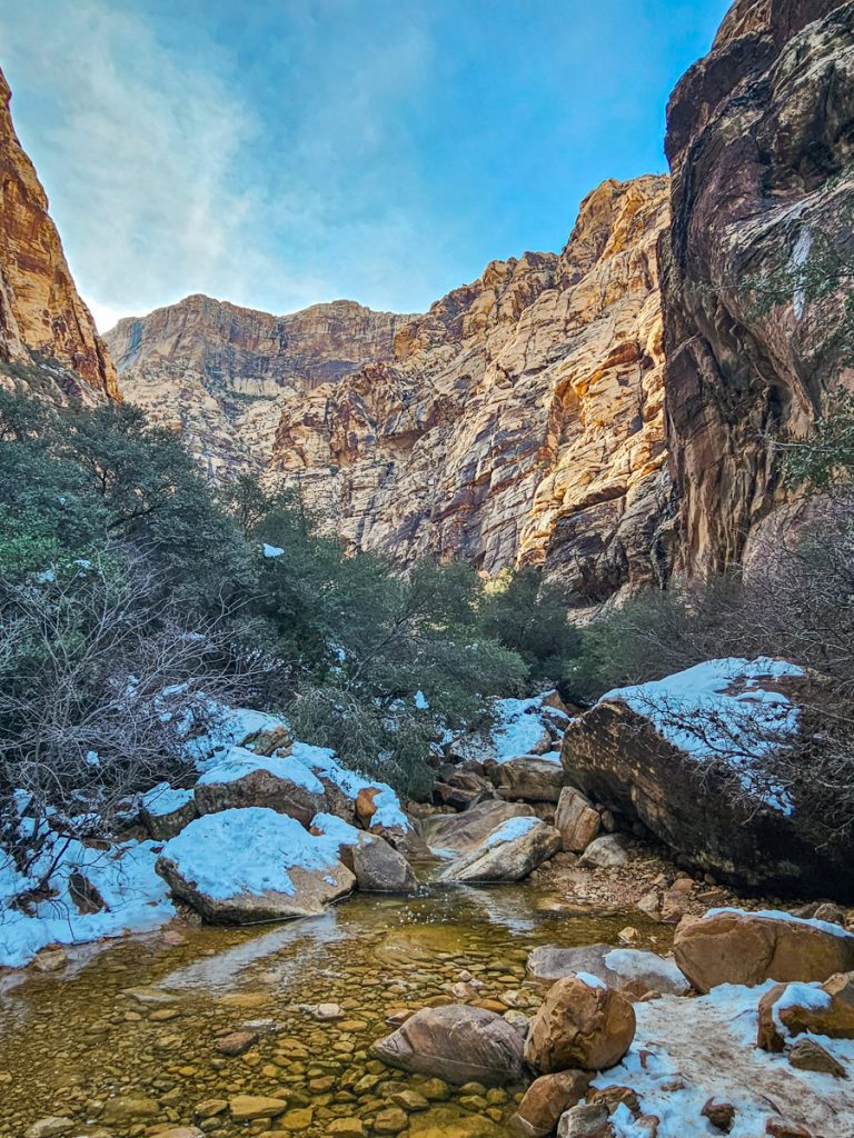
If you follow the trail all the way to the end, you’ll reach a small waterfall tucked into the back of the canyon, though it’s often dry or just a light trickle. The final section is also the most difficult, with a more challenging scramble up toward the falls.
Because of the route-finding through the rocky creek bed, it’s a good idea to download the trail map ahead of time.
Trail Stats:
🚶♀️ Distance: 2.2 miles
🥾 Elevation Gain: ~400 feet
⏱️ Time: 2-3 hours
📈 Difficulty: Moderate to strenuous (due to rocky terrain and scrambling)
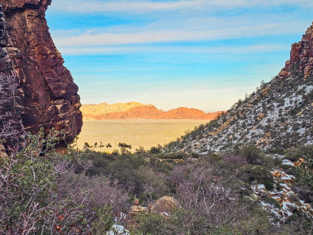
7. Red Rock Canyon Overlook
While Ice Box Canyon is the last stop I’m recommending inside Red Rock proper, you’re not quite done yet. Just after you exit the Scenic Drive and get back onto Highway 159 (the road leading to the park), you’ll find Red Rock Canyon Overlook.
This viewpoint offers a fantastic vantage point across the entire conservation area, with especially great views of the Calico Hills and their striking red sandstone formations. This was a perfect place to finish the day. The late afternoon sun was lighting up the red rocks beautifully, making the colors of the cliffs and hills really stand out.
Practical Information
Entrance Fees
Red Rock Canyon charges an entrance fee of $20 per vehicle. You can also use an America the Beautiful pass (National Parks Pass) or a Red Rock annual pass for entry.
Timed Entry Reservations
Timed reservations are required for vehicle entry to the Scenic Drive between 8:00am and 5:00pm from October 1 through May 31.
If you already have a pass that covers the entrance fee, you can reserve a timed entry slot online for $2. When I visited mid-week in February, the reservation times weren’t even close to selling out.
If reservations are sold out, another option is to arrive before 8:00am, when timed entry is not required.
Park Hours
The Scenic Drive has seasonal opening and closing hours. Note that the closing hours are hard stop times, and you do need to be out of the park by then, so plan accordingly.
- Nov–Feb: 6:00am – 5:00pm
- March: 6:00am – 7:00pm
- Apr–Sep: 6:00am – 8:00pm
- Oct: 6:00am – 7:00pm
Visitor Center
The Visitor Center is open daily from 8:00am to 4:30pm. I recommend stopping here to grab a park map so you don’t miss any trailheads or viewpoints along the Scenic Drive. The road is one-way, so if you miss a turnoff, you won’t be able to loop back easily. Alternatively, you can also download a map to your phone
It’s also helpful to look closely at the trailhead names. Some parking areas are named differently from the hikes they serve. For example, Calico Tanks starts from the Sandstone Quarry parking lot.
Cell Service
I had cell service along much of the Scenic Drive, but usually lost it once I got onto the trails. It’s a good idea to download maps ahead of time if you plan to rely on your phone for navigation.
Hikes Outside the Scenic Drive
There are also several hikes located outside the paid Scenic Drive area, which means they don’t require the entrance fee or timed reservation. I didn’t have time to explore those on this visit, but they can be a good option if reservations are full.


