How to Do the Fisher Towers Trail in Moab
Moab, Utah is an area of natural beauty that can compete with anywhere on earth. Not only is it a stone’s throw from two national parks (Arches and Canyonlands), it also has arches, the picturesque Colorado River, canyons, off-roading options, and hiking galore.
One of the best hikes to do near Moab is Fisher Towers, where massive sandstone towers rise above the Colorado River. The trail winds among the towers, allowing you to grasp just how immense they are, while also granting great views of the surrounding area.
Read on for all the details about exactly what it’s like hiking Fisher Towers.
Fisher Towers Hike Stats
- Distance: 4.5 miles
- Elevation Gain: 700 feet
- Difficulty: Moderate
- Time to Complete: 2 hours
Getting Started
Utah State Highway 128, which runs along the Colorado River, is one of the most scenic highways in America. It winds between towering red canyon walls, with plenty of spots to stop and explore. The trailhead for Fisher Towers is just off Highway 128, about 30 minutes east of Moab.
From Highway 128, there’s a short side road to the parking lot (unpaved but easily manageable). There are actually two parking lots here, an upper and a lower. The lower one was added more recently to expand capacity, and both have restrooms. It doesn’t make a big difference which lot you use, but the upper lot shaves about 0.1 miles off your hike.
Hiking the Towers
Ok, so this hike really is amazing. Following a short descent into a small and rugged wash/canyon, you immediately head up next to the towers.
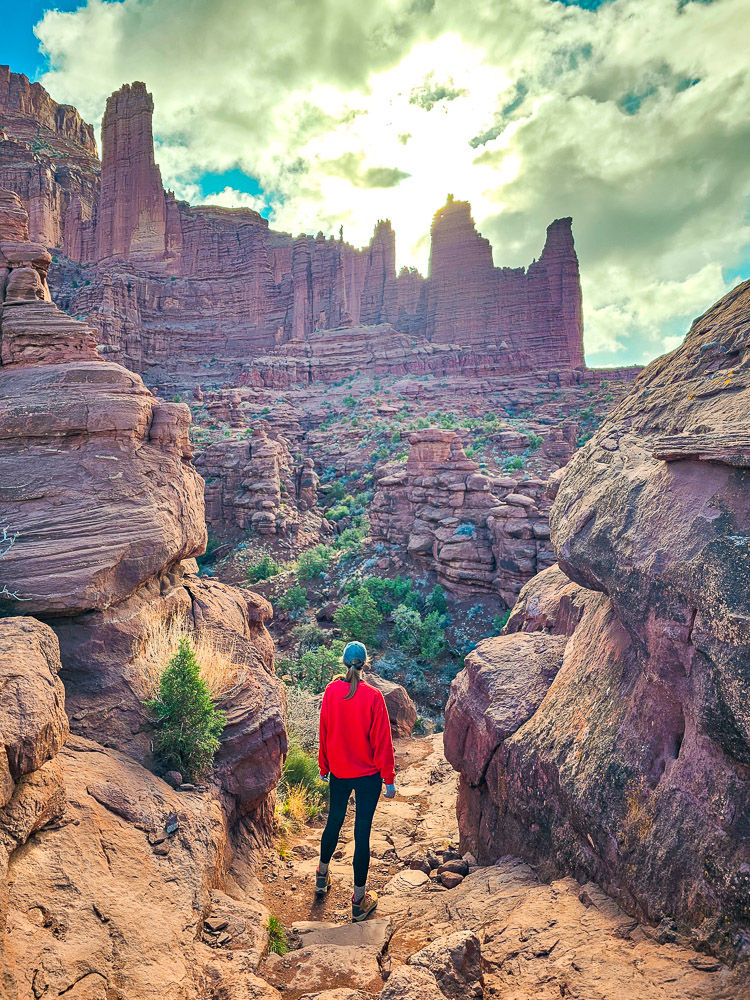
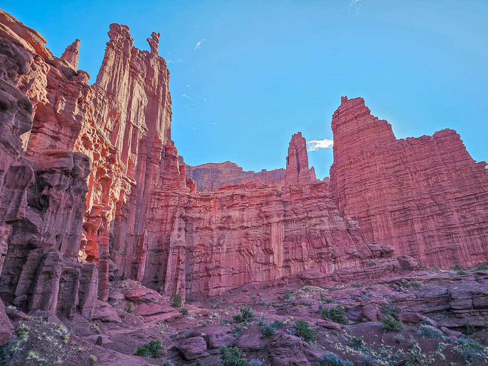
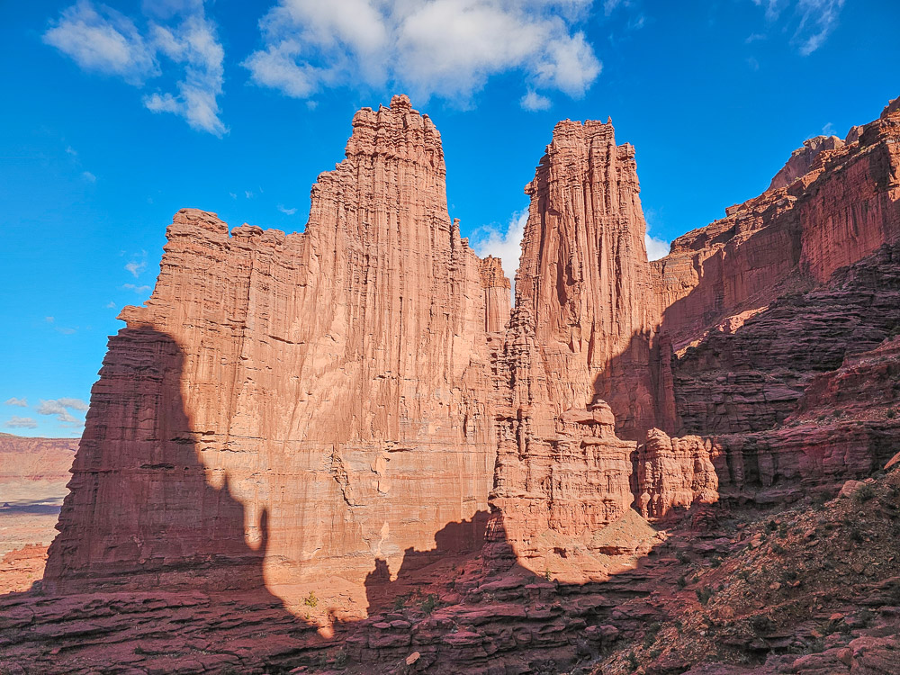
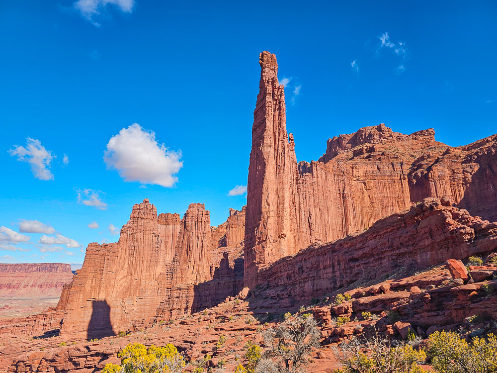
At first glance, the Fisher Towers seem like one straight ridgeline of jagged peaks. But as you start hiking, you’ll realize they’re actually a series of sandstone fins jutting out from a larger cliff face. The trail weaves around them, keeping you close as you move in and out of narrow canyons and around cliff edges.
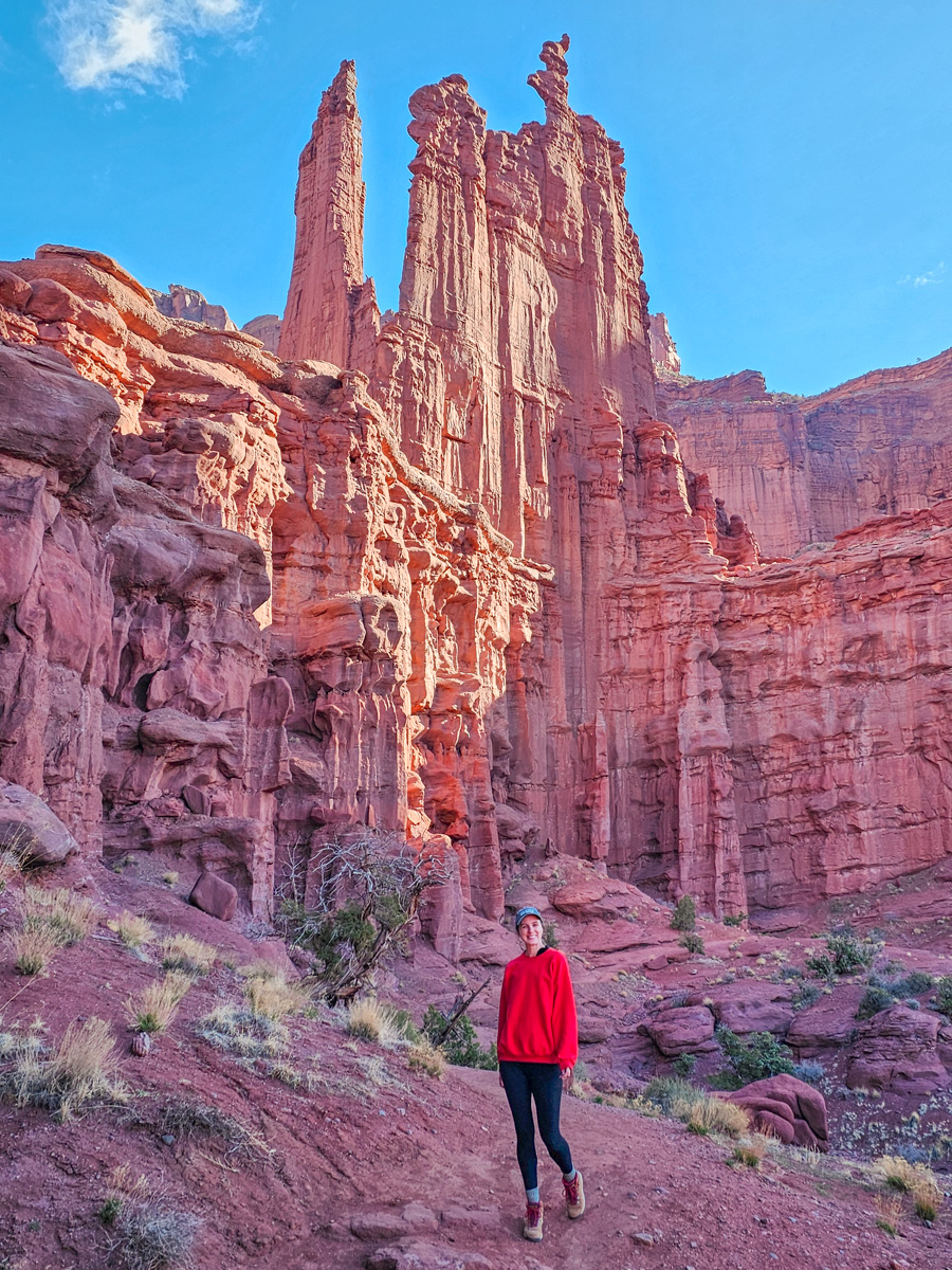
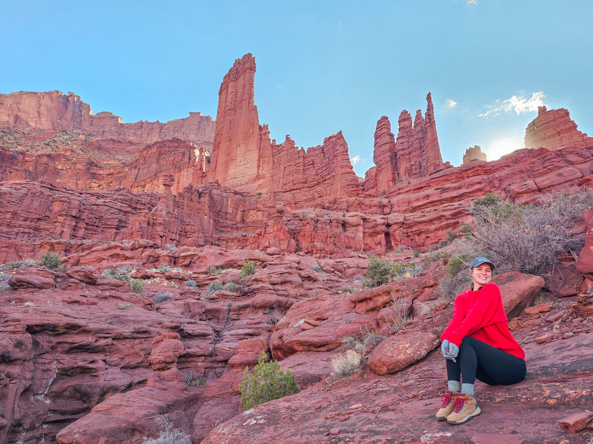
The towers themselves are unbelievably tall and spindly—much thinner than seems possible. We loved the jagged, knobby cliff faces and the irregular, spiked tops. The biggest of the group, the Titan, is 900 feet tall!
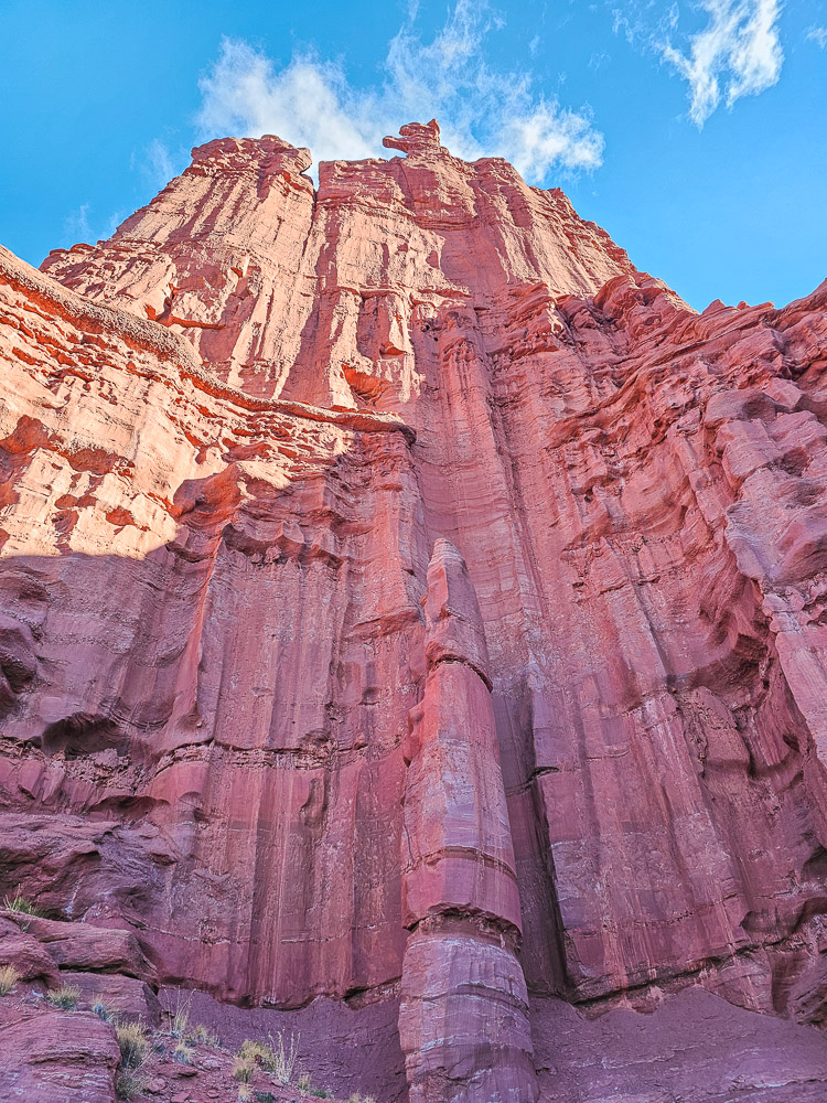
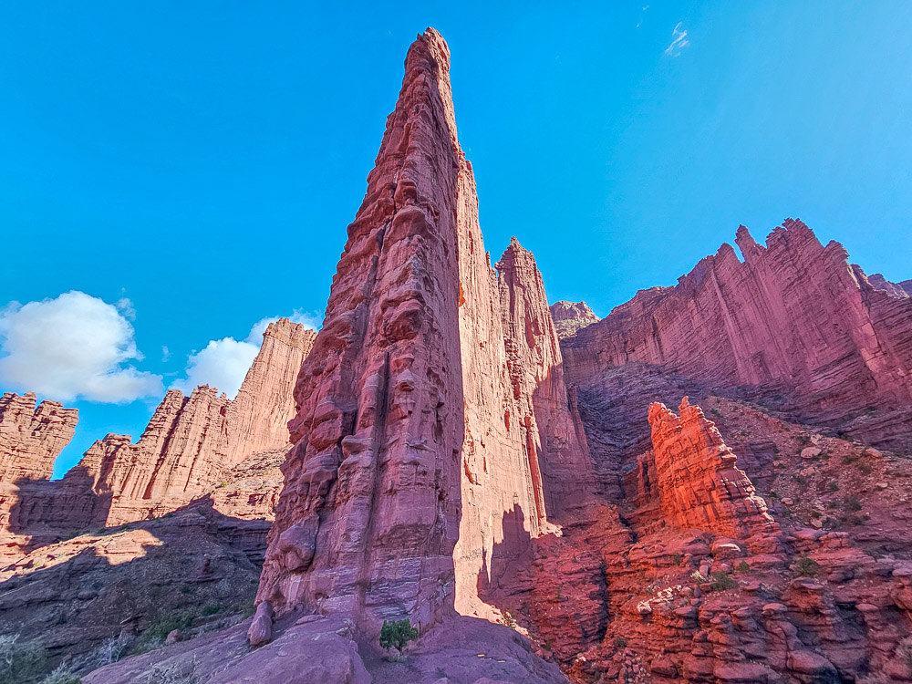
The trail stays fairly narrow here, with the rock wall of the tower rising on one side and a gorge dropping off on the other, creating a dramatic gap between you and the next tower. We loved the whole experience, and standing at the base of a tower and looking straight up at these massive monoliths was just incredible.
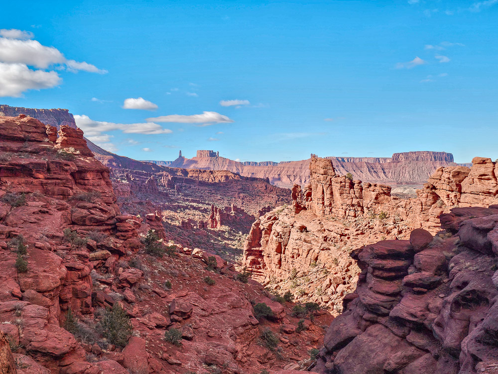
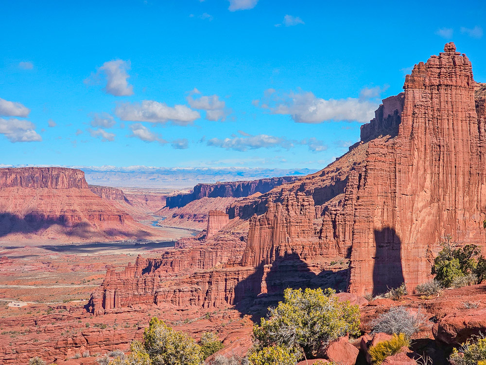
This is definitely a trail where the journey is the highlight, not just the destination. That said, the path eventually brings you to a saddle with sweeping views back toward the fins and the Colorado River, and forward into the canyon with the La Sal Mountains in the distance.
From here, the trail continues about a third of a mile along a ridge to the ending point. Honestly, you don’t have to go all the way to the end of the ridge, but walking out even partway gives you an epic view of the Colorado River meandering off into the horizon.
A Few Things to Consider
While this hike isn’t terribly long (just 4.5 miles), it does come with a few steep climbs. I’d call the trail moderately challenging overall.
The good news is that if you’re not up for the entire trail, you don’t have to hike to the end to enjoy the best parts. Even just winding through the first few fins is a great experience, and once you reach the first clear view of the Titan, you’ve already seen most of the standout scenery. Honestly, the first 1.25 miles are the best.
One other note: AllTrails significantly overstates the elevation gain. It seems to think the trail climbs over the fins (it doesn’t), inflating the total from around 700 feet to over 1,500 on the app.
Final Thoughts
This hike was one of my favorites in the Moab area. The sheer scale of the towers was amazing, and the trail is engaging and feels adventurous. It offers epic views all along the way, and is still a great experience even if you only do part of the trail. Happy hiking!


