12 Unbelievable Things to Do in Death Valley National Park
Death Valley National Park is a place of extremes. Located in eastern California, right along the Nevada border, it’s officially the hottest place on Earth, holding the world record for the highest air temperature ever recorded at 134°F (57°C).
It’s also the driest place in the United States, averaging only about two inches of rain per year, and the lowest national park in North America, thanks to Badwater Basin sitting 282 feet below sea level.
But while those statistics are impressive, what really struck me about Death Valley was how beautiful and rugged it is. There’s a surprising amount of variety in the park’s landscapes, with tall mountain ranges, massive salt flats, sand dunes rising out of the desert, a volcanic crater, winding slot canyons, and incredible panoramic viewpoints. And scattered throughout many of these areas are colorful badlands hills, full of winding washes and eroded ridgelines.
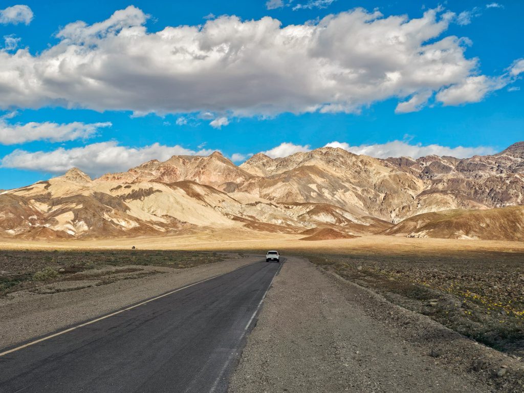
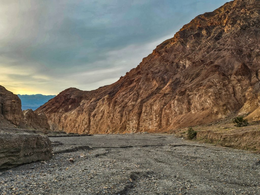
Driving into Death Valley really does feel like you’re heading deep into the middle of nowhere, with long empty roads and vast open desert stretching in every direction. Once you arrive, the scale of the landscape really starts to sink in.
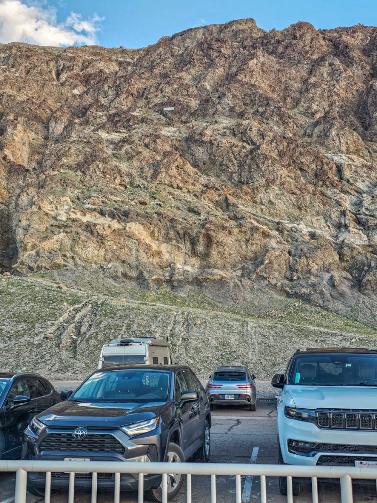
The park is enormous. In fact, it’s the largest national park in the contiguous United States. That said, 93% of the park is designated wilderness, and many of the main viewpoints and hikes are actually clustered within about 45 minutes of the Furnace Creek Visitor Center.
Once you’re in the central area, it doesn’t feel terribly long to move between spots (I would say Yellowstone felt way more spread out than Death Valley, for example).
Without further ado, these are 12 incredible spots you can’t miss in Death Valley, separated into viewpoints and hiking trails.

Where to Stay in Death Valley National Park
There are 3 nice hotels within the park boundaries that will keep you central to the hikes and viewpoints. For camping options, see the end of the post.
✅ The Inn at Death Valley: A beautiful oasis in the desert with an outdoor pool, spa, restaurant, and golf. Very centrally located.
✅The Ranch at Death Valley: Also a beautiful property & centrally located, with pool, spa, restaurant, golf, playground, and other activities
✅Stovepipe Wells Village Hotel: A little farther away in the Stovepipe Wells district, this hotel has a restaurant, pool, firepit, and is further away from most of the crowds
Six Great Viewpoints in Death Valley
Where you can enjoy fantastic views very close to the parking lot.
1. Badwater Basin
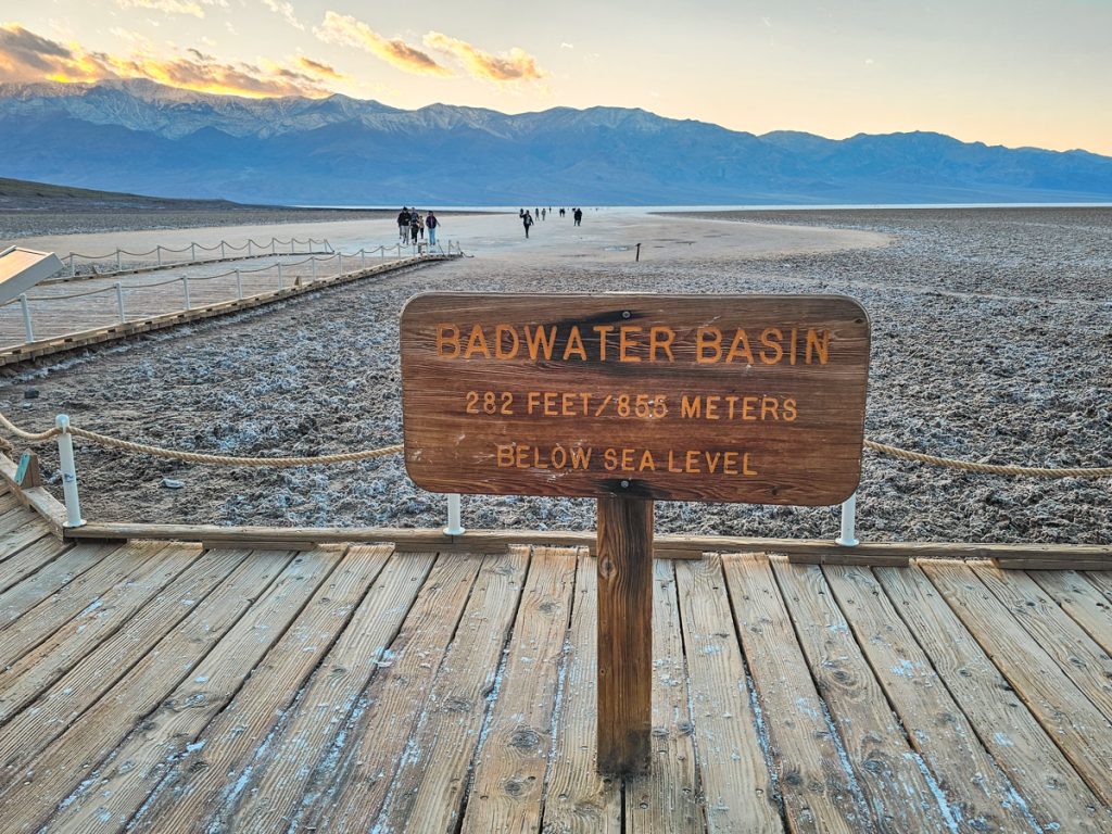
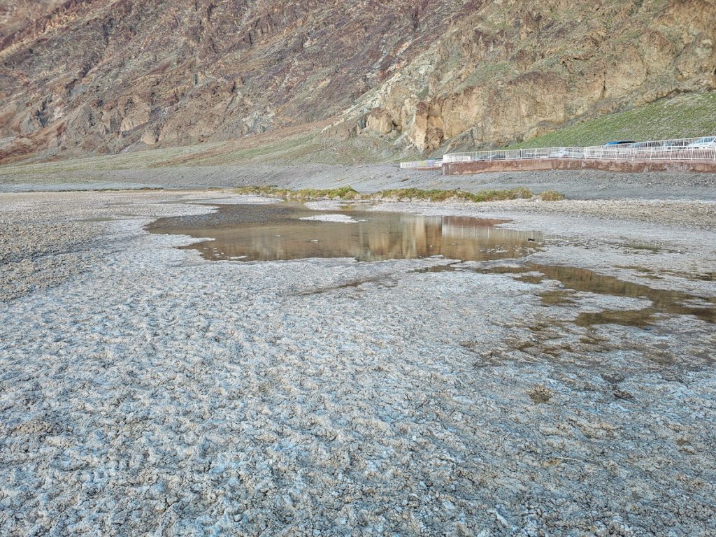
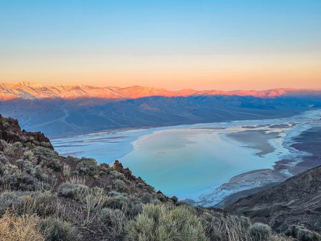
If there’s one place Death Valley is known for, it’s Badwater Basin, the lowest point in North America at 282 feet below sea level. It was formed by tectonic forces that pulled the Earth’s crust apart, allowing large blocks of land to slide along faults and the valley floor to steadily sink.
The basin covers nearly 200 square miles and is completely filled with salt flats left behind after ancient Lake Manly evaporated thousands of years ago.
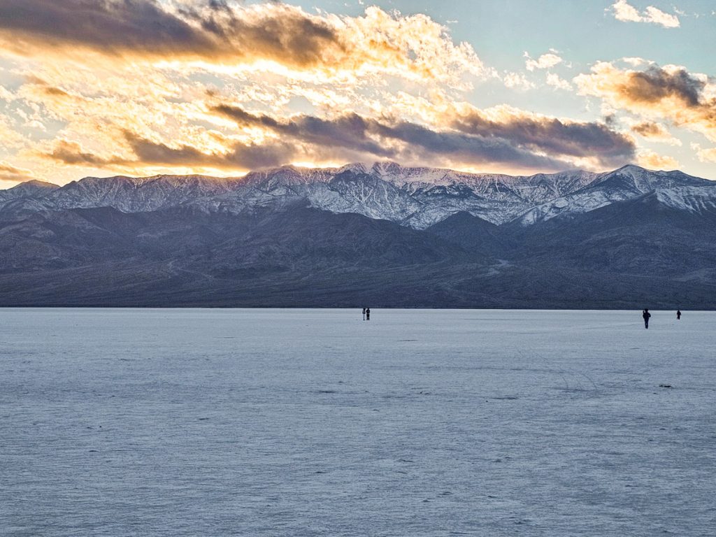
Badwater really is the focal point of the park. Mountains rise on both sides, where they contain many of the best hikes and viewpoints. Badwater Road runs right along the basin, connecting trailheads and pullouts. I was rather surprised by this – I think I was expecting Badwater to be a little bit more contained, a place you specifically go to see. Instead, it’s omnipresent, seemingly going on forever, and you can see it from all over the park.
The main access point to walk on the salt flats is about 25 minutes south of the Furnace Creek Visitor Center, just off Badwater Road. A short boardwalk protects the small spring by the parking area, and then you can head straight out onto the salt, going as far as you’d like.
The first stretch of salt closest to the boardwalk is a little “dirty” looking, so you’ll want to walk out at least 1/3 of a mile before the salt flats become white and pristine. The surface is constantly changing, so you might see ridges, cracks, flat sections, or even a thin layer of water depending on recent conditions.
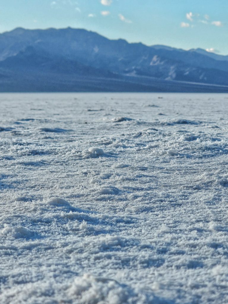

When I was here, the salt was mostly flat, with just a few cracks forming further out. I’ll admit, I was a little disappointed by this – I was definitely hoping to see the dramatic geometric salt polygons. It was still beautiful, and that’s just how this landscape works!
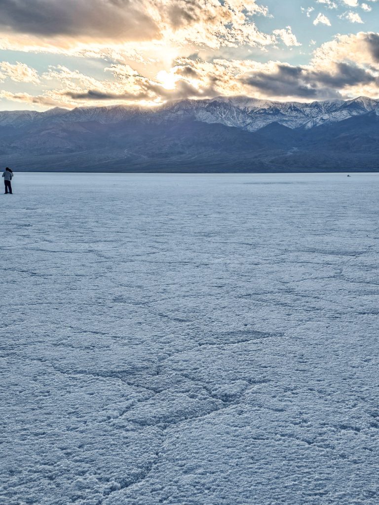
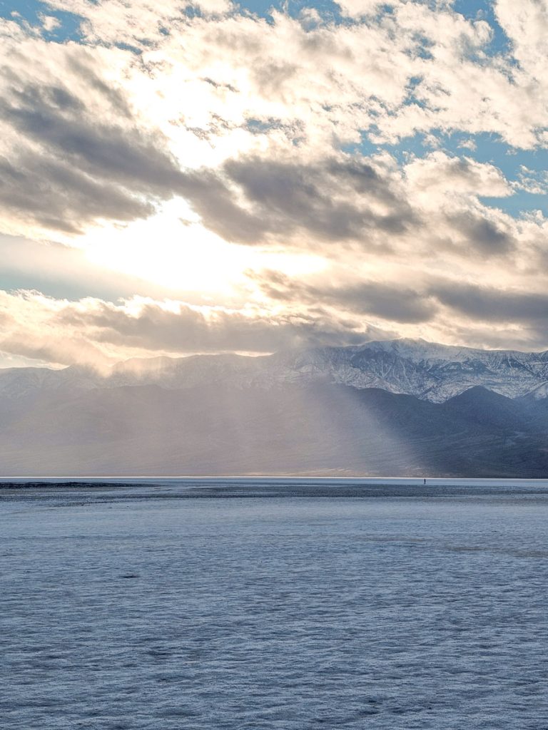
You can visit at sunrise or sunset for softer light, but I’d recommend sunset. The mountains to the west are more scenic in this particular spot, so having the sky light up in that direction makes the whole scene more interesting.
Most of the salt flats are open to walk on, but areas around the creek and boardwalk are closed off. Please respect the signs and avoid walking past them.
As you start to walk out on the salt, turn around and look up at the cliff wall above the parking lot. There’s a small white sign marking sea level, which really helps you visualize just how far below it you’re standing. Also, take a minute to read the informational signs at the start of the basin; they have a lot of interesting and helpful context for what you’re looking at.
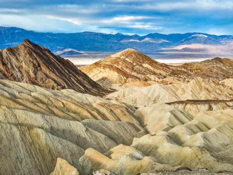
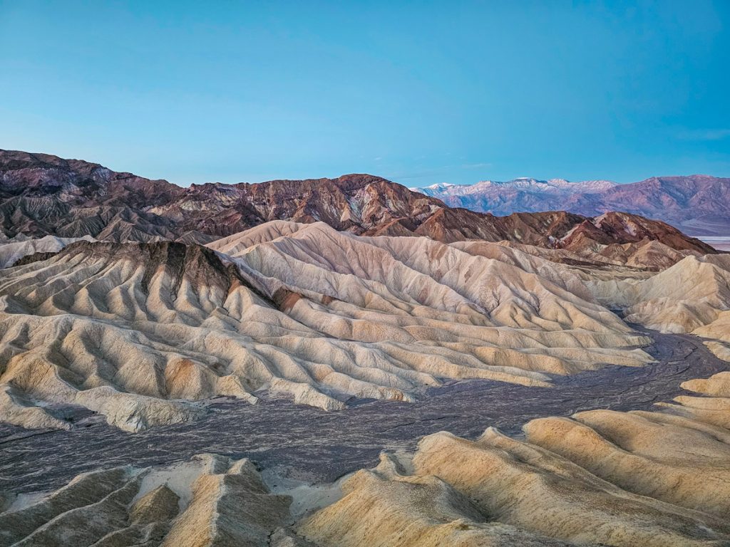
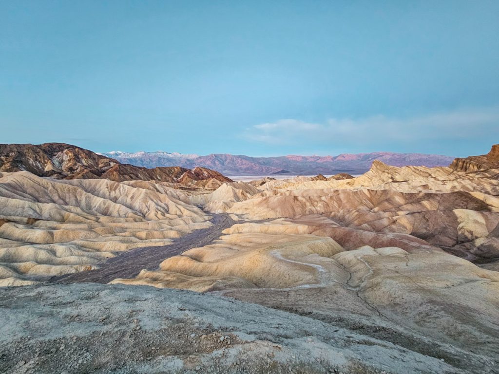
2. Zabriskie Point
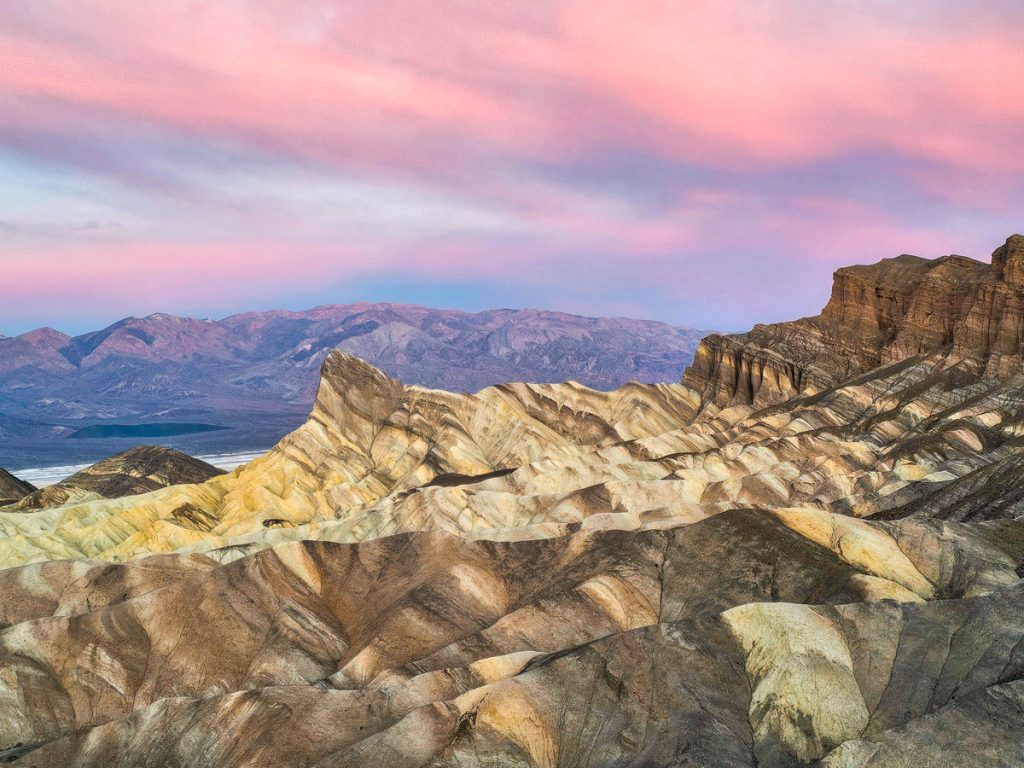
Zabriskie Point is probably the most famous panoramic viewpoint in Death Valley. It’s a very short, moderately steep walk from the parking lot up to the overlook, which looks out over the distinctive Manly Beacon peak and the rolling badlands hills.
It really is a stunning view. Manly Beacon (the little triangle poking up almost in the center of the picture, above) rising up in front of you, striated badlands spilling out in every direction, a peek of Badwater Basin below, and the Panamint Mountains rising majestically in the distance all combine into a pretty epic shot. The badlands closest to the viewpoint, especially with all their striping and texture, are gorgeous.
I highly recommend coming here for sunrise. I arrived just as dawn was starting to peek over the mountains behind, then sat down on a big rock and watched the sun slowly illuminate the valley. The colors and lighting were so beautiful, and it was absolutely worth the early wake-up call. I’d plan to be there at least 15 minutes before sunrise, when the best color is in the sky, and then stay another 15 minutes after to watch the rocks start to glow.
Sunset can also be nice, but the view will be backlit until the sun drops behind the mountains across the valley. That can still create some great color, but I personally loved sunrise here.
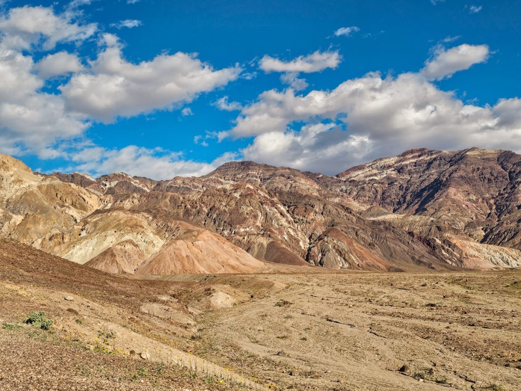
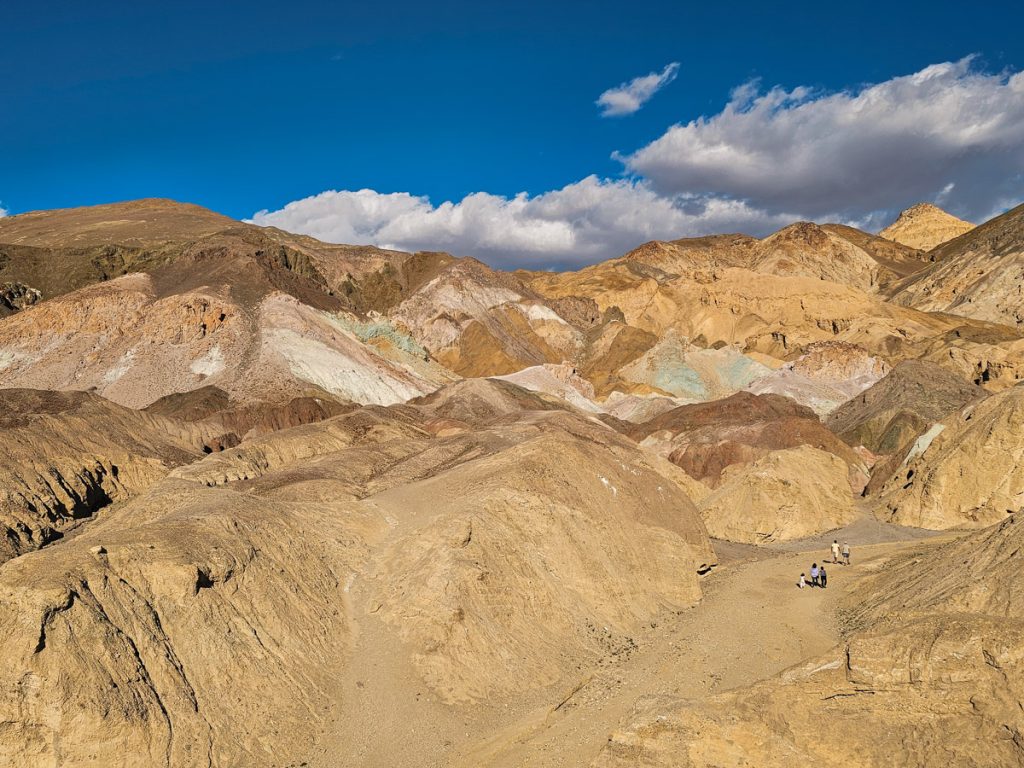
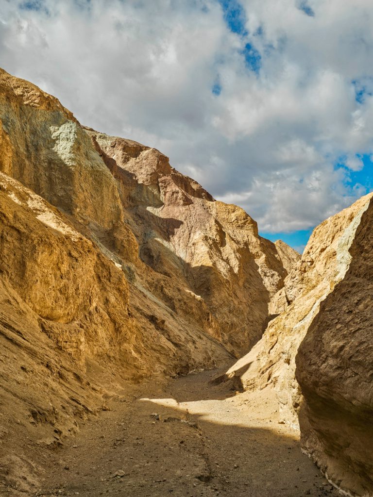
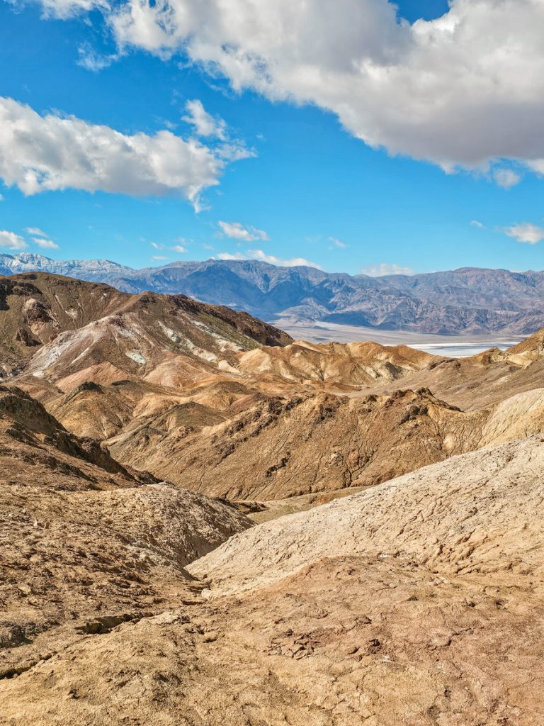
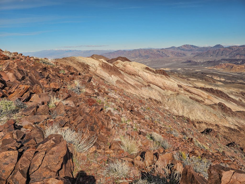
3. Artist Drive
Artist Drive is a 9-mile, one-way scenic road off Badwater Road that takes you into the hills along the eastern side of the valley, where streaks and patches of color run through the rock.
The colors are beautiful in person, but I’ll be honest, they aren’t especially vibrant and don’t photograph all that boldly. They’re softer shades of blue, green, and pink within the more “regular” red and tan canyon walls, which are also streaked with gray and black.
So you’re not driving through solid rainbow hills the entire time, but rather seeing pockets of pastels punctuating a landscape that otherwise feels like classic badlands, with deep erosion, sharp ridges, and narrow little canyons everywhere you look.
There are lots of unnamed pullouts along the drive where you can stop, climb up a short hill, and take in the view. In many spots the shoulders are wide enough to pull over, and you can wander around a bit and explore.
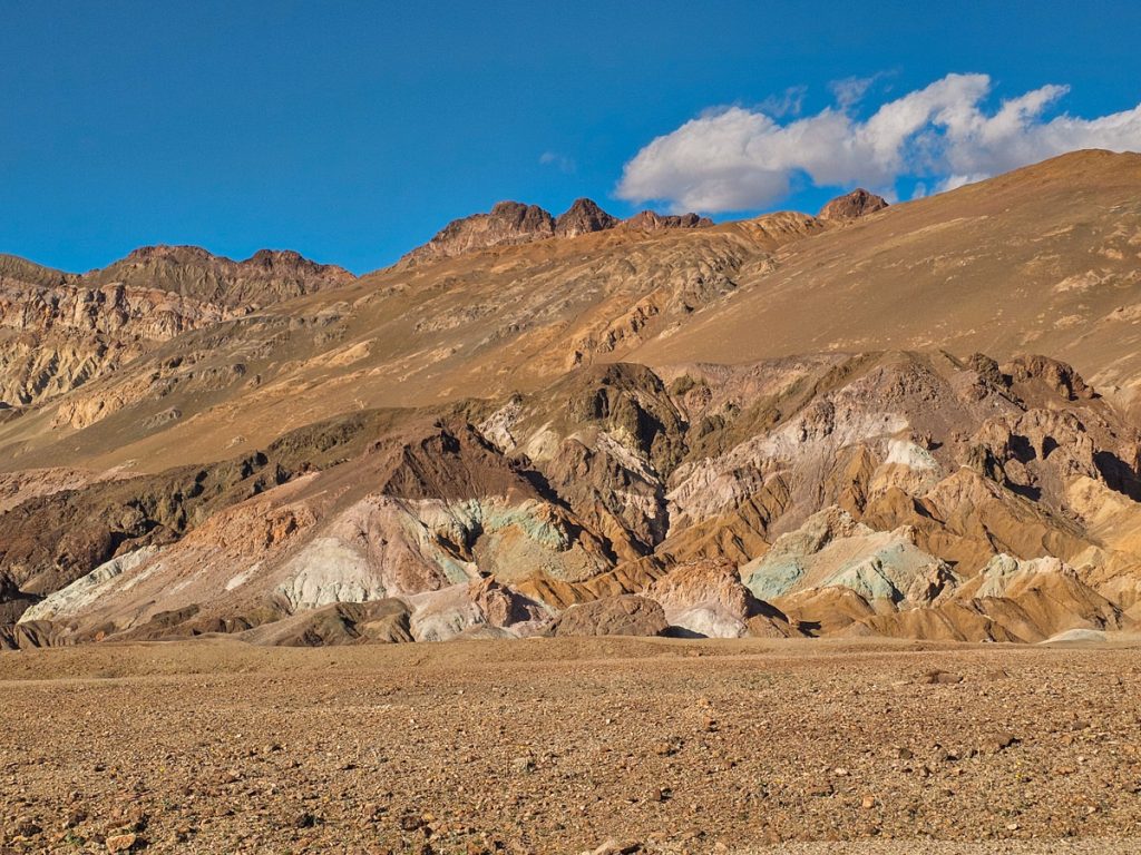
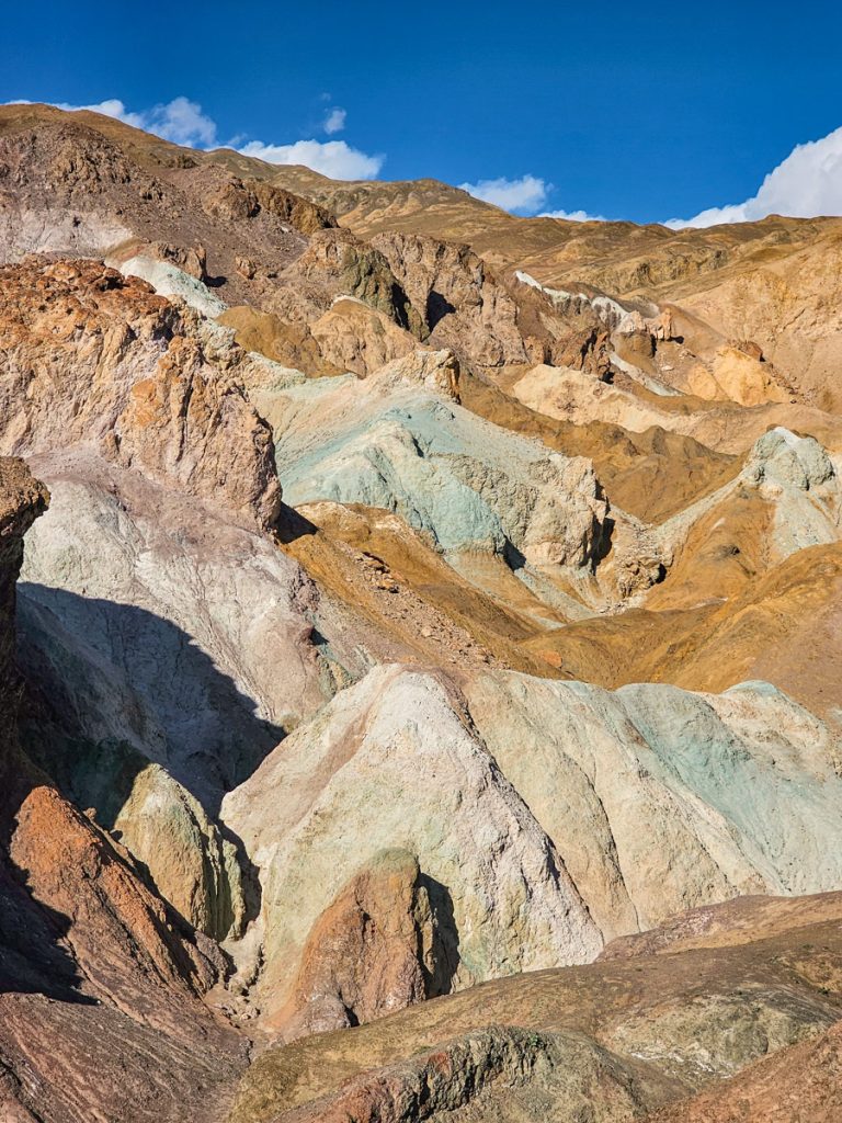
About halfway through is the turnoff for Artists Palette, the main, named viewpoint. The eroded hills fold into each other in every direction, and the colors move from blue to pink to red to tan across the slopes. The name really is perfect – it does almost look painted on.
You can park and walk down into the hills on a short path, which lets you get up close to the colors and feel surrounded by them. It only takes a few minutes to reach the most colorful sections. That said, the overlook itself might actually be the best overall vantage point.
After Artists Palette, the second half of the drive narrows into more of a canyon, with taller rock walls rising right beside the road. It’s a fun change of scenery.
The best time to drive Artists Drive is later in the afternoon, when the sun is hitting the hills directly. In the morning, the light tends to be behind them and the colors get washed out.
Artists Palette is one of the classic Death Valley views and shouldn’t be missed.
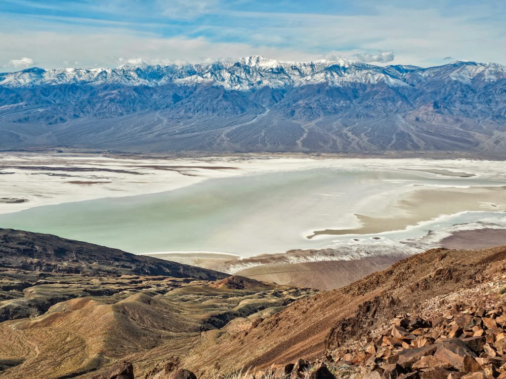
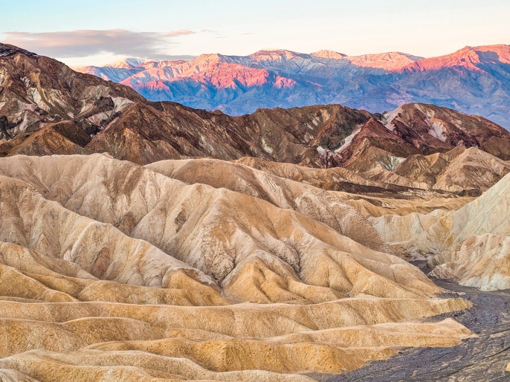
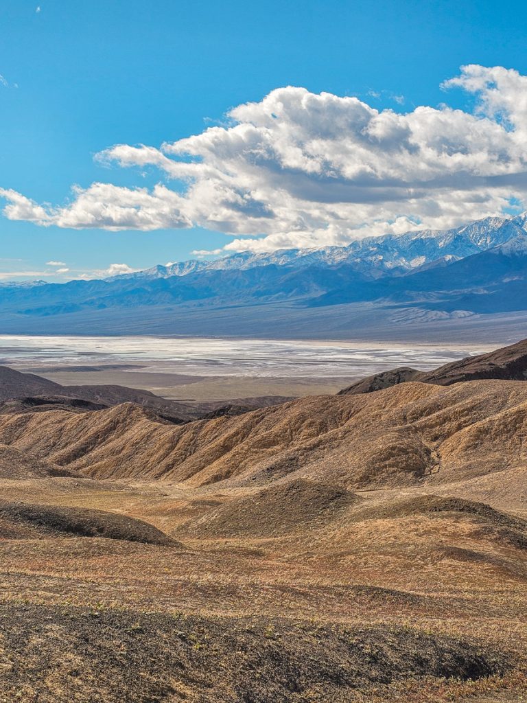
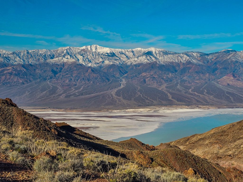
4. Dante’s View
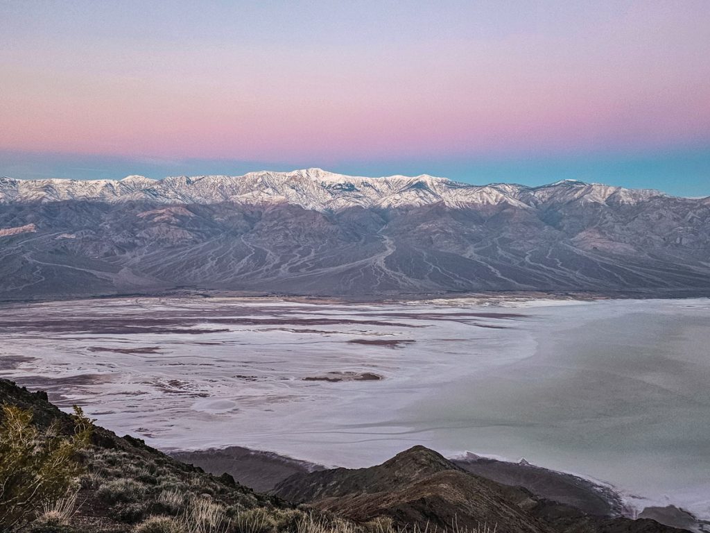
Dante’s View is an incredible panoramic viewpoint high up in the mountains with sweeping views of Badwater Basin stretching far to the north and south. You get great views right at the parking lot, but there are some little trails around that you can explore for slightly different perspectives. It’s quite a bit farther of a drive than Zabriskie Point, about 30 minutes from the Furnace Creek Visitor Center.
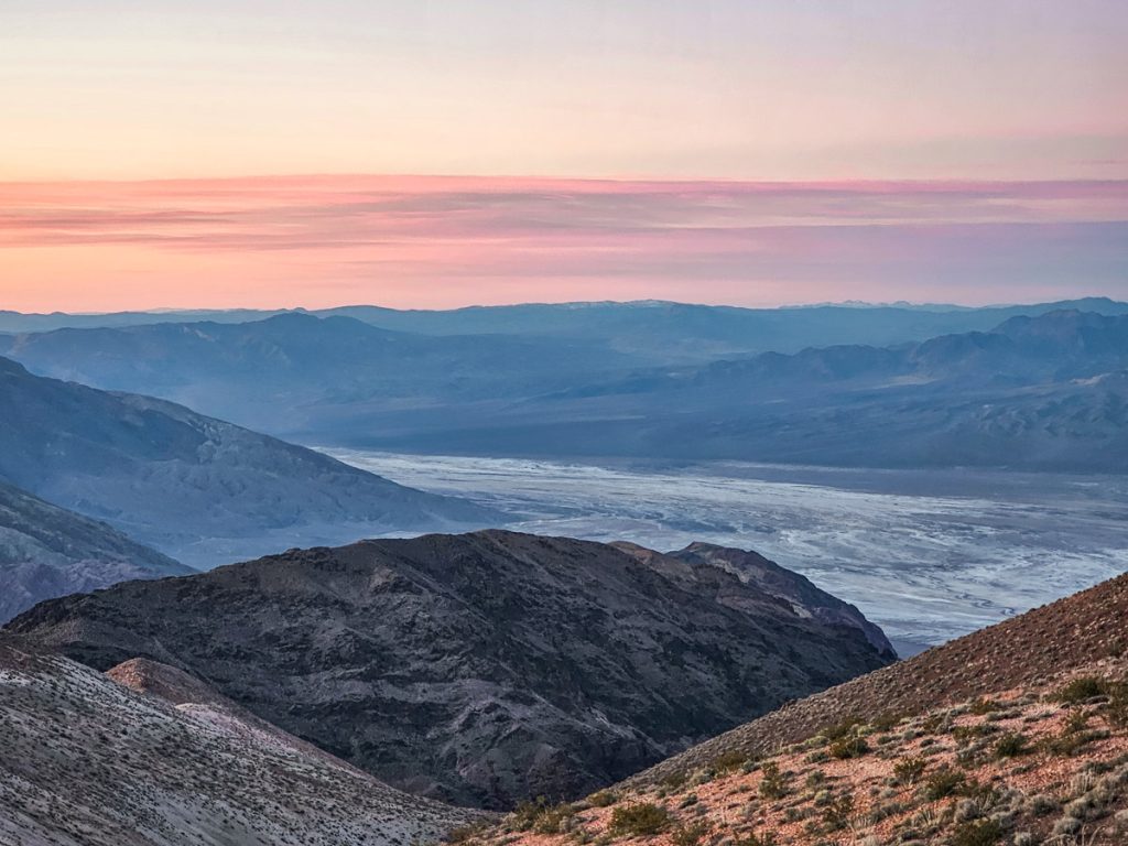
Dante’s View is a fantastic spot for sunrise or sunset. I was there for sunrise, when the sun rises behind you and lights up the mountains across the valley, illuminating Badwater Basin below. There were beautiful pink tones in the sky in front of us as everything started to glow. This would also be a fantastic spot to watch the sunset.
5. Ubehebe Crater
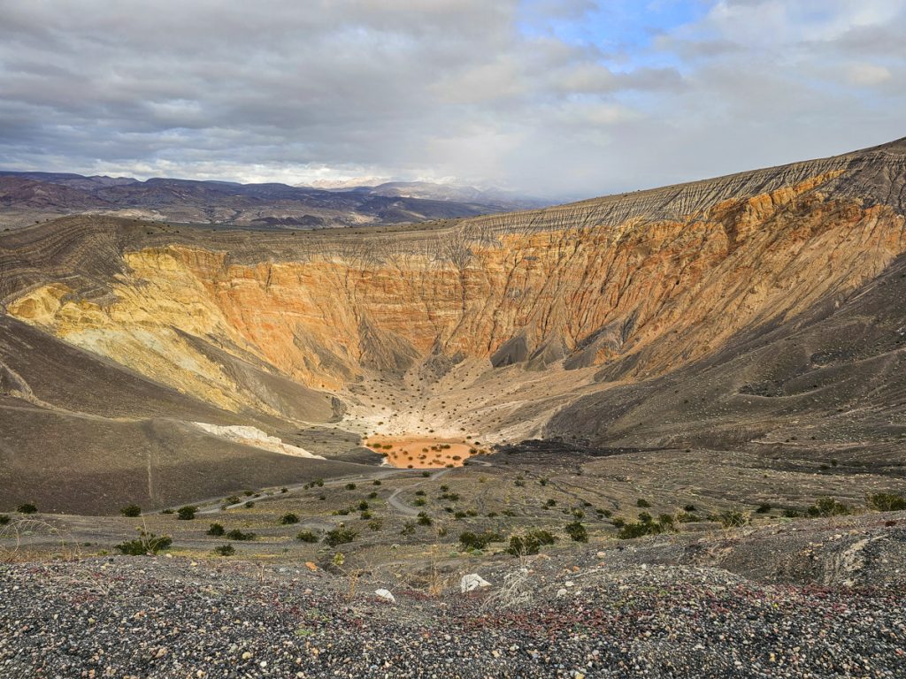
Ubehebe Crater is an old volcanic crater left behind by an eruption 2,000 years ago – in geology terms, it’s almost brand new. The eruption left a dramatic, deep depression in the ground and is definitely a unique feature in the park.
That said, it’s over an hour drive north of the Furnace Creek Visitor Center, and about 1.5 hours from Badwater Basin. The drive itself is easy, just long, and there isn’t much else nearby apart from Scotty’s Castle. But the road to the Castle has been closed for a while due to flood damage. So visiting Ubehebe adds a significant chunk of time to your day for just the one rather quick attraction.
The crater itself is very impressive, though. There’s a 1.5 mile trail that loops around the rim, with great views down into the crater the entire way. The beginning is fairly steep, and parts of the trail feel like walking through sand or small lava pebbles, so it can be a bit of a workout.
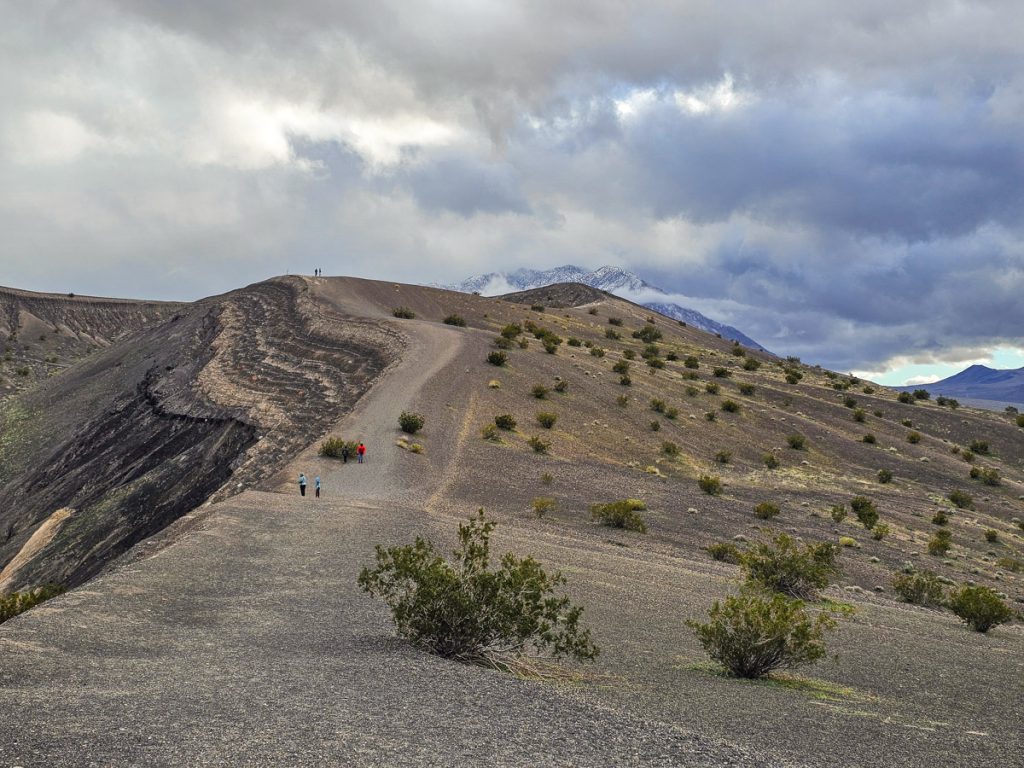
Honestly, you don’t have to do the rim hike to appreciate it. The view doesn’t change dramatically as you go around, and you get a very good perspective right from the parking lot. If you have the time and want the exercise, go for it. If you’re tired or visiting with little kids, it’s completely reasonable to just enjoy the overlook.
There’s also a trail that takes you down into the bottom of the crater, which is pretty fun. I’ve visited several old volcano sites, and this was the first one where I could actually walk down into the crater itself.
Overall, it’s a nice stop, but I wouldn’t call it essential for a first visit to Death Valley. If you have three or more days, it can good add-on. I wouldn’t prioritize it over the main highlights closer to Furnace Creek, and I wouldn’t commit to the time to visit if you only have 1-2 days in Death Valley.
6. Sea Level Signs
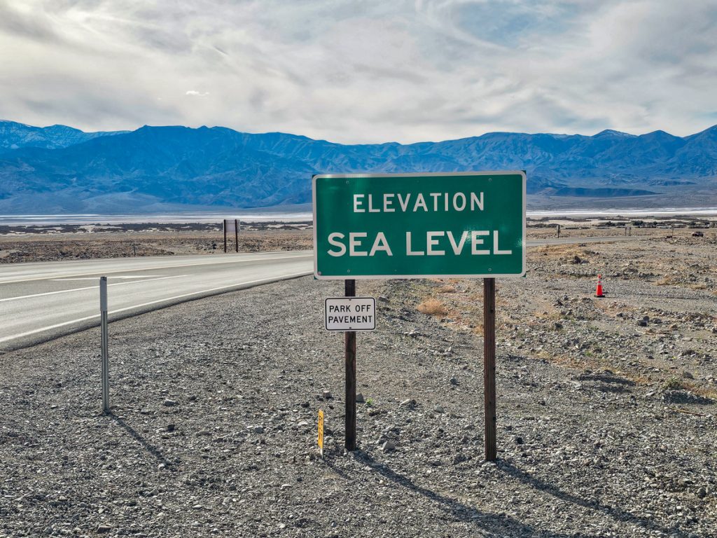
One fun feature throughout the park are the road signs marking sea level. What’s wild about them is that you usually can see the elevation continue dropping quite a bit behind the signs, underscoring yet again how low this area of North America really is.
Six Fantastic Hikes in Death Valley
7. Natural Bridge
Natural Bridge is a short but sweet hike in Death Valley. You start by hiking up a wide canyon, and before long the natural bridge comes into view, spanning high across the canyon walls. It’s a pretty cool sight as you round the bend and see it overhead.
The trail is just 0.6 miles round trip with a moderate elevation gain. I think this is a great kid-friendly experience, and I saw quite a few families doing the hike.
If you want to keep going, the trail continues past the arch for roughly another half mile until you reach a set of dry falls where you can climb and scramble around a bit. It’s a pretty quick add-on, although I didn’t end up doing this since I was running short on time.

The trailhead is 1.5 miles off Badwater Road, and road to the parking lot is unpaved gravel. It’s fairly washboarded, and the road gets bumpier as you go. I drove it in a standard SUV without any issues, though I slowed down in a few rougher spots. I did see several sedans in the lot, including one very low car, so most vehicles should be fine. Just take it slow and navigate carefully around the bigger bumps.
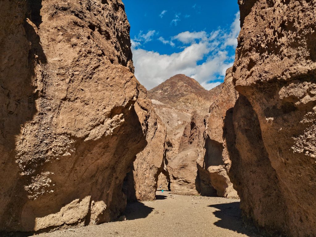
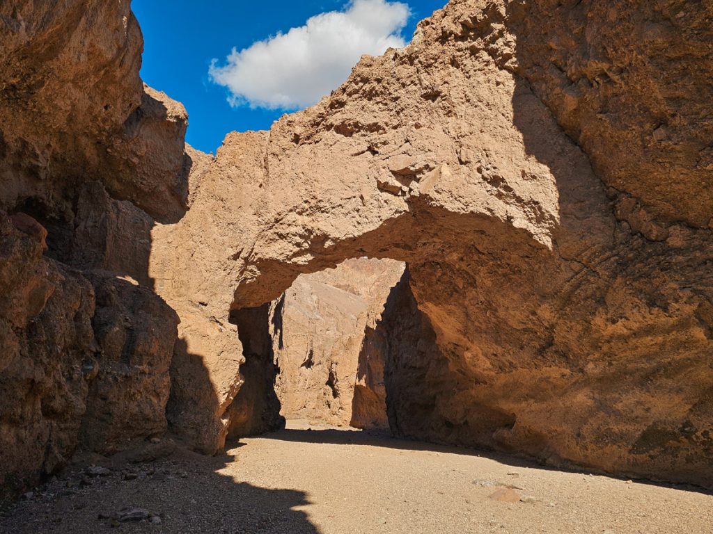
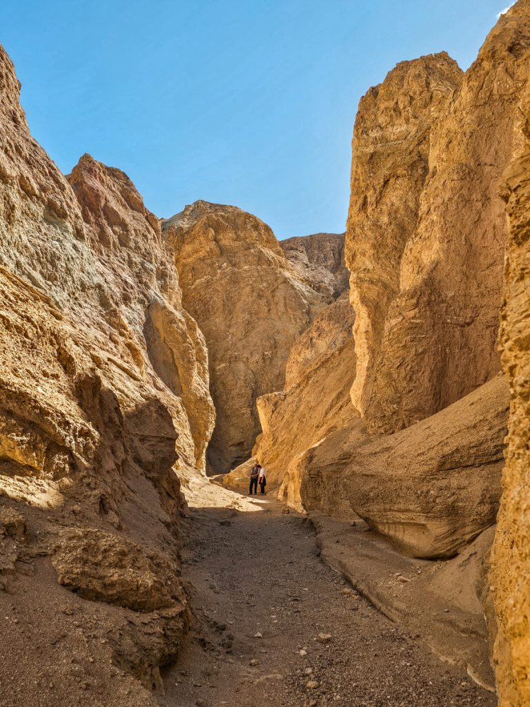
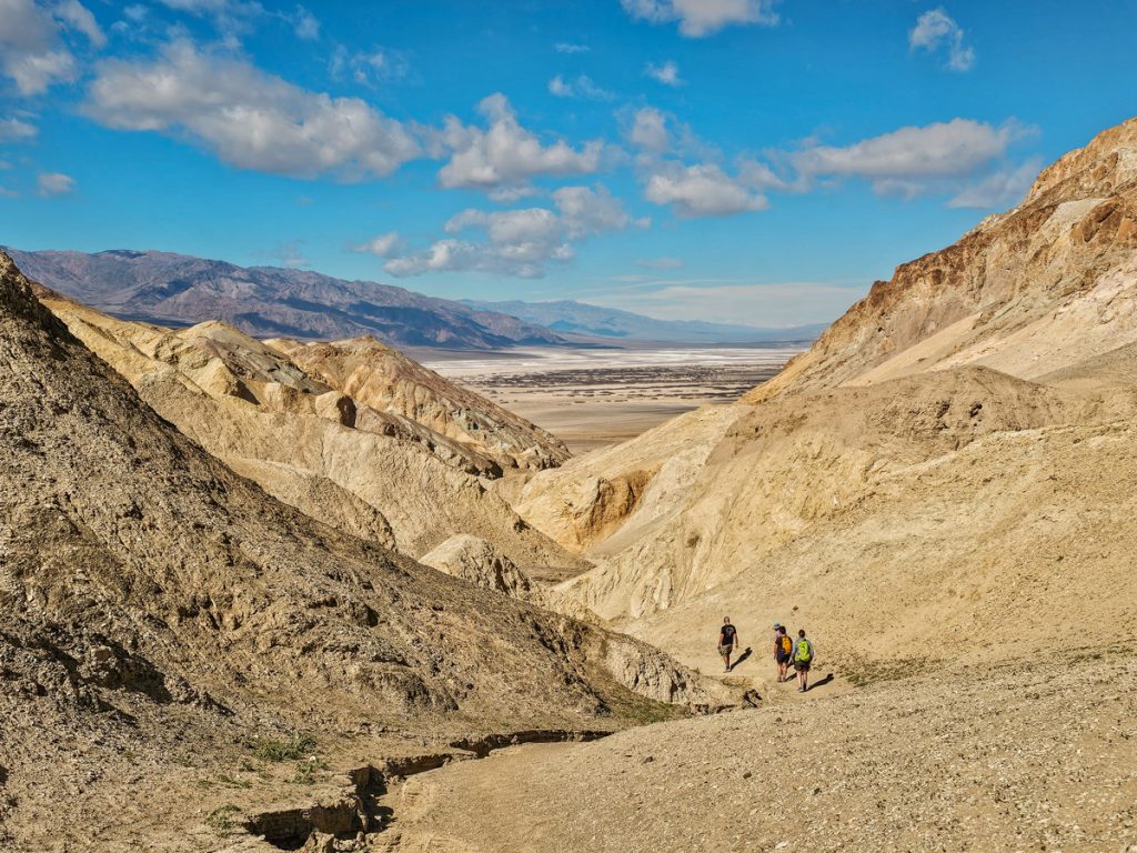
8. Golden Canyon, Gower Gulch, and Badlands Loop
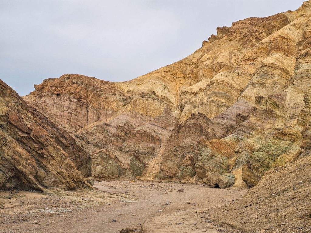
Golden Canyon, Gower Gulch, and the Badlands Loop is one of the most interesting hikes in the park, giving a ton of variety in terrain and options for what to experience. Technically, this is several separate trails, but they all intersect and can create one long loop.
I did the full loop, which ended up being 7.8 miles and 1340 feet of elevation gain, but you could definitely do smaller portions of the trails too. Here’s an overview of the trail and what and where all the different sections are.
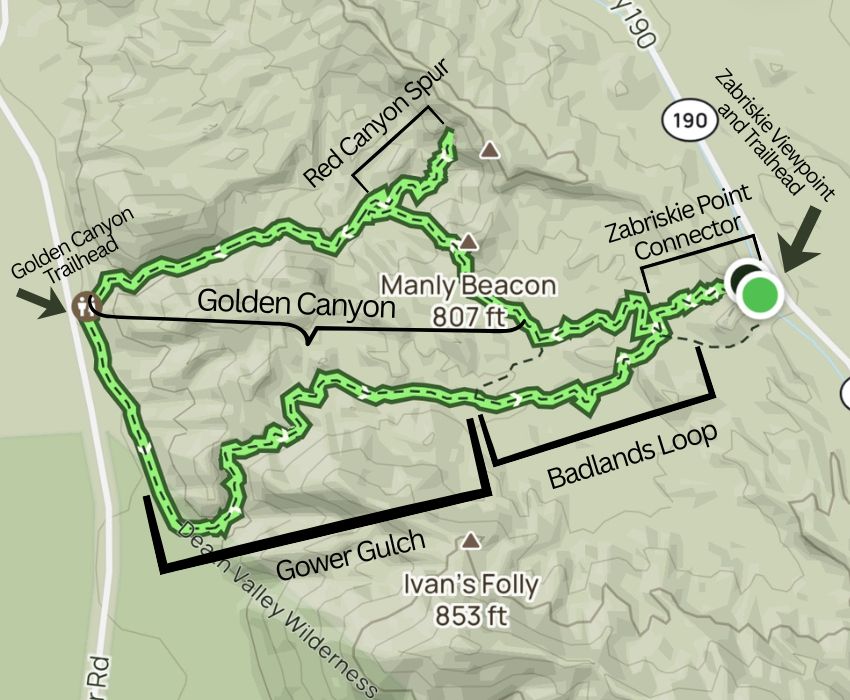
- The Badlands Loop takes you into the badland hills in front of Zabriskie Point.
- Golden Canyon starts from the Golden Canyon Trailhead off of Badlands Road, and takes you into a wide, dramatic canyon trail
- Gower Gulch also starts from Golden Canyon Trailhead, but you head south, walking next to the hills for about a mile, before turning into the canyon.
- Red Canyon is a pretty side trail off of Golden Canyon that takes you up to a tall cliff face.
I have a lot to say about this hike, so I wrote an entire post about doing this big trail, and all of the options that you have.
👉Read More: How to Hike the Golden Canyon, Gower Gulch, and Badlands Loop Trail
9. Mesquite Flat Sand Dunes
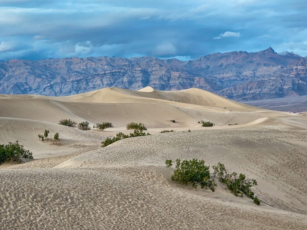
The Mesquite Flat Sand Dunes are a very fun feature of Death Valley. From a distance, they almost look out of place, just rising up suddenly out of the flat desert floor. From the main parking lot, you can walk straight out into the sand wherever you’d like. There’s no set trail, you just wander. The tallest dune is roughly a mile from the parking area and hiking through sand can be surprising difficult, but you don’t have to go that far unless you want to.

This is a really fun place to explore, take photos, try sandboarding, or just hang out and climb around in the sand. I was there in the evening, which was a very nice time to visit. The dunes are also known as a good stargazing spot (although there’s not really a bad spot in the park). Just be careful you keep track of where you are and how to get back to your car after dark.
The sand dunes are about 25 minutes north of the Furnace Creek Visitor Center.
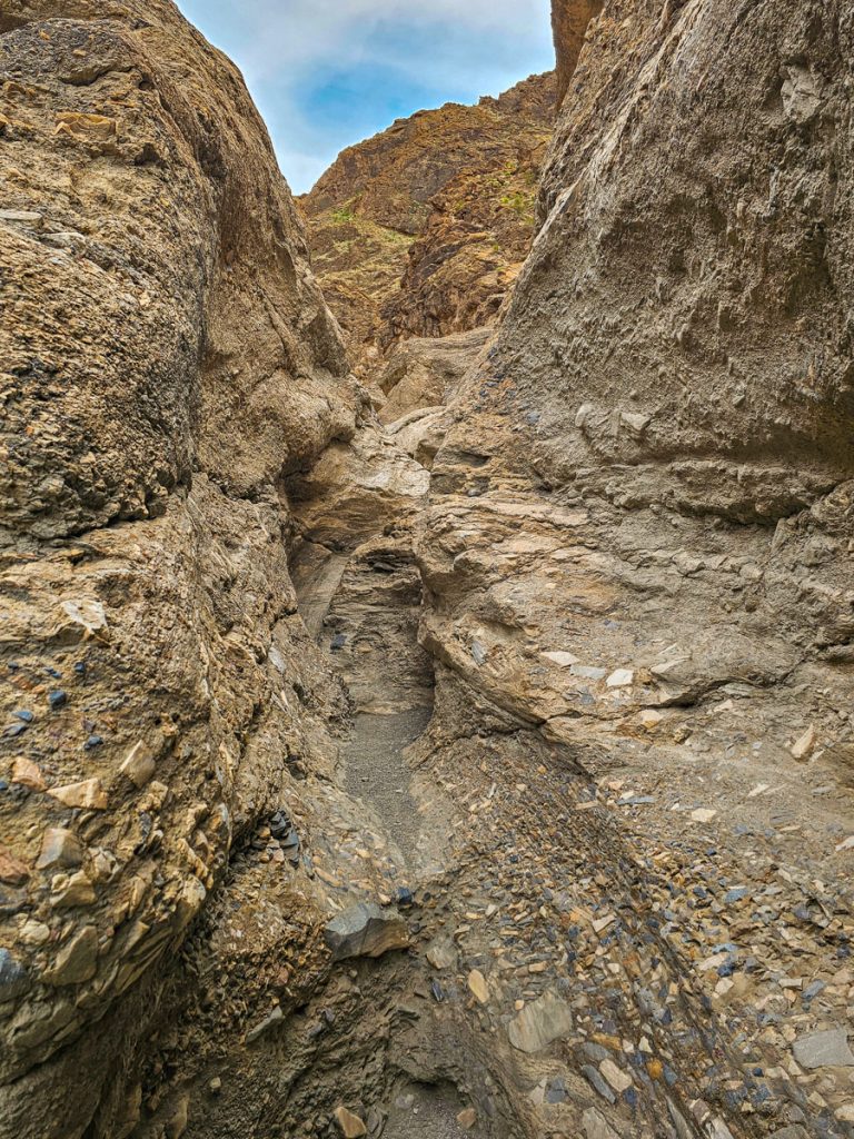
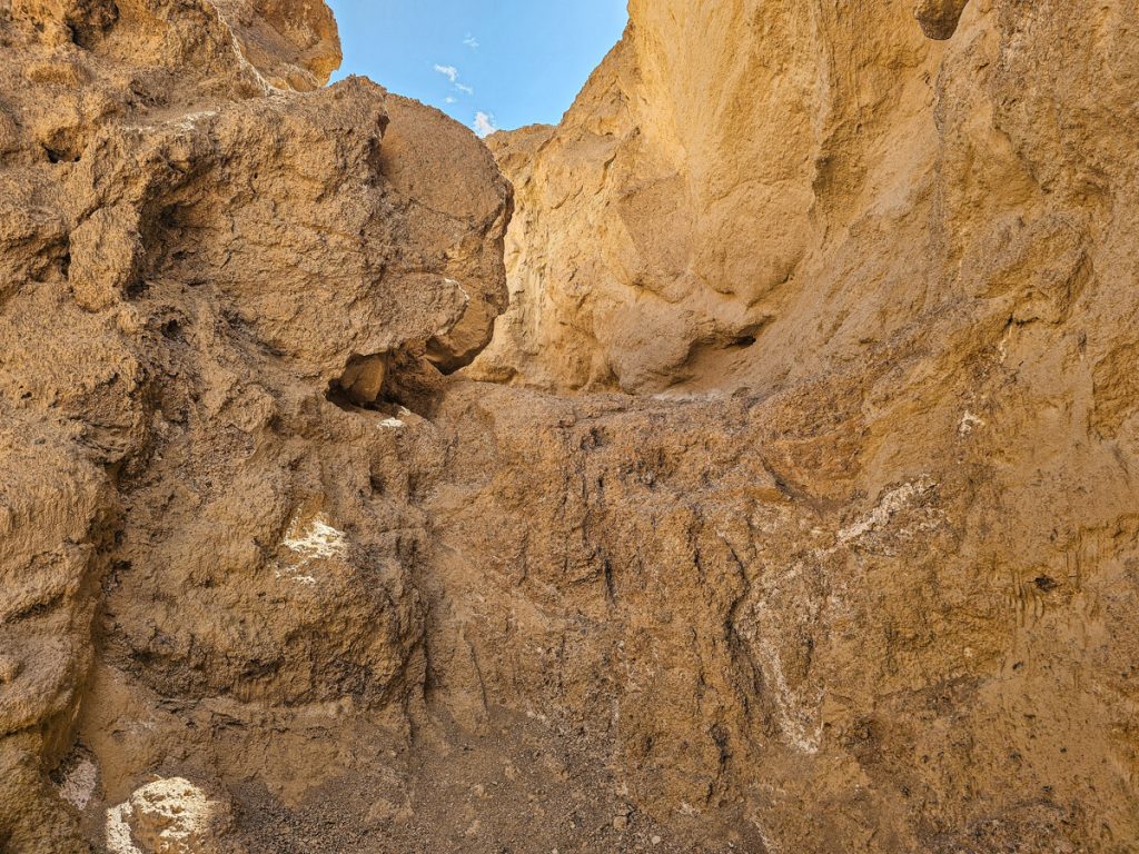
10. Mosaic Canyon
Mosaic Canyon is about 10 minutes past the Mesquite Flat Sand Dunes, near the Stovepipe Wells Ranger Station. The full hike is about 3.5 miles round trip and is a really fun, varied canyon walk.
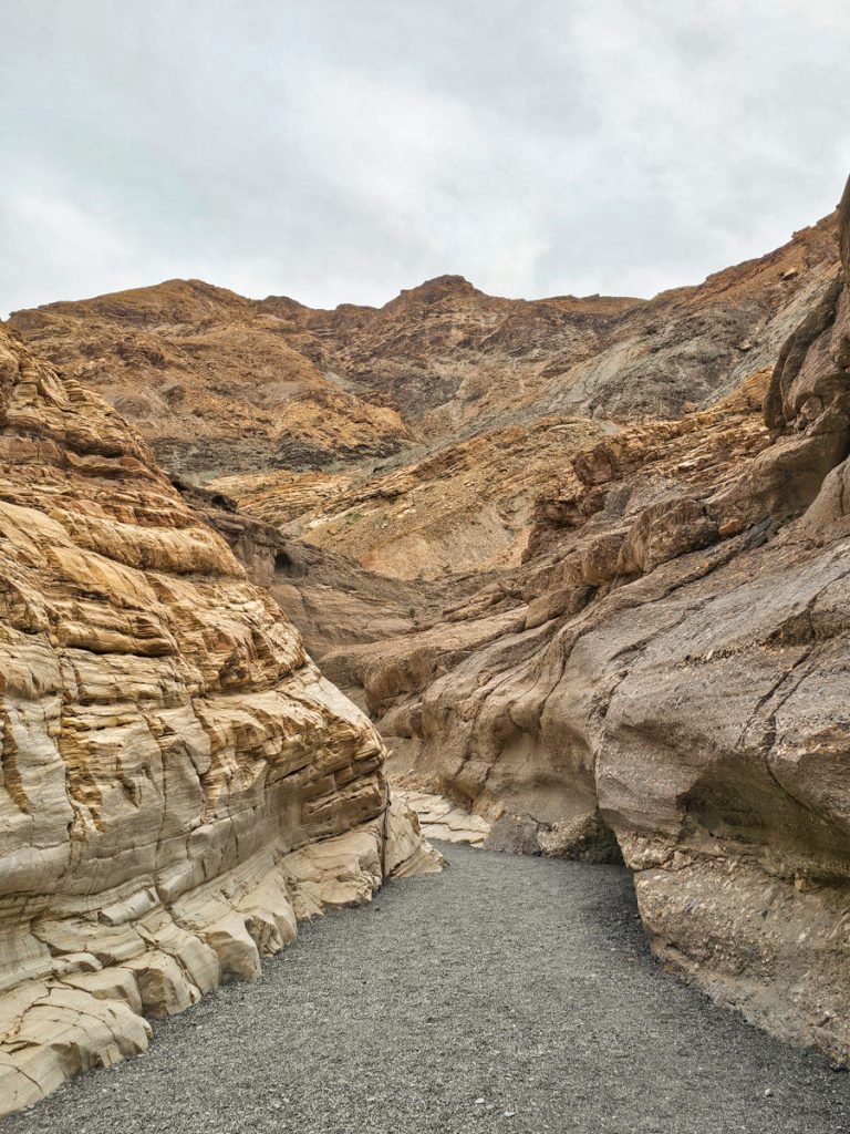
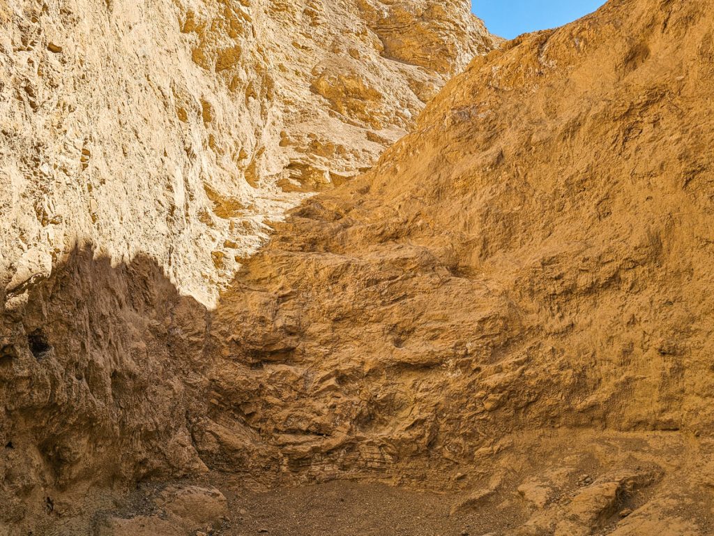
From the parking area, it only takes a minute or two to reach the mouth of the canyon, and then it quickly narrows into a pretty slot section. That tight canyon doesn’t last too long before the walls open up into a much wider stretch, almost half a mile of broader canyon walking. It’s still beautiful, just less dramatic.
Then the canyon narrows again, and the final half mile or so is the most fun part. You’re back in slot canyon terrain, and there are around eight different scramble sections to work your way through. I’d classify the scrambles as fairly easy (class 2 scrambles), but they add a lot of interest and adventure to the hike.
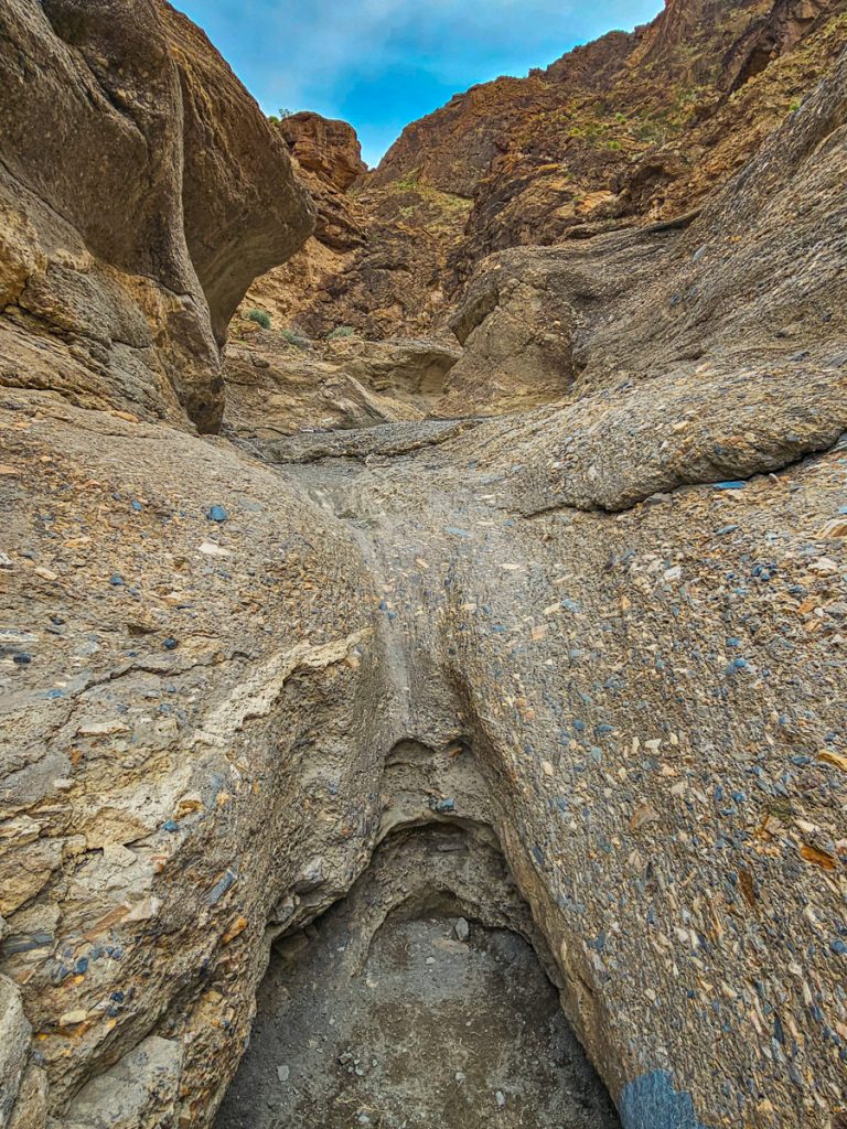
As you hike and climb, also keep an eye out for the mosaic breccia that gives Mosaic Canyon its name. Breccia is rock formed when smaller fragments of older rock are naturally cemented together, and you can see plenty of examples of it along the trail, especially in these pictures, above.
After you’ve done five or six of the scrambles, pay attention to the arrows made of small stones on the ground that direct you to a bypass. If you continue straight, you’ll run into a tall dry fall that blocks the way, but following the arrow takes you up and around on an overpass to a few more scrambles and the final dry fall cliff face.
If you’re planning to visit both the sand dunes and Mosaic Canyon, it makes sense to do them back-to-back since they’re so close to each other.
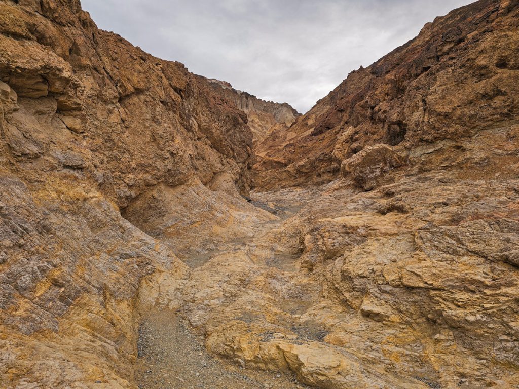
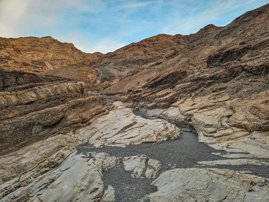
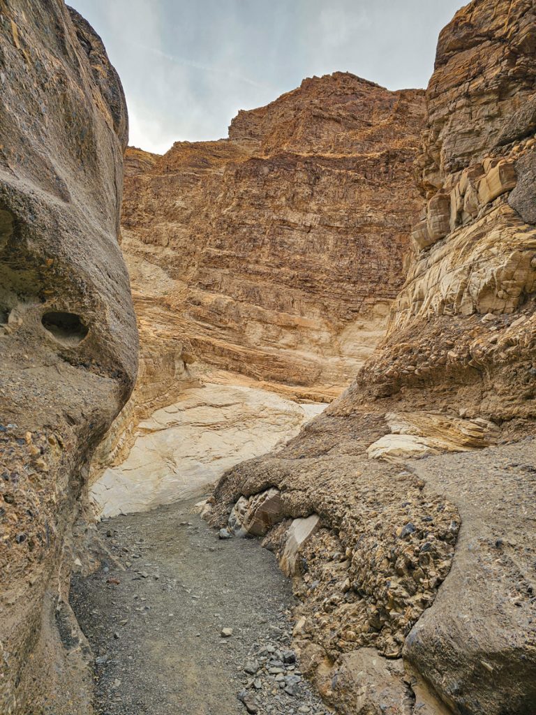
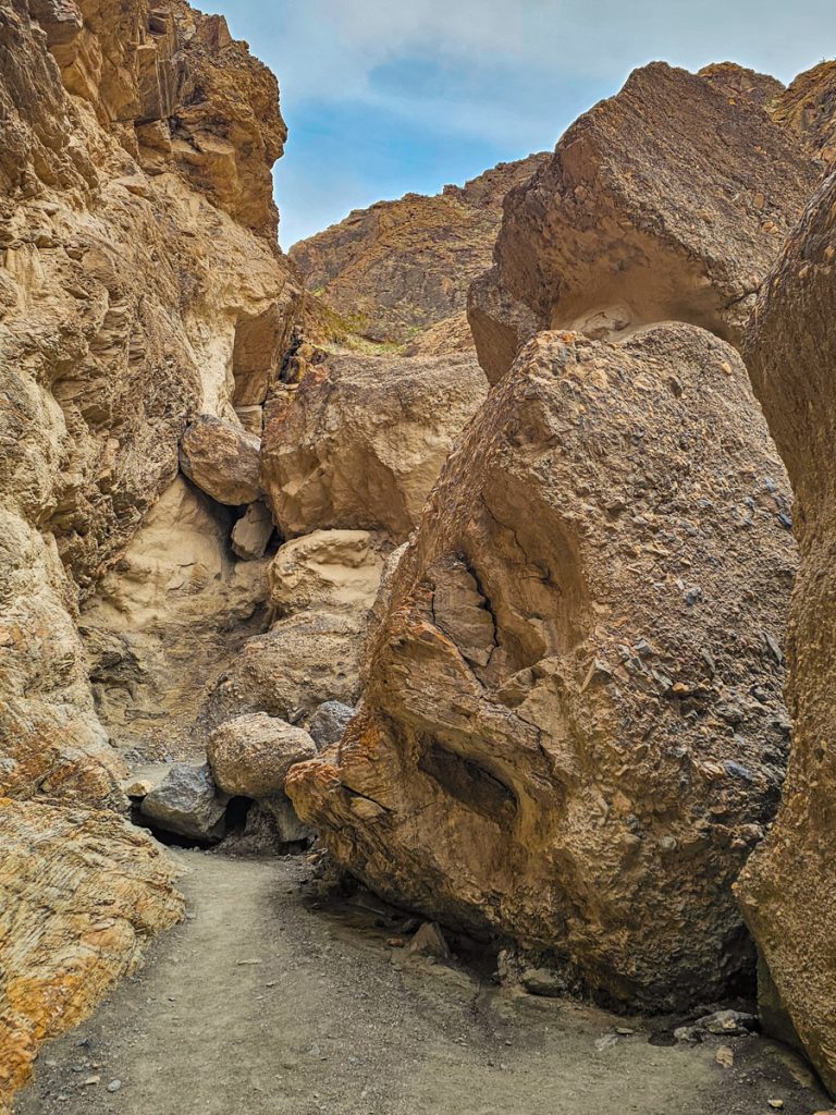
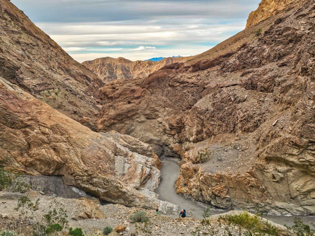
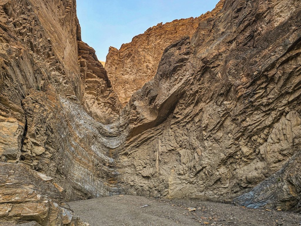
11. Desolation Canyon
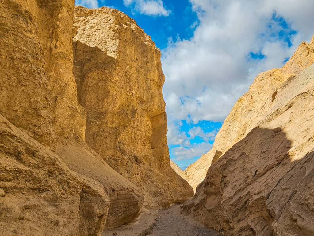
Desolation Canyon is located off Badwater Road and is a fun hike through a slot canyon. It’s also much less busy than other spots along this road (for example, when I did this hike in the middle of the day, there were 6 cars in the parking lot vs over 50 cars at the Golden Canyon trailhead parking).
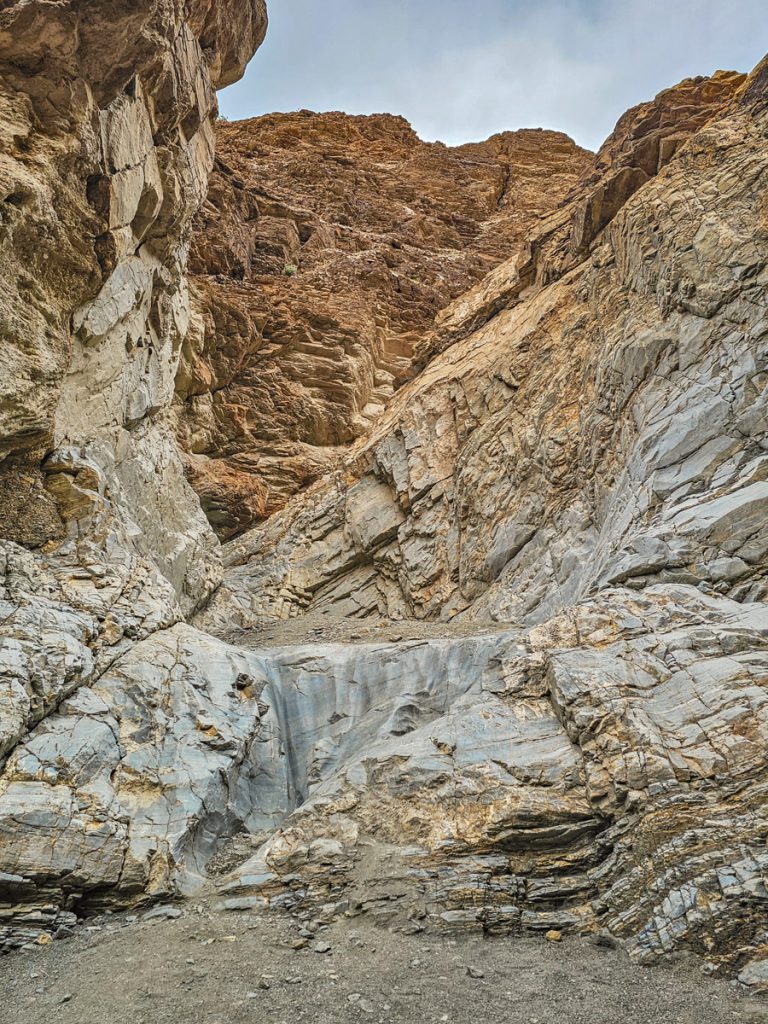
The hike starts with about a 2/3 mile walk through the desert from the trailhead to the mouth of the canyon. From there, you head up into a winding slot canyon with tall, steep walls that twist back and forth. In some sections, the canyon narrows and feels taller and tighter, and in others, the walls tilt outward and the path widens a bit. Either way, it’s a really beautiful slot canyon and I really enjoyed the hike.
The trail gradually gains elevation as you move through it. I’d call it a moderate incline overall, nothing especially steep for most of the hike, though you are steadily climbing. About halfway through, there are 3 little scramble sections – nothing too challenging (I’d call them class 2).
The last tenth of a mile is where it gets noticeably steeper and sandier as you push up to the top. At the summit, you’re rewarded with 360-degree views over the surrounding mountains and down into Badwater Basin.
For the most part, you just follow the canyon itself, though there are a few offshoots to be aware of. You’ll see arrows made of rocks on the ground pointing you in the right direction. The first one is pretty obvious, since the side canyon is extremely narrow and clearly not the main route. The later ones are more important to pay attention to.
If you don’t care about the panoramic views at the top, you could simply hike as far as you’d like into the canyon and then turn around. The full canyon is only about 1.2 miles long, so it’s not especially long either way.
There is a short, unpaved, gravel drive from the main road to the parking area, but any standard car should be able to handle it.
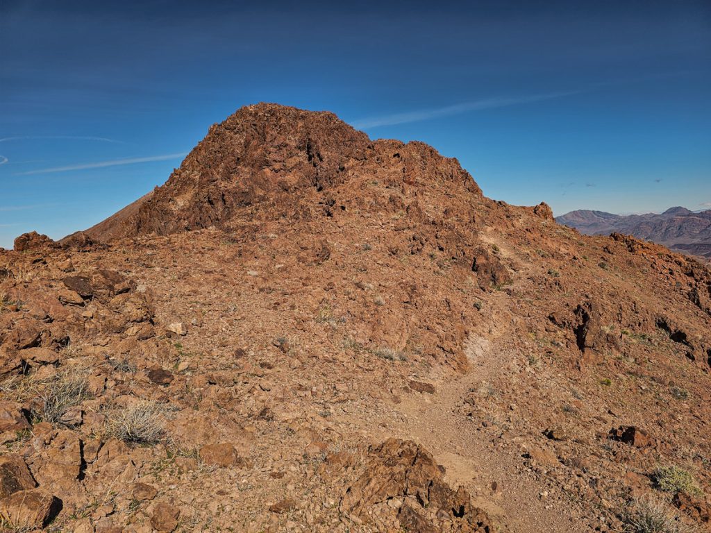
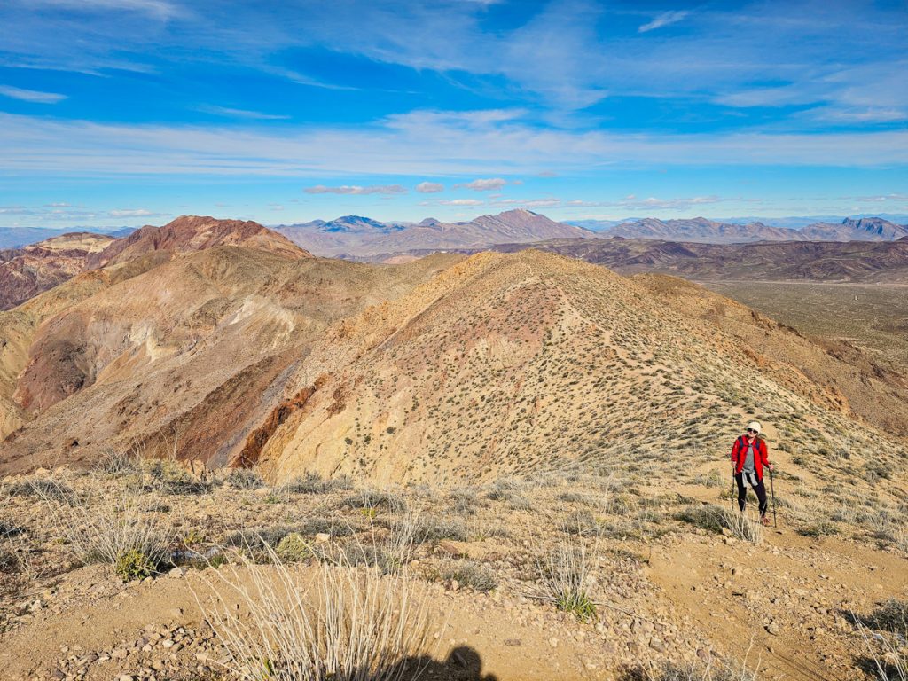
12. Mount Perry
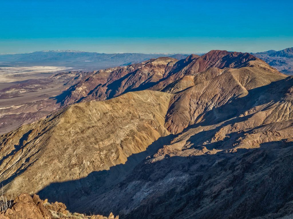
Mount Perry is one of the biggest hikes in Death Valley. The trailhead starts right at the Dante’s View parking lot and takes you up and across a series of mountain peaks before reaching Mount Perry, the slightly larger red peak you see in the distance.
This is a strenuous hike. It’s 8.8 miles round trip with about 2,000 feet of elevation gain, and there are some fairly steep climbs and descents along the way. I was very happy to have my hiking poles, both for the distance and for the downhill sections, many of which were on loose, gravelly, or sandy paths.
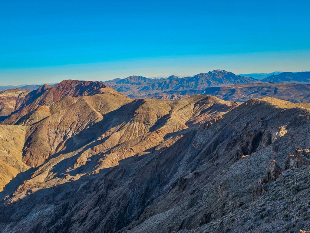
The views are phenomenal from start to finish. You’re looking east toward layered mountain ranges, and west down over Badwater Basin and the mountains beyond. Much of the trail follows right along the ridgeline of the multiple peaks you’re crossing, sometimes going straight up and over rocky sections, which makes for a fun trail. I felt very safe on this trail, although I wouldn’t do the hike in very windy conditions.

My one complaint with this hike is that the views are very, very similar from start to finish. Sure, you get changing vantages of Badwater Basin and the mountains you’re climbing, and they’re fantastic views. But there’s no real change in scenery, big payoff at the end, or unique features you come across during the trail. Still, if you want to get away from the crowds, this really is an excellent option – I only saw 5 other people the entire time I was hiking.
It took me just over 5 hours total to finish the hike. I came up to Dante’s View for sunrise, then started the hike shortly after. This was nice timing, because the sun was shining towards the views and the basin and mountains weren’t backlit.
Where to Stay in Death Valley
I would definitely try to stay within the national park when you visit, as it’s actually quite a long drive through the desert to get into the central part of the park from the nearest outside towns, and that will eat up quite a bit of your time.
There are campgrounds and hotels based in two different areas: Furnace Creek and Stovepipe Wells. Furnace Creek is the main area. It has the main Visitor Center (with Wifi) and closer proximity to the majority of the spots on this list.
Stovepipe Wells is about 30 minutes north of Furnace Creek and is right by Mosaic Canyon and near the Mesquite Flat Sand Dunes. There is a very small ranger station here, and a general store, but it is more out of the way.
Both of these locations have gas stations.
Whether you are camping or staying in a hotel, I would recommend staying in Furnace Creek, I just think its the more central and logical option.
Furnace Creek Hotels:
- The Inn at Death Valley: A beautiful oasis in the desert with an outdoor pool, spa, restaurant, and golf. Very centrally located.
- The Ranch at Death Valley: Also a beautiful property & centrally located, with pool, spa, restaurant, golf, playground, and other activities
Stovepipe Wells Hotel:
- Stovepipe Wells Village Hotel: A little farther away in the Stovepipe Wells district, this hotel has a restaurant, pool, firepit, and is further away from most of the crowds
Main Furnace Creek Campgrounds:
Sunset Campground: An enormous campground with hundreds of spots. It’s almost more like a gravel parking lot – there are no trees, no picnic tables, no fire rings, just places to park. If you want nature-y vibes, this isn’t really your place, but the good news is that it almost never fills up. When I was there in mid-week in mid-February, maybe only 5% of the spots were filled.
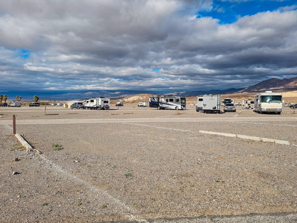
Furnace Creek Campground: This is the only campground that takes reservations, and the campsites are generally nicer than Sunset.
Texas Springs Campground: This campsite has great views and some trees/vegetation.
Main Stovepipe Wells Campgrounds:
Stovepipe Wells Campground: Large campground with limited vegatation but close to the general store
This is just an overview of the campground information at Death Valley – for more details and important information, please visit the Death Valley camping page.
How Many Days Do You Need in Death Valley?
Three days in Death Valley gives you a really good overview of the park. This is what I did, and it really did feel like the perfect amount of time.
If you only have one day in Death Valley, I would prioritize Zabriskie Point for sunrise or sunset, then do Badwater Basin, Artist Drive, and a smaller hike near Badwater Road. I would recommend choosing between Badlands Loop, Desolation Canyon, or Natural Bridge.
If you are willing to get up at sunrise and go until sunset, and want to see and do as much as possible, you could consider Zabriskie Point for sunrise. After sunrise, immediately do the Badlands Loop-Golden Canyon-Gower Gulch loop, then Artist’s Drive, then Badwater Basin for sunset. It will be a full day and you’ll need to keep moving, but it’s possible.
If you have two days, I’d for sure add Dante’s View, Mesquite Flat Sand Dunes, and Mosaic Canyon on the second day. If you’re up for a big hike, you could add Mount Perry in there, but you might not have enough time for the sand dunes AND Mosaic Canyon if you do .
With three days, you could add any of the other hikes from this list that interest you, and/or head north to see Ubehebe Crater.
When to Visit Death Valley
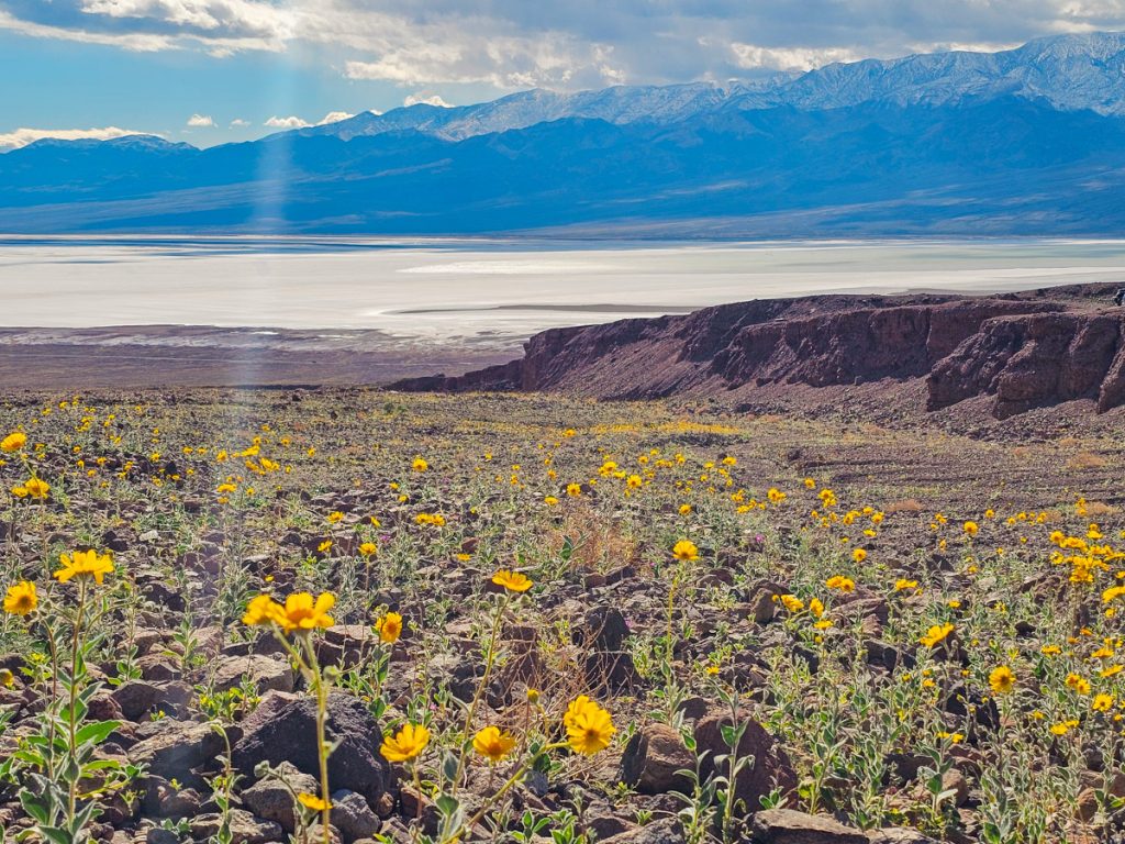
November through March is the best time to visit. Mid-February through mid-April is wildflower season. I was there in mid-February and the wildflowers were already starting to bloom and looked beautiful.
Summer should generally be avoided, as temperatures can become dangerously hot and make it difficult to do much beyond a few viewpoints. Even spring and fall can be extremely hot, and ideally should be avoided if you want to do much hiking.
Timed Entry Reservations at Death Valley
No reservations are required for entrance into the park or any of the day hiking trails. Some backcountry/overnight trails do require a permit that you can pick up at the Visitor Center.
![How to Spend 4 Perfect Days in San Diego [Itinerary]](https://usadventurer.com/wp-content/uploads/2023/08/coronado-island-beach-sidewalk-san-diego-california-768x576.jpg)