This Canyon River Hike in Capitol Reef Feels Like Utah’s Underrated Answer to the Narrows
Hiking in the Narrows in Zion, with the tall, red walls of the canyon towering over you, is absolute bucket list material. But what most people don’t know is that there’s another, very similar hike in another Utah national park, with a fraction of the crowds.
The hike? Sulphur Creek, and it’s probably my favorite hike in the Fruita District of Capitol Reef National Park (at the very least, it’s tied for first with Cassidy Arch). We loved this exciting, adventurous trail that took us through deep canyons with fiery orange walls, passing 3 different waterfalls as we walked next to or in the picturesque Sulphur Creek.
And what’s maybe the best part: we saw almost no one else on this hike. Despite being smack dab in the middle of the popular Fruita District, this hike flies very much under the radar.
Incredible hike all to ourselves? YES PLEASE
Now, that being said, there are some considerations that may make this hike not doable for your group. So, let’s get into everything to know about hiking the Sulphur Creek Top Down Trail.
Hike Stats
- Distance: 5.8 miles (9.5km)
- Elevation Gain: Negligible – you’re heading downstream the entire time
- Difficulty: Moderate
- Time to Complete: We took just under 3.5 hours to complete this hike. Of that, our moving time was 2 hours 45 minutes.
- AllTrails: Check out the map
The Trailhead
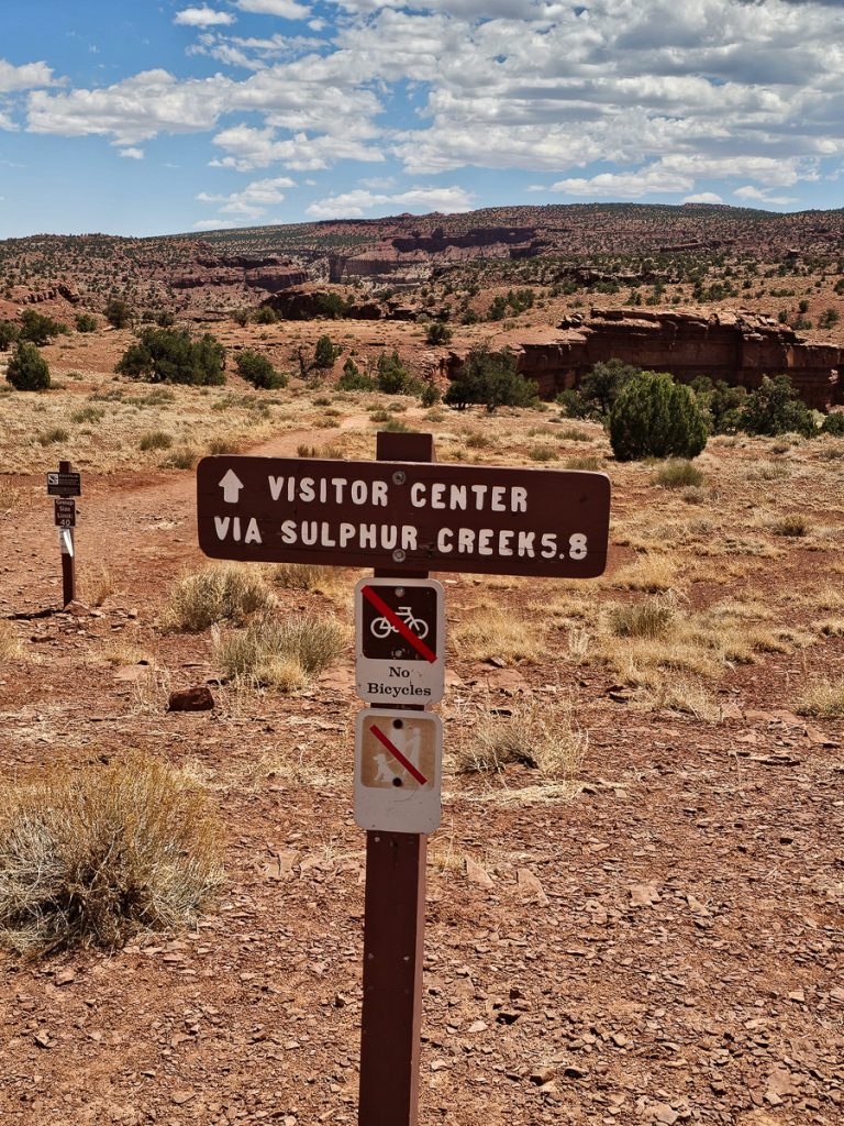
The trailhead for Sulphur Creek is off Highway 24, just west of the Chimney Rock parking lot and a 5-minute drive from the Visitor Center. You can find the location here.
Now, Sulphur Creek is designed to be a point-to-point hike, aka a one-way hike, with the trail ending at the Fruita District Visitor Center.
You need two vehicles to do take advantage of this, dropping one car at the Visitor Center and then driving the group in the second car to the trailhead.
Alternatively, if you really want to do the hike but only have one car, you could leave it at the Visitor Center and hike the 3 miles along Highway 24 to the trailhead. Not a great option, but technically you could do this.
Finally, you could also park at the Sulphur Creek trailhead and hike to the final of the 3 waterfalls on the trail, and then turn around and come back up the stream to the trailhead, making it an out-and-back hike. This would be about 10 miles round trip.
Starting the Trail
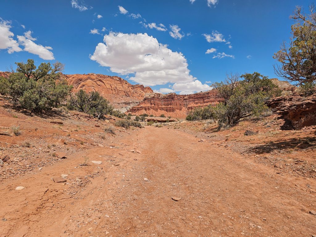
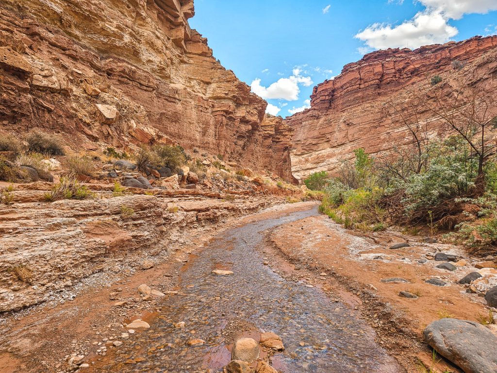
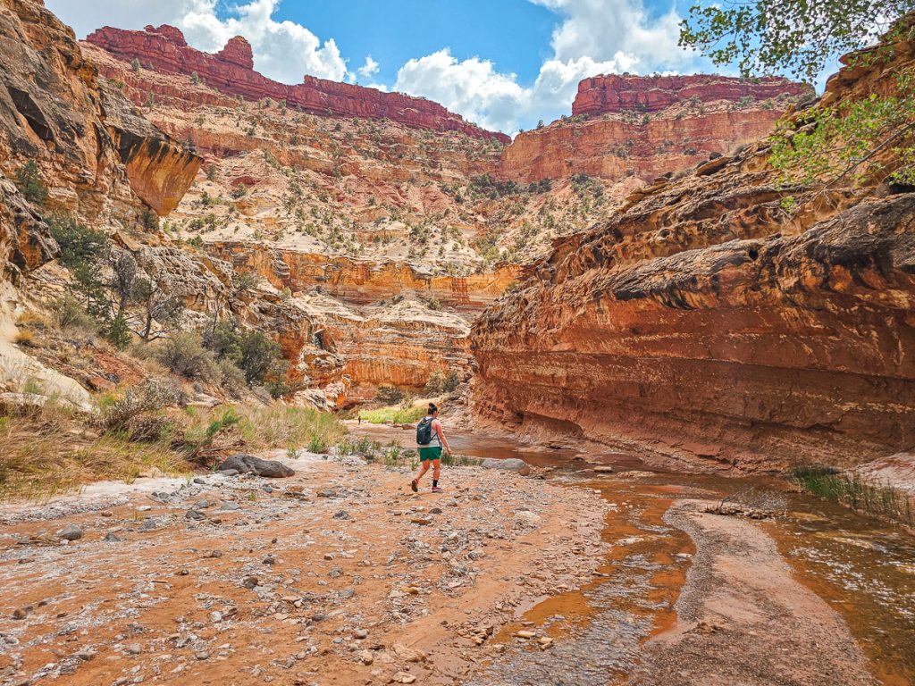
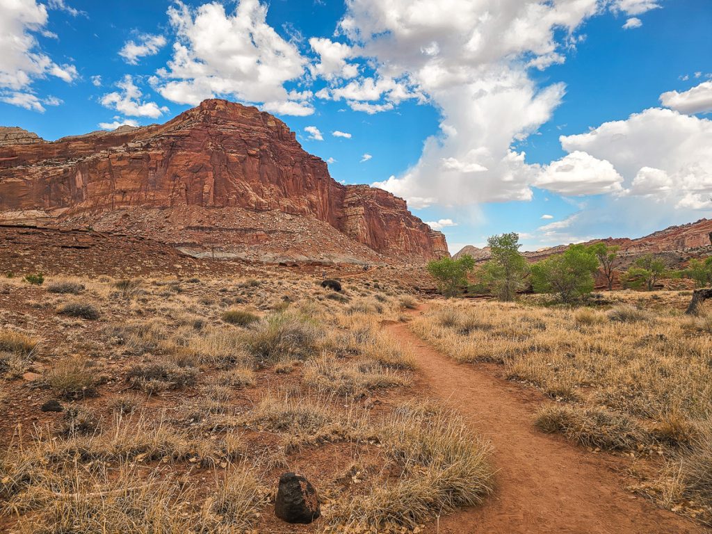
The entire hike is 5.8 miles, with the first 1.8 miles being in a dry wash. As you start the trail, you’re hiking essentially just in the middle of the desert, with no real canyon to speak of around you. As you continue hiking, the trail starts dropping in elevation, and the canyon walls start rising higher around you.
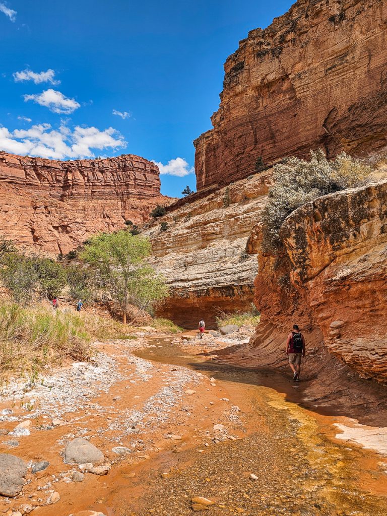
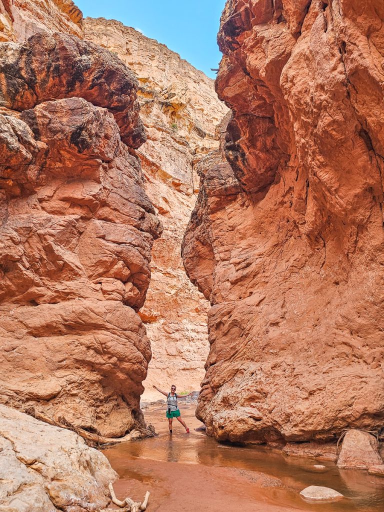
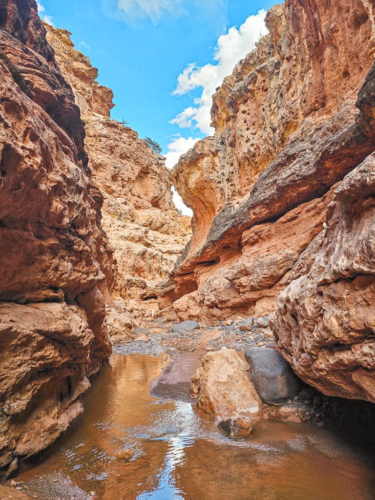
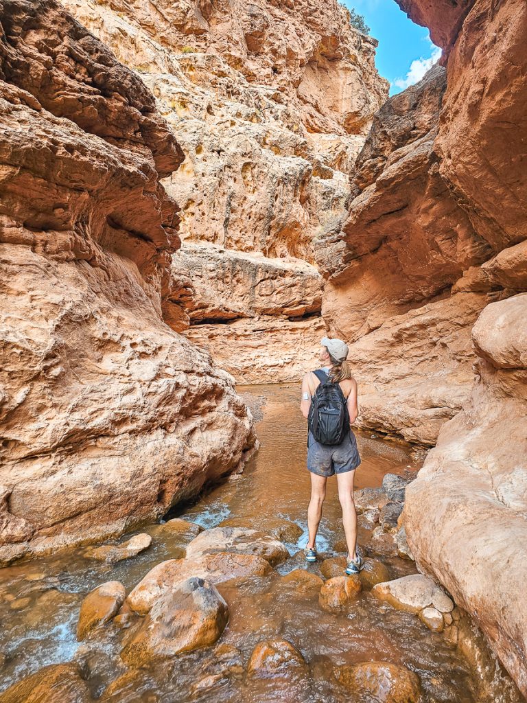
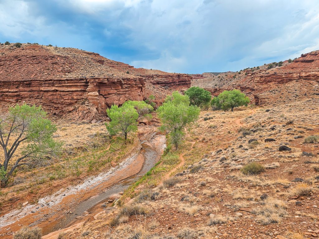
The canyon winds back and forth until, at 1.8 miles, you intersect Sulphur Creek! Here, you’ll take a left to hike with the flow of the water. You’ll continue in this creek for the next four miles.
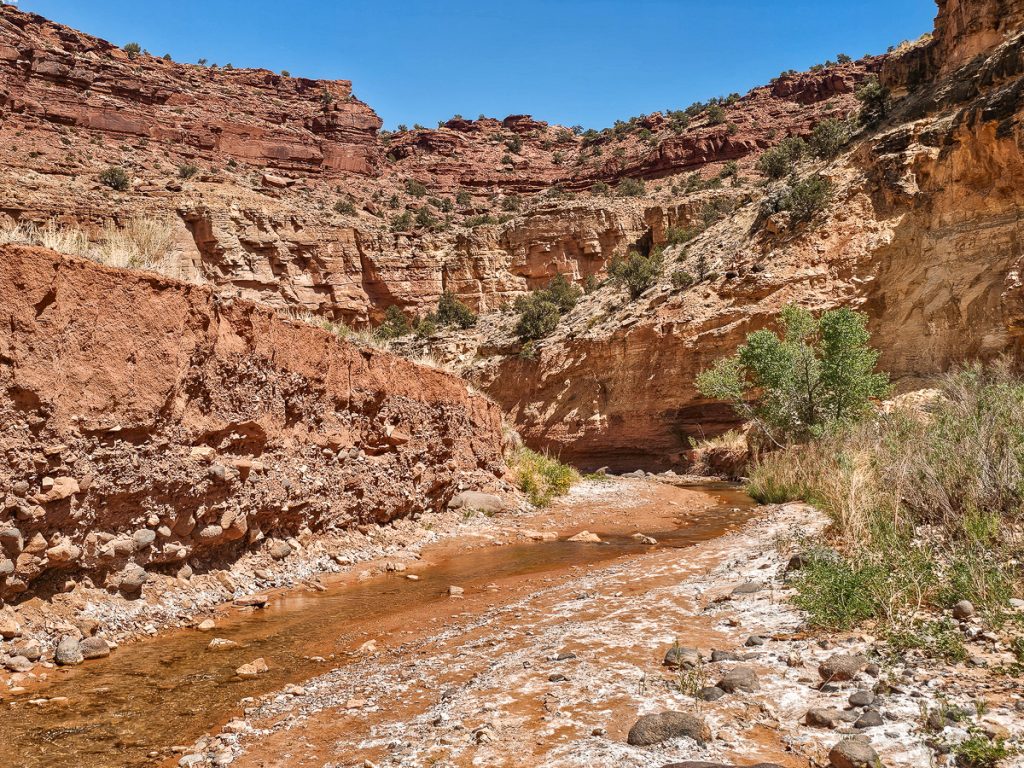
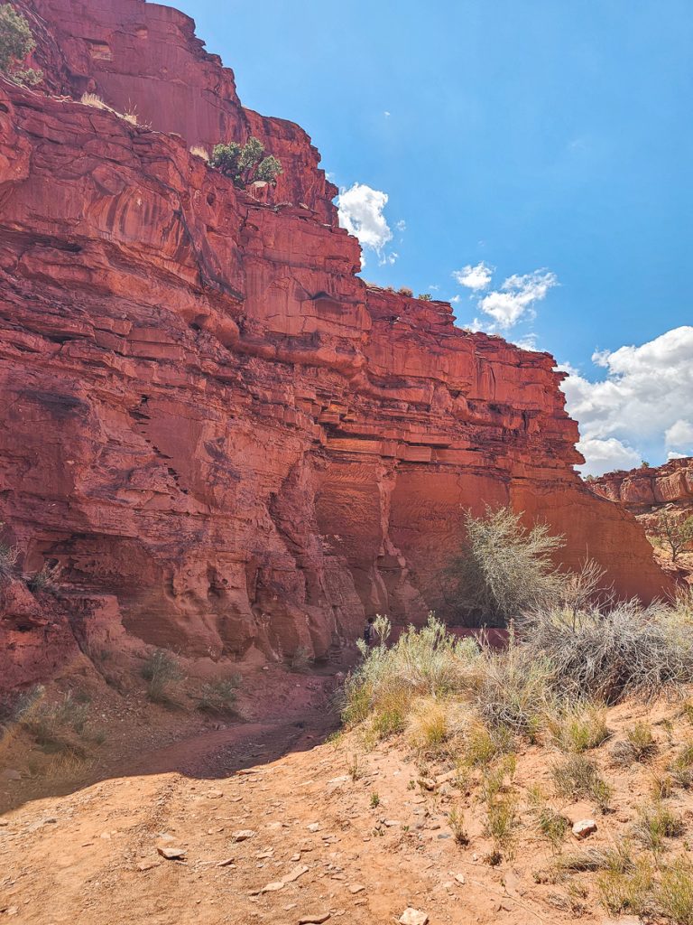
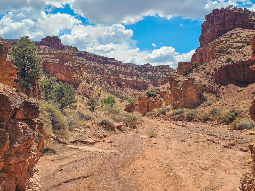
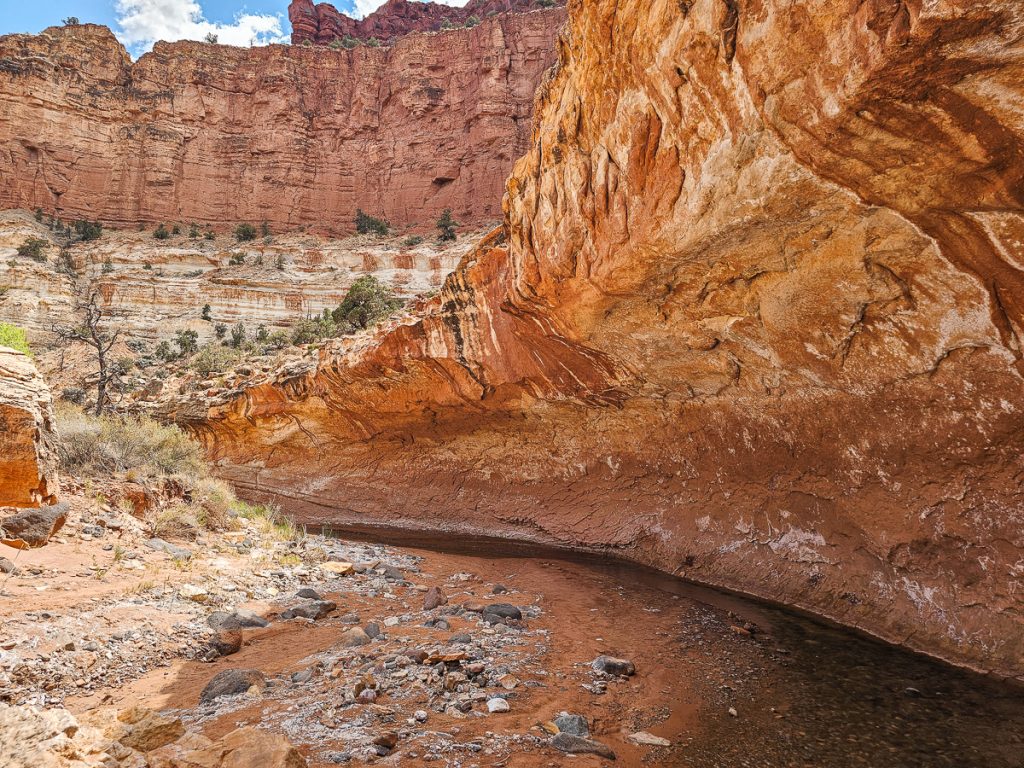
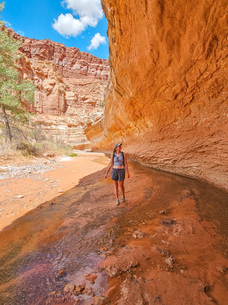
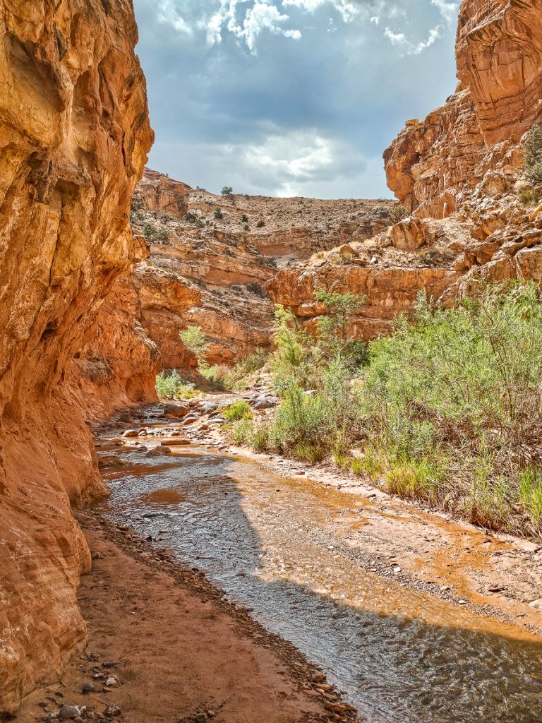
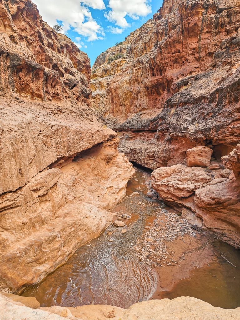
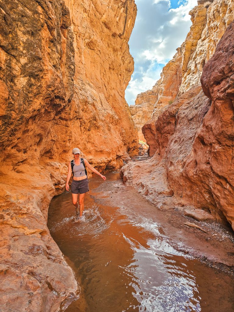
The views are amazing, with tall, sheer red canyon walls curving around you, the clear creek babbling in the center, and bushes and trees dotting the water line. The canyon meanders back and forth, curving with the squiggly river.
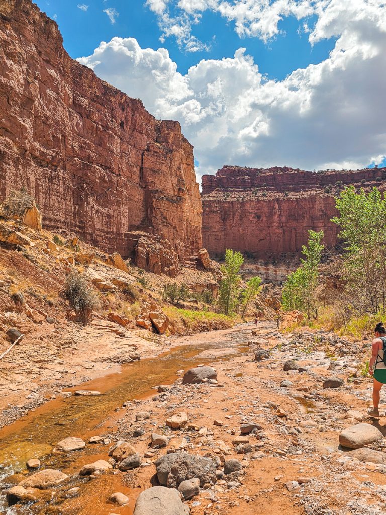
We loved the curving walls, and the way flash floods had sometimes carved little overhangs in the cliffs. Every turn and bend in the canyon was just incredibly scenic.
Especially since we were all by ourselves, it felt like a big adventure, discovering the next cool spot on the trail.
I’ll let the photos do the talking for a minute:
Quick sidenote: The best viewpoints in the Fruita District are 3 overlooks right by each other: Panorama Point, Goosenecks Overlook, and Sunset Point (make sure these are on your itinerary!). Anyway, Goosenecks Overlook looks down over a dramatic curve in Sulphur Creek.

As you’re hiking, pay attention to your map (download AllTrails and/or offline Google maps) – because you’ll actually be hiking through Goosenecks at the bottom of the overlook.
If you look up at the right time, you can even see just a little bit of the railing of the overlook far above you. This is a phenomenal overlook from above, and it’s extremely cool to actually be hiking it down in the canyon.
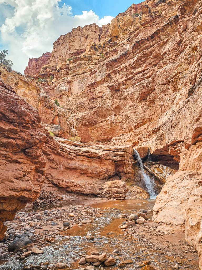
The Upper Waterfall
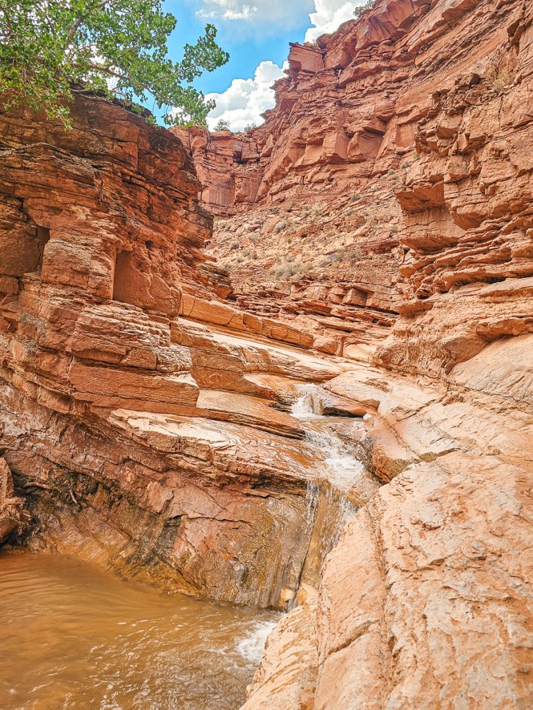
After just over a mile hiking in the creek (which is almost exactly halfway through the whole hike), you reach the first waterfall (or the Upper Falls). Keep to the right of the falls and carefully climb down the ledges to get to the base – you’re climbing down the rocks next to the falls, not through the water going over the ledge.
This is a very easy ledge to get down; be careful, but the average adult shouldn’t have any problems.
Once you’re down, you can go back and swim and play in the small pool underneath the waterfall (depending on water depth). The view from the bottom, looking back at the falls, is really pretty, with lots of curving ledges creating visual interest. It almost felt like the waterfall was tucked away in a hidden cove.
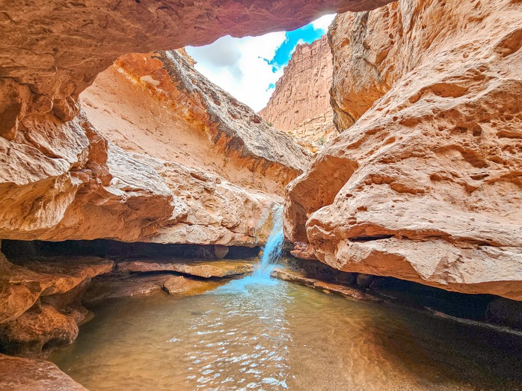
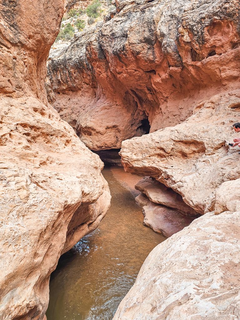
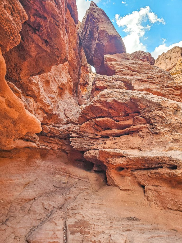
At the first waterfall, the canyon gets a lot more more narrow, becoming a true slot canyon for a while. Before this, we’d call this a canyon hike, but not quite slot canyon level until after the first waterfall.
The Middle Waterfall
The Middle Waterfall is just 0.25 miles past the Upper Falls. Like the first, you scoot around to the right side of the waterfall and scramble down a series of ledges.
This scramble was a little more technical, but again, felt extremely doable for the average adult, and no one in our group felt like this was dangerous at all. Most of it was just going down little ledges, but you did have to carefully position your feet and brace your hands against the rocks for the final drop.
I feel pretty confident saying that if you can do a 6-mile hike, you can do these scrambles.
The view back up at the Middle Waterfall from below was also extremely beautiful, with a lot of texture and variation in the canyon walls around the cascade.
There are 1.7 miles between the Middle Waterfall and Lower Waterfall. The slot canyon continues for a litle bit after Middle Falls, and then opens back up again. No matter the width of the canyon, the views continue to be phenomenal!
The Lower Waterfall
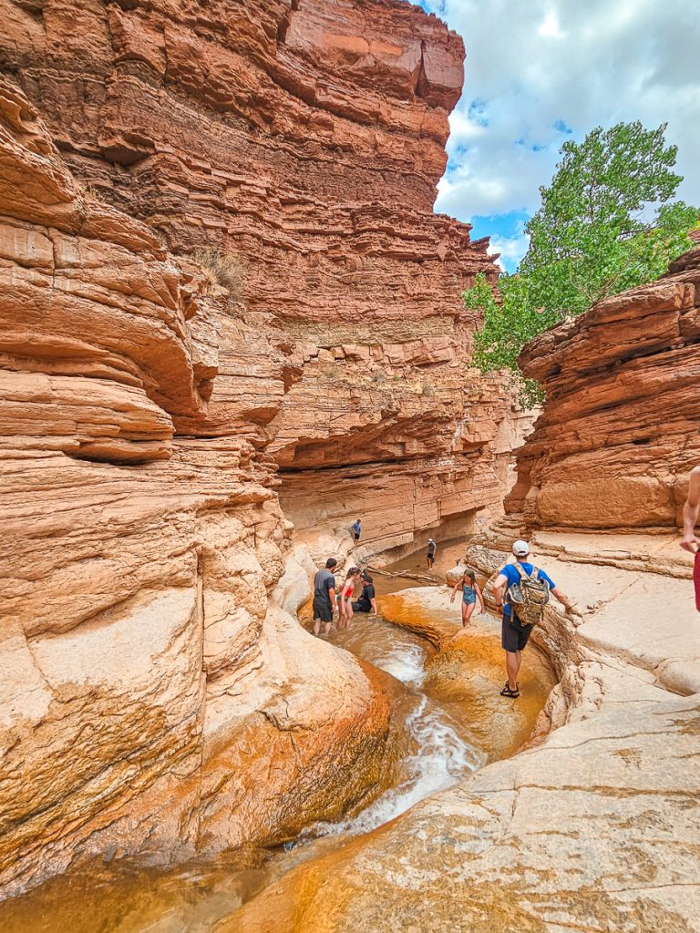
The third and final waterfall is about 0.75 miles before the end of the trail. This one is extremely fun, as the stream has cut a narrow, smooth, winding path down through the rock, which people use as a slide.
Now, fair warning—park rangers officially advise against sliding down this waterfall, since it’s the most common spot for injuries in the entire park. The pool at the bottom isn’t very deep, and even though the slide itself isn’t long, it’s surprisingly easy to hurt an ankle when you hit the sand hard.
That said, plenty of people were ignoring the recommendation and sliding down anyway, including most of our group. You’ll have to decide for yourself, but keep the risks in mind, and if you do choose to slide, watch your ankles when you hit the bottom.
If you don’t want to slide, you can shimmy along the ledge to the left of the falls and then scramble down to the base.
Finishing Up
The final ~3/4 mile takes you out of the canyon and through the hills to end at the Visitor Center.
About halfway through this section of trail, keep an eye out for the historic Sulphur Creek Lime Kiln just off to your left. Built around 1900 by Fruita residents, the kiln was used to produce lime for mortar and cement, to neutralize acidic soils, and to protect fruit trees from pests.
Crowds
One of the best things about this trail was the lack of other people on it. We saw one group hiking back up to the trailhead as we were about 1 mile in and still in the dry wash – they said they just hiked to the stream and back.
(Honestly, I wouldn’t recommend this as you’re still doing nearly 4 miles round trip and it’s in the least interesting section of the trail.)
We saw literally no one for 3.5 miles of hiking in the creek, and it was amazing.
We finally started seeing groups only when we reached the final waterfall. This is because there’s technically a bottom-up trail, called the “Sulphur Creek Waterfall Hike,” that takes people from the Visitor Center to the Lower Falls.
This trail is short, easy, dry, and family friendly, and is thus pretty popular – we saw probably 7 groups in that last 1/2 mile.
Water Levels
The creek’s water level varies quite a bit, depending on the season, recent rainfall, and snow runoff. Ocasionally the water can get pretty deep, and even have areas where the water is chest high, and you have to swim. Check with the rangers at the visitor center to get a read on current conditions before you start.
When we hiked in early June, the deepest it ever got was knee to mid-thigh, but this was just the occasional deep spot here and there. Mostly the water was ankle deep, and sometimes mid-shin deep.

Lower water levels also meant that the stream wasn’t all that wide, and there was plenty of space to walk along the dry shore. This made it easy for us to walk on the dirt/rocks on the side of the river or to cross the stream by hopping on the rocks as needed.
About half of our group, who wanted less time with wet feet, did this for several miles. It was pretty hot the day we hiked and I wanted to cool down, so I spent most of my time hiking through the water. It was really pleasant! I still walked on the banks sometimes and bypassed the sections that were a little bit rockier or deeper.
The water temps in early June were very pleasant; not chilly at all.
Flash Flood Precautions
Sulphur Creek is in a flash flood danger zone. Check the forecast or at the Visitor Center before you go, and don’t hike if there’s rain anywhere in the region. Flash floods can and do occur, even if there is rain miles away, and are incredibly dangerous and kill people every year.
If the water in the creek starts to get muddy, churned up, and/or water levels start to rise, immediately seek high ground.
Children
I’d be hesitant to bring young children on this hike if the water level is higher. For example, if it was deep enough to require actual swimming, I definitely wouldn’t bring kids (although honestly, I might not want to do the hike myself if it was that deep).
Final Thoughts
Overall, the combination of tall, undulating canyon walls, river views, and the adventure aspect of hiking in the water and going down waterfalls made this a truly phenomenal hike. Despite it being a longer distance, the hike was honestly pretty easy, and is an unforgettable way to spend an afternoon in Capitol Reef National Park.