Utah’s Oft-Forgotten National Park Is Full of Epic Arches, Canyons, and Views (and Pie!)
Utah’s oft-forgotten national park is filled with soaring mountains, steep canyons, colorful rock formations, historic buildings, and some truly fantastic hikes…
Capitol Reef is one of the least visited national parks in Utah – but it shouldn’t be. There are SO many incredible sites here!
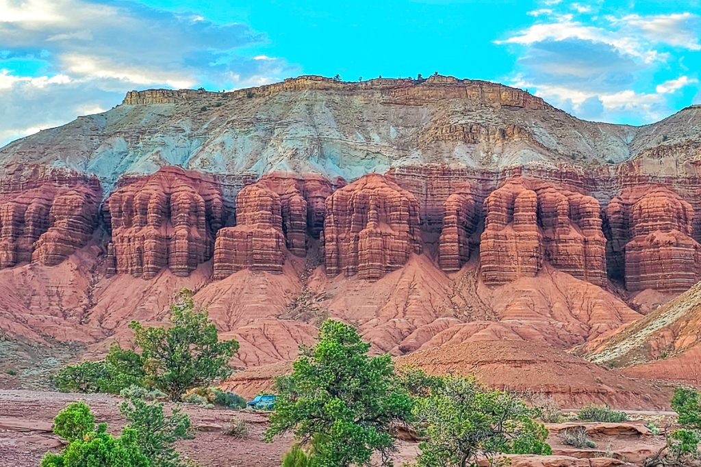
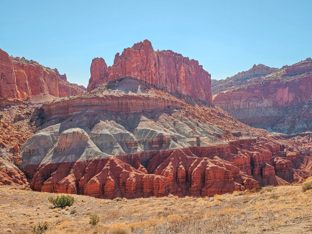
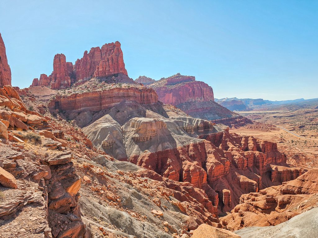
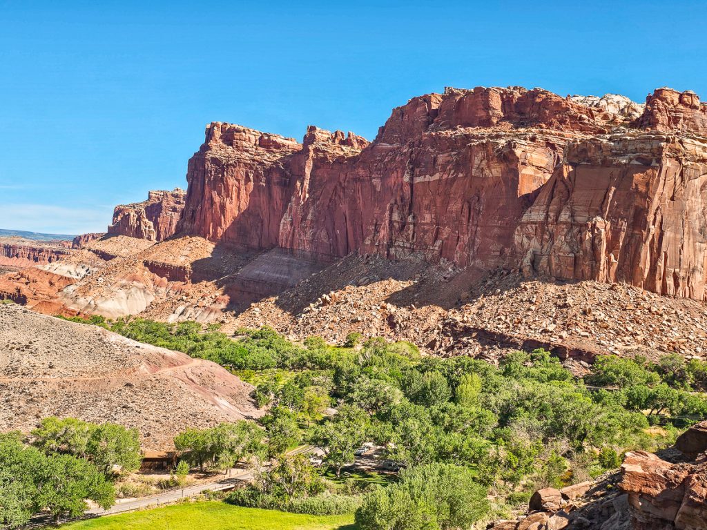
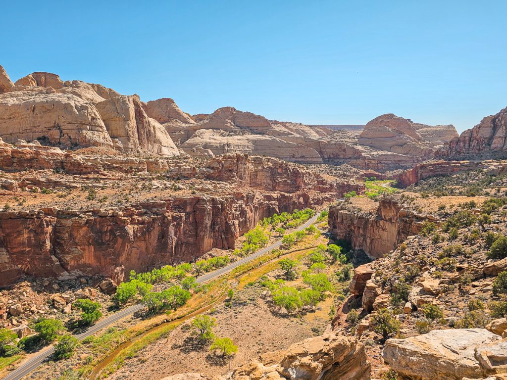
The park was established to protect the Waterpocket Fold, a 100-mile-long monocline -essentially a giant wrinkle in the earth’s crust created from the forces of deposition, uplift, and erosion.
The main features of Capitol Reef follow this massive feature, and you’ll get to explore the impressive curves, textures, and formations of the Waterpocket Fold as you experience this park.
Capitol Reef has three districts: Fruita, Cathedral Valley (the Northern District), and the Southern District. Both the northern and southern regions are remote, often requiring high-clearance or 4WD vehicles, depending on road conditions.
Most visitors stick to the Fruita District – and that’s what this article will focus on: the best hikes, scenic viewpoints, and can’t-miss experiences around Fruita.


10 Fantastic Hikes in Capitol Reef
1. Cassidy Arch Trail

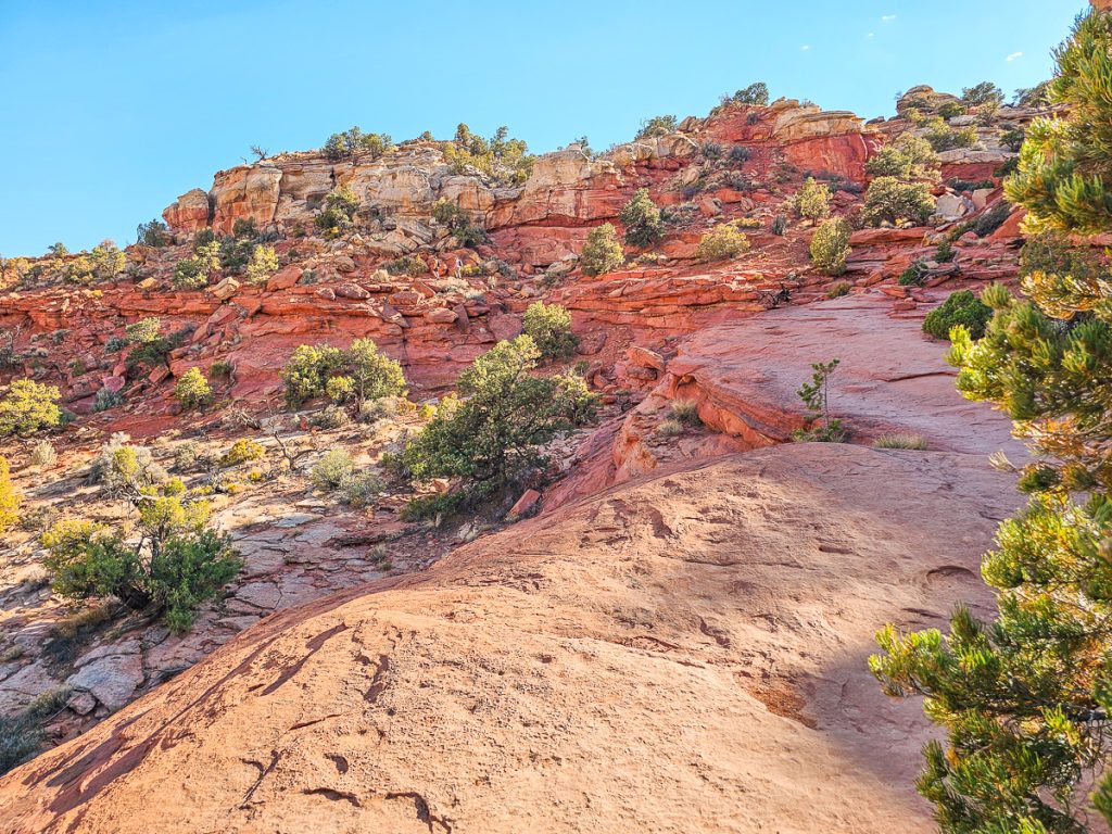
Cassidy Arch should be on just about everyone’s itinerary when visiting Capitol Reef. This is one of our favorite hikes in the park, and is a moderate hike that many people can handle.
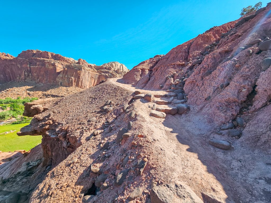
This trail starts by following the Grand Wash Trail, then quickly turns and heads straight up the mountain. The trail becomes quite steep as you climb up the side of the cliff, often climbing rocky “staircases.” This is where you’ll get most of your elevation gain.
When you reach the top of the ridge, the hardest part is over, and you’ll follow the ridge line in and out along the mountainside until you reach this incredible viewpoint looking towards Cassidy Arch!
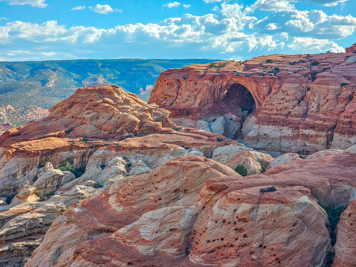
While this might seem to be the “end point” (there’s the arch!), you will keep hiking for another 1/2 mile, winding around the ridge until you actually right behind the arch.
It’s a little bit deceptive, because from the viewpoint, Cassidy Arch almost looks like a cave, but there’s no question when you arrive behind it. Plus, the views from the backside are insane!

Not only do you get a cool from behind shot of Cassidy Arch at the end, this is one of the few arches in Utah that you can actually walk on (usually walking on arches is strictly forbidden).
And don’t worry, the arch is actually very wide and easy to get to – the risk of just accidentally falling off is very, very low.
If you fancy an extreme adventure, there are actually metal loops drilled into the top of the arch for rappelling.
- Distance: 3.1 miles round trip
- Elevation Gain: 667 feet
- Difficulty: Moderate
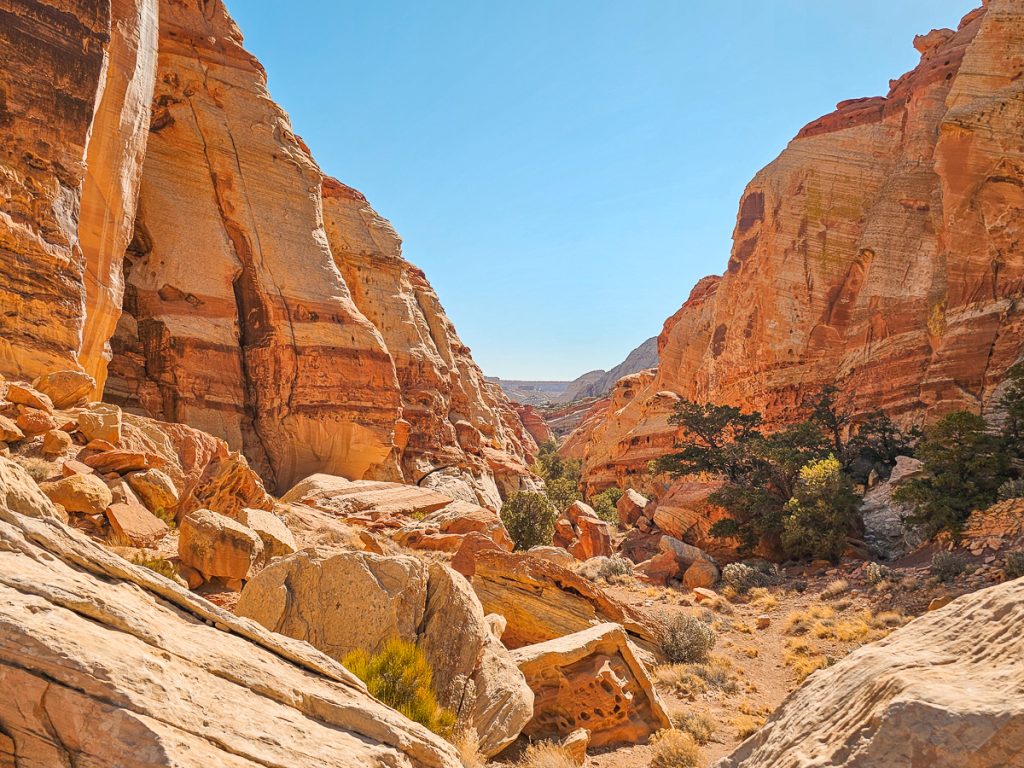
2. Grand Wash Trail
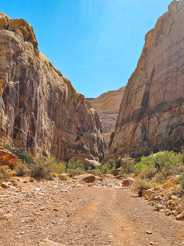
This easy, flat trail leads you through a scenic canyon with towering rock walls on either side. About a mile in, the canyon begins to narrow, creating a more enclosed, slot canyon-like feel. This section is appropriately called “The Narrows.” It’s never a tight slot, but the walls do close in enough to make it feel more dramatic.
If you’re familiar with the Narrows in Zion, I’d say it’s about similar to the first sections of that trail, just without the water.
The trailhead for Cassidy Arch branches off about 0.3 miles from the start of Grand Wash, so you can easily continue down Grand Wash after doing the arch.
Grand Wash Trail and Cassidy Arch begin off Grand Wash Road, a spur from the Capitol Reef Scenic Drive. If you hike Grand Wash Trail all the way through, you’ll eventually end at Highway 24. Alternatively, you could also start the hike from Highway 24 and end at the parking lot on Grand Wash Road.
- Distance: 4.7 miles round trip – but you can easily just do as much or as little of the hike as you want
- Elevation Gain: 340 feet
- Difficulty: Easy
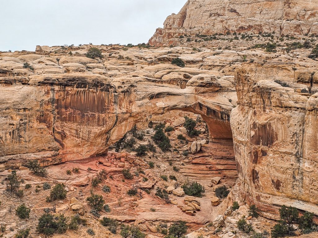
3. Hickman Bridge Trail

Hickman Bridge is one of the most popular hikes in Capitol Reef—and for good reason. The path is scenic, the hike is relatively easy, and it ends at a striking natural bridge.
This interesting trail starts by following the Fremont River and then takes a moderate climb up into the hills. You’ll pass a small arch/cave right on the path, before arriving at the Hickman Bridge!

Hickman Bridge stands 125 feet tall and spans 133 feet across—an impressive natural formation. The trail offers several great vantage points: you’ll first spot the bridge from a distance, then pass directly beneath it, and finally loop behind the bridge for another unique view.
Overall, it’s an easy hike with a big payoff.

- Distance: 1.7 miles round trip
- Elevation Gain: 416 feet
- Difficulty: Easy-moderate (Overall, I’d say easy, but there’s a small section with a decent elevation gain)
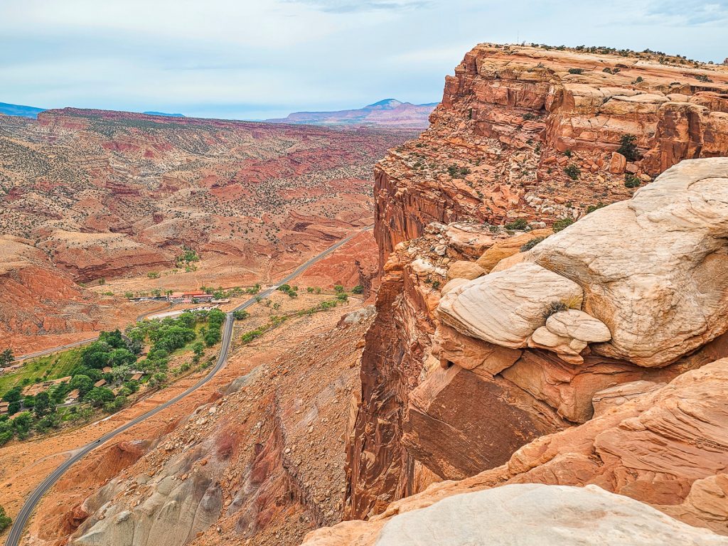
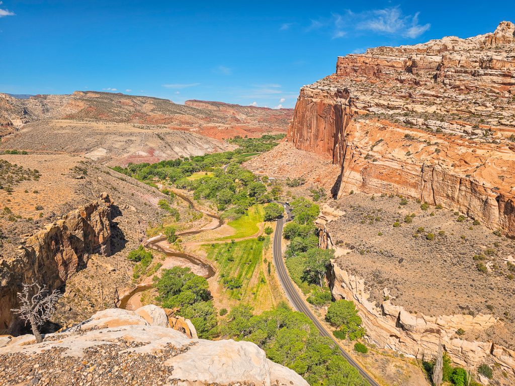
4. Rim Overlook Trail
The Rim Overlook trail starts off by following the same path as the Hickman Bridge Trail for about 1/4 mile, then splits off and heads higher up on the mountain. It follows rocky terraces surrounded by mountain peaks and craggly rocks, with dramatic views spread out in front of you,
The trail is a steady uphill climb for the entire hike, with a moderate, manageable incline.
Make sure you stop at the Hickman Bridge Overlook about halfway up the trail, where you can look down at the bridge from above. You’ll need to have sharp eyes though, as the bridge really blends in well with the background here!
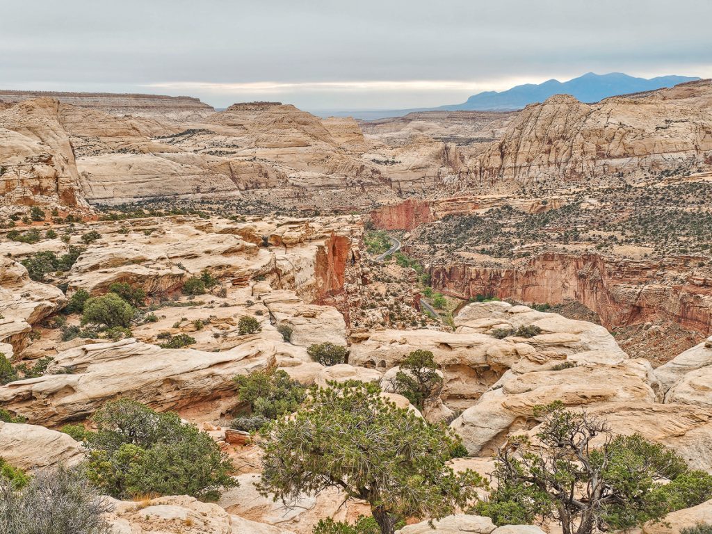
Finally, you’ll end at a panoramic vista at the rim along the very top of the Waterpocket Fold. It is absolutely wild being up on the highest point of the fold, looking down and along the steep cliffs stretching out in both directions.
Want to go even farther? The Navajo Knobs trail is a continuation of the Rim Overlook Trail, going 2.4 miles farther along the same path (for an 8.4 mile round trip hike).
- Distance: 4.3 miles round trip
- Elevation Gain: 1066 feet
- Difficulty: Moderate
5. Capitol Gorge Trail

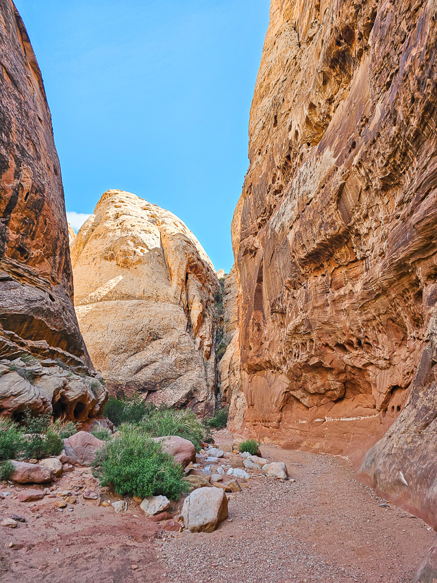
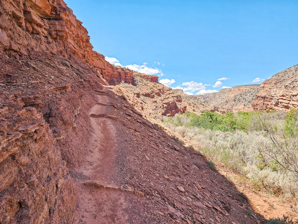
Capitol Gorge Trail is about a 30-minute drive south along the Scenic Drive from the Fruita District. In many ways, it’s similar to the Grand Wash Trail—a long canyon flanked by tall cliff walls. However, we felt like Capitol Gorge was the more visually interesting of the two.
The trail is flat, easy, and follows a dirt/gravel path through the deep canyon. A number of small side canyons break up the rock face, adding variety, and distinguishing it from the Narrows.
You’ll find a classic example of these side canyons midway through the hike. Here you’ll reach a turnoff for a side trail, where a short scramble takes you up the canyon wall to a ridge above.
This side trail leads to The Tanks—naturally formed depressions in the rock that often hold water. (They were unfortunately dry during our visit in mid-July.)

Along the way, look for the Pioneer Register, where early LDS settlers carved their names into the canyon walls.

- Distance: 4.4 miles round trip, but if you just go to The Tanks and back (what we did), it’s just 2 miles round trip
- Elevation Gain: 200 feet
- Difficulty: Easy
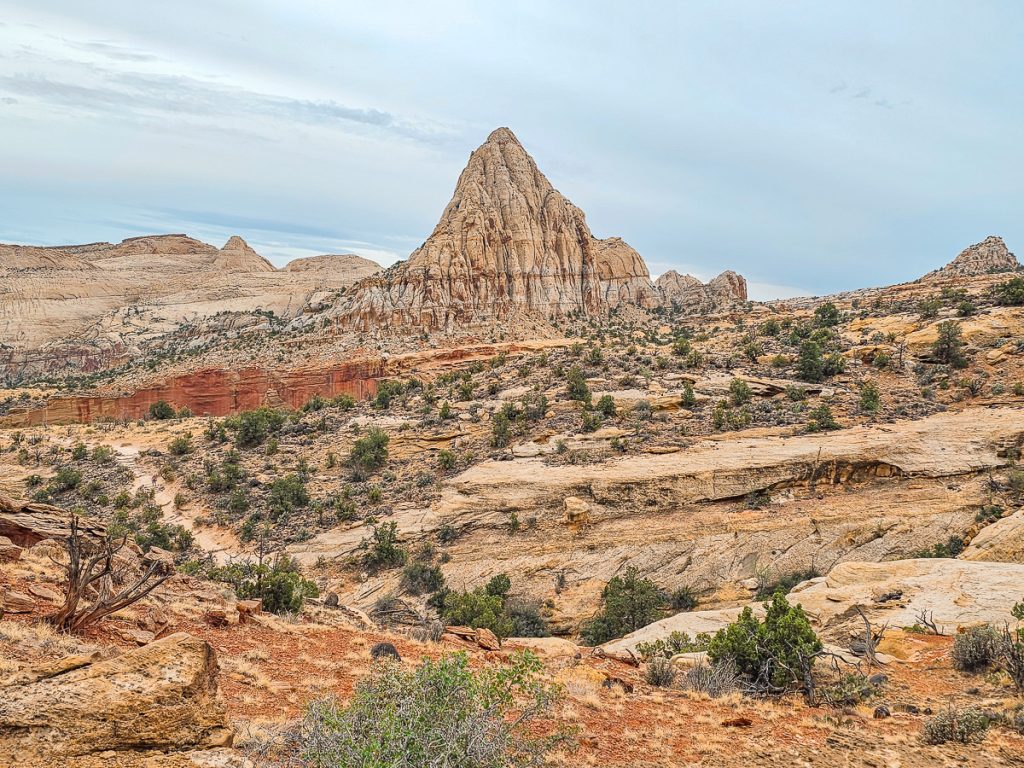
6. Chimney Rock Trail
Chimney Rock is a sandstone monolith fin that backs up against the Waterpocket Fold. It feels very similar to the Temple of the Sun and Moon in Cathedral Valley, or even Fisher Towers in Moab.
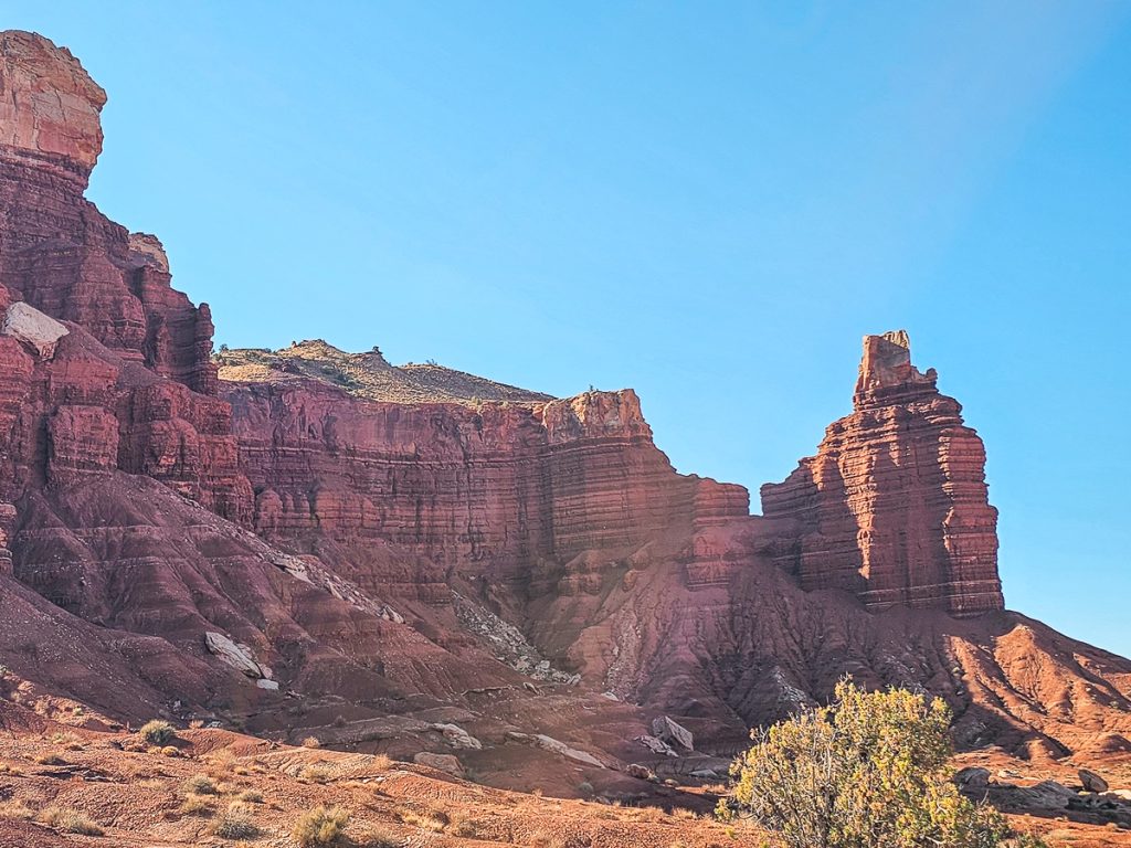
Chimney Rock Trail is located off Highway 24, and you can actually see the Chimney Rock formation from the road and parking lot. If you’re not up for another hike, it’s worth just pulling into the parking lot to admire the formation there. But if you have the energy and time, I do think the trail is worth it.
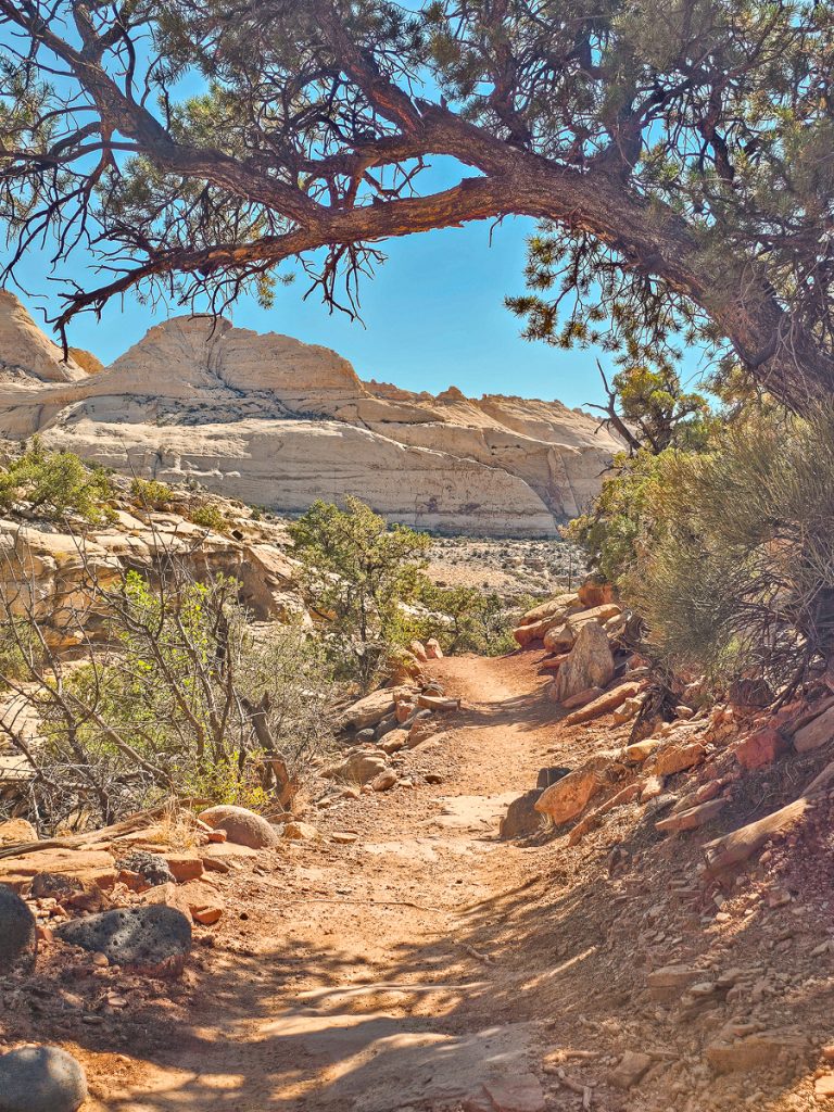
The trail starts with a short flat section before quickly climbing a series of fairly steep switchbacks up to the rim. Near the top, you’ll be rewarded with elevated views of the Chimney, which continue as you get to the top of the rim.
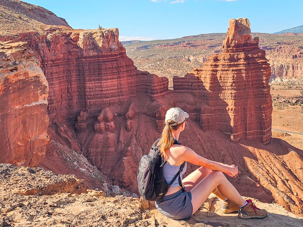
From the rim, the trail circles around to the backside of Chimney Rock, where you’ll get more fantastic views from above.
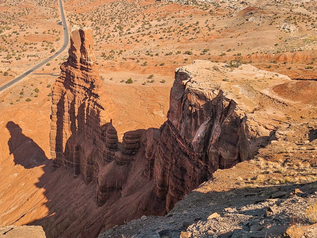
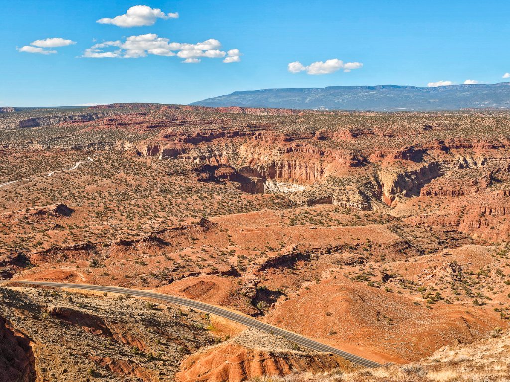
You’ll then continue hiking along the perimeter of the bluff, with expansive views of the Waterpocket Fold—some spots offer nearly 360-degree panoramas.
The trail then makes a loop and wraps around the far side of the bluff and then drops into a relatively shallow canyon between Chimney Rock and the Waterpocket. The views here are fantastic, as you’re extremely close to the layered, textured rock formations of the Fold.
From there, the loop connects back to the original trail, and you’ll descend the switchbacks to return to the trailhead.
- Distance: 3.6 miles
- Elevation Gain: 590 feet
- Difficulty: Moderate
7. Sulphur Creek Top Down Trail
This is, hands down, my favorite hike in Capitol Reef. However, it won’t be for everybody, but if you can make it work, you’re going to love it.
The Considerations
So, what makes it a little tricky? First off, this is a 5.8-mile point-to-point trail, meaning you’ll want to have two vehicles so you can leave one at the endpoint.
If you don’t have two cars, it’s still possible to do the hike, but you’ll need to walk 3 miles along Highway 24 to reach the trailhead from the endpoint. Alternatively, you could do an out-and-back hike, but it would then be over 10 miles.
Second, this is a hike through a canyon/slot canyon in Sulphur Creek. Depending on water levels and personal preference, you will frequently be hiking in the water. At the very least, you will definitely be doing a lot of creek crossings, and will occasionally get your feet wet.
Third, there are 3 small waterfalls you’ll need to navigate down on the hike. These are, honestly, pretty easy descents, but may be tricky if you’re with children or those with limited mobility.
The Hike
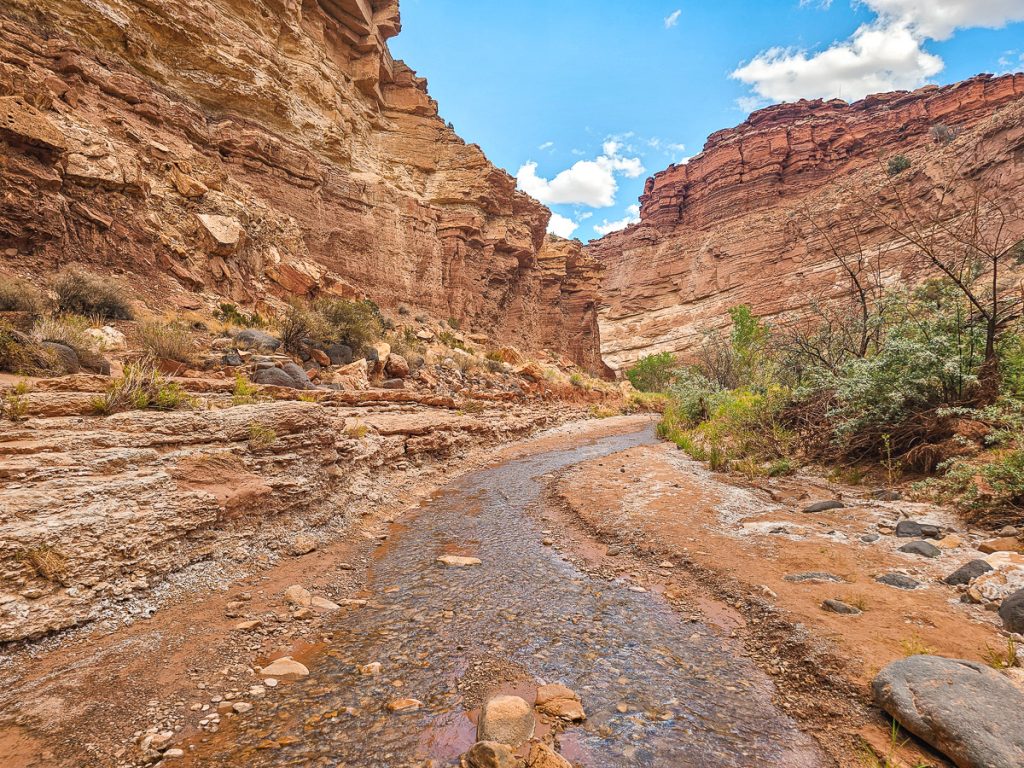
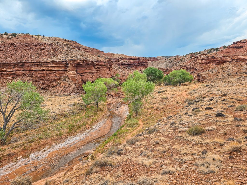
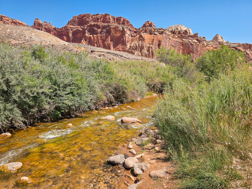
The trailhead for Sulphur Creek is on Highway 24, just west of the Chimney Rocks parking lot. The first 1.8 miles are through a meandering dry wash before you intersect Sulphur Creek and turn left to follow the flow of the stream.
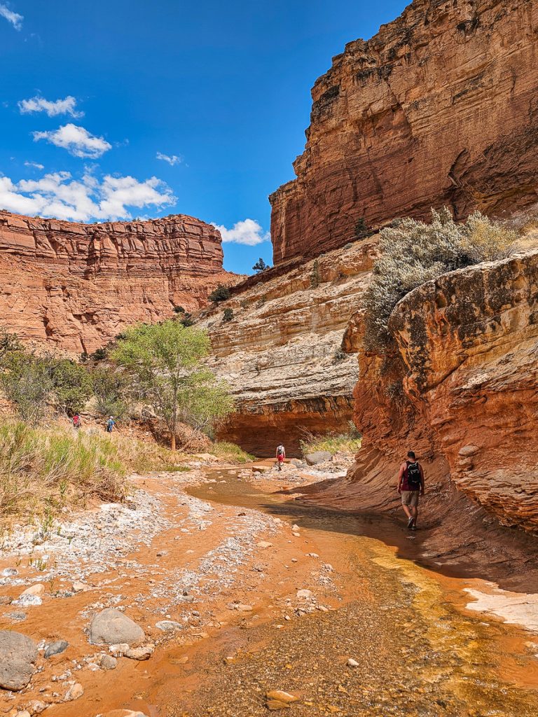
This is where the real fun begins: the views are amazing, with tall, sheer red canyon walls curving around you, the clear creek running in the center, and bushes and trees lining the water. The canyon walls curved and meandered around us, creating a really picturesque hiking setting.
Almost exactly halfway through the hike are the first and second waterfalls, where you have to carefully climb down some ledges to the side of the falls to continue on the trail. Around the waterfalls,the canyon gets a lot narrower, becoming a true slot canyon for just under a mile.
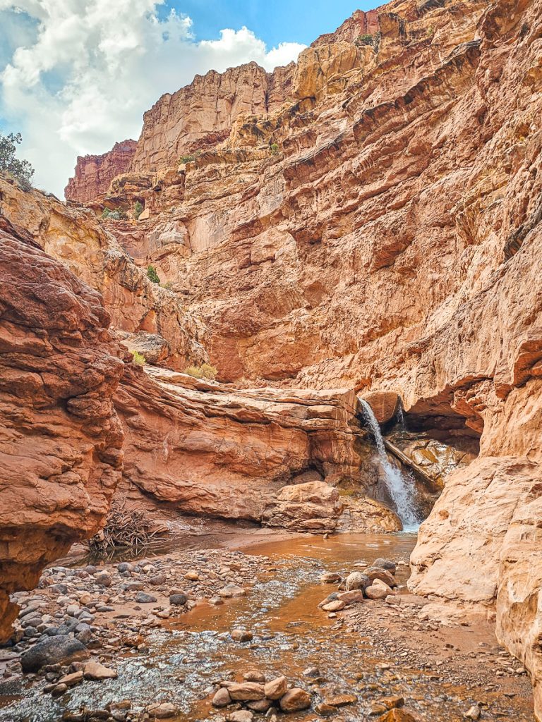
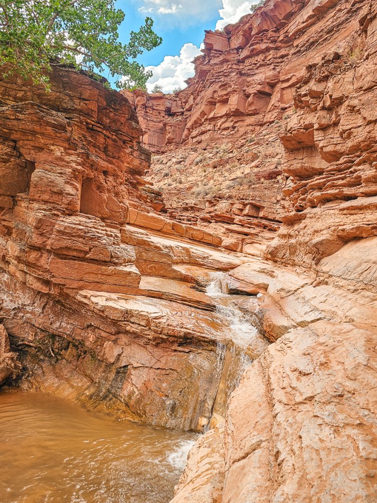
The third and final waterfall is 3/4 mile from the trail’s end. This one is really fun, as the stream has cut smooth, narrow, winding paths down through the rock. A lot of people slide down these falls (although the official recommendation from the rangers is not to slide, and just scramble down – ankle injuries are common here)
Overall, this hike was amazing thanks to the combination of tall canyon, river views, zero crowds until the last 1/2 mile, and the adventure aspect of hiking in the water and going down waterfalls.
- Distance: 5.8 miles
- Elevation Gain: 400 feet
- Difficulty: Moderate (Very flat but the decent distance plus the river walkings/crossings and waterfall scrambles would push it into moderate category)
Check out my dedicated post about the Sulphur Creek trail, with tons more information and explanation about this hike.
8. Sulphur Creek Waterfall Trail
If you don’t want to hike the full Sulphur Creek Trail, you can start behind the Fruita District Visitor Center (the endpoint) and follow the creek upstream to the third waterfall.
This is a popular option, especially for families, since it’s flat, relatively short, and ends at a scenic waterfall, with the option to climb up and slide down if you want. You can easily keep your feet dry along the way, unless of course you choose to splash around at the falls.
- Distance: 1.5 miles (round trip)
- Elevation Gain: 100 feet
- Difficulty: Easy
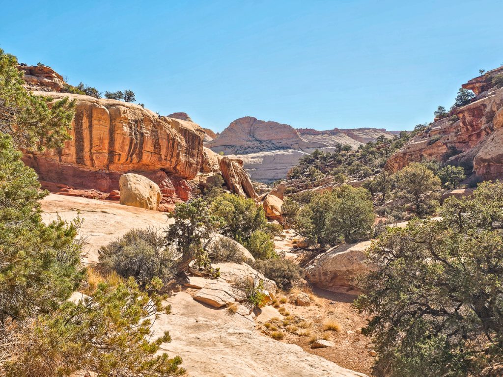
9. Cohab Canyon Trail
Cohab Canyon is a fun, scenic, and a bit of a unique trail in Capitol Reef.
The trail connects the Scenic Drive in the Fruita Historic District with Highway 24, right by the Hickman Bridge trailhead. You can start the trail from either trailhead, or even just do a point-to-point hike (though the trail isn’t all that long and most people do out and back.)
I did this as an out-and-back hike starting from the Fruita District. The first 0.3 miles climb steeply up switchbacks to the top of the ridge, but you’ll get great views of Fruita as you climb.
From there, the trail crosses in front of the cliff face to a narrow canyon tucked between rock walls – Cohab Canyon. It’s surprising because it feels like a canyon you’d walk through on the valley floor, but it’s actually perched halfway up the mountain.
The canyon walls rise steeply on both sides, giving an almost slot canyon-like feel, the walls striped in reds, oranges, and creamy beige. The cliffs have all kinds of bends, pockets, ledges, and smooth curves, creating interesting texture and undulations.
The trail follows the sandy wash through the canyon, weaving past scrubby trees and large boulders for about a quarter mile. Along the way, there are a few small side canyons that you can pop into and explore. Eventually, the canyon opens up, and the trail shifts to slickrock with more expansive views.
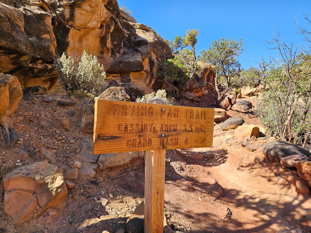
About halfway through the canyon, there are two spur trails you could consider.
The first is Frying Pan Trail, a long 3.5 mile connector trail heading south between Cohab Canyon and Cassidy Arch. It’s definitely an off-the-beaten-path hike in Capitol Reef, and a great option if you have two cars and want to hike it point to point.
The second is a side trail to the north that takes you up to the North Overlook and South Overlook over Fruita and the Waterpocket Fold. I actually took the Overlook spur trail by accident, but I’m glad I did – the views were phenomenal and only added a little bit of extra distance.
After this, the trail becomes much more rugged and rocky, with a deep ravine opening up, and the trail staying higher up on the ledge. You can also see the whiter mountains near Hickman Bridge in the distance, and the trail makes its way down the hill to the Hickman Bridge Trailhead.
If you’re doing out and back, you could easily skip the final ¼ of the trail, as you’re just descending to the parking lot and then turning back around to climb back up the mountain.
- Distance: 3.3 miles
- Elevation Gain: 797 feet
- Difficulty: Moderate
10. Fremont River Trail
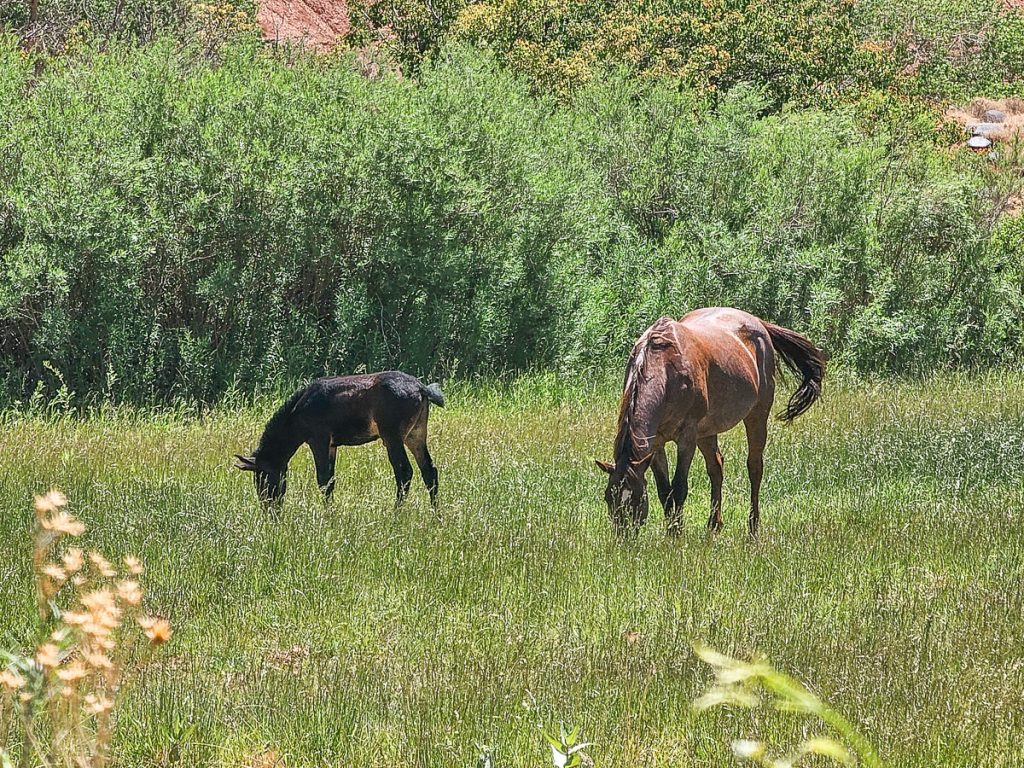
The Fremont River Trail is a short, easy stroll that starts in the Fruita Historic District. The trail follows the Fremont River, which is essentially a shallow stream, although the water is often obscured by grasses or trees as you walk along.
There are a few nice areas where you can go down to the water and play or even wade (although the water can be chilly – it was pretty brisk even in early June).
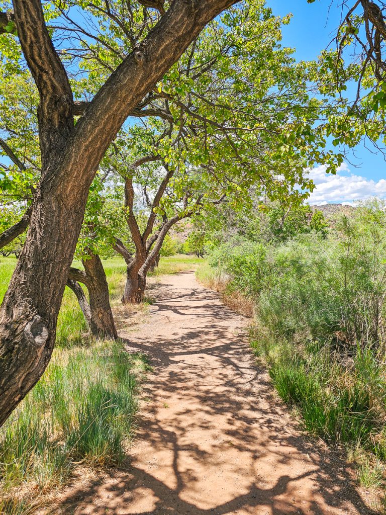
Sometimes you’ll walk under shaded trees, other times in direct sun. You’ll even pass by a few pastures (keep your eyes out for horses!).
The final 1/3 mile takes you from the riverside pathway up and along a ridge to the top of the mesa for panoramic views – you can easily stop when the incline gets steep if you’d rather keep this a short and easy hike.
- Distance: 2 miles if you go to the top of the mesa
- Elevation Gain: 400 to the top of the mesa
- Difficulty: Easy-moderate
Sites to Visit in the Fruita District Historic
Fruita was the site of the original Mormon settlement in the region, and today you can still visit many of the historic buildings and sites developed by these families in the 1800s. This type of historic and cultural “attraction” is very unique for a national park!
These are the different spots you can visit. All are very close to each other (with the exception of the schoolhouse):
Gifford House Museum for Fresh Pie

Whatever you do in Capitol Reef, you must stop at the Gifford House for homemade pies—they’re made with fruit grown in the park orchards, and are delicious. Strawberry rhubarb and mixed berry were our favorites, but they also have peach, cherry, and apple. There is also a large variety of jams, preserves, honeys, and other specialty/novelty items for sale.
The Gifford House is open from 9am-4:30pm, with a 45-minute closure from 12-12:45 for lunch. The pies always sell out early—both times I’ve visited, they’ve sold out around 1:30pm.
Implement Shed
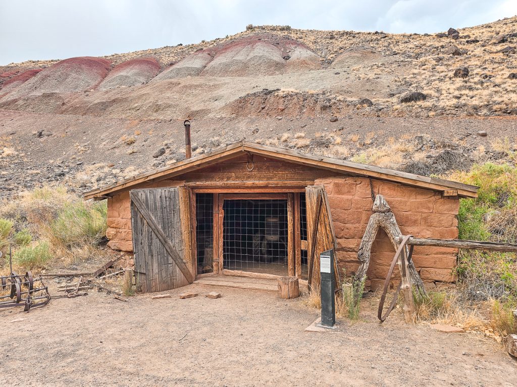
This sandstone building was built in the 1930s as a workshop, blacksmith shop, and tool shed. An old tractor and farming tools are still inside today and you can peak in and look.
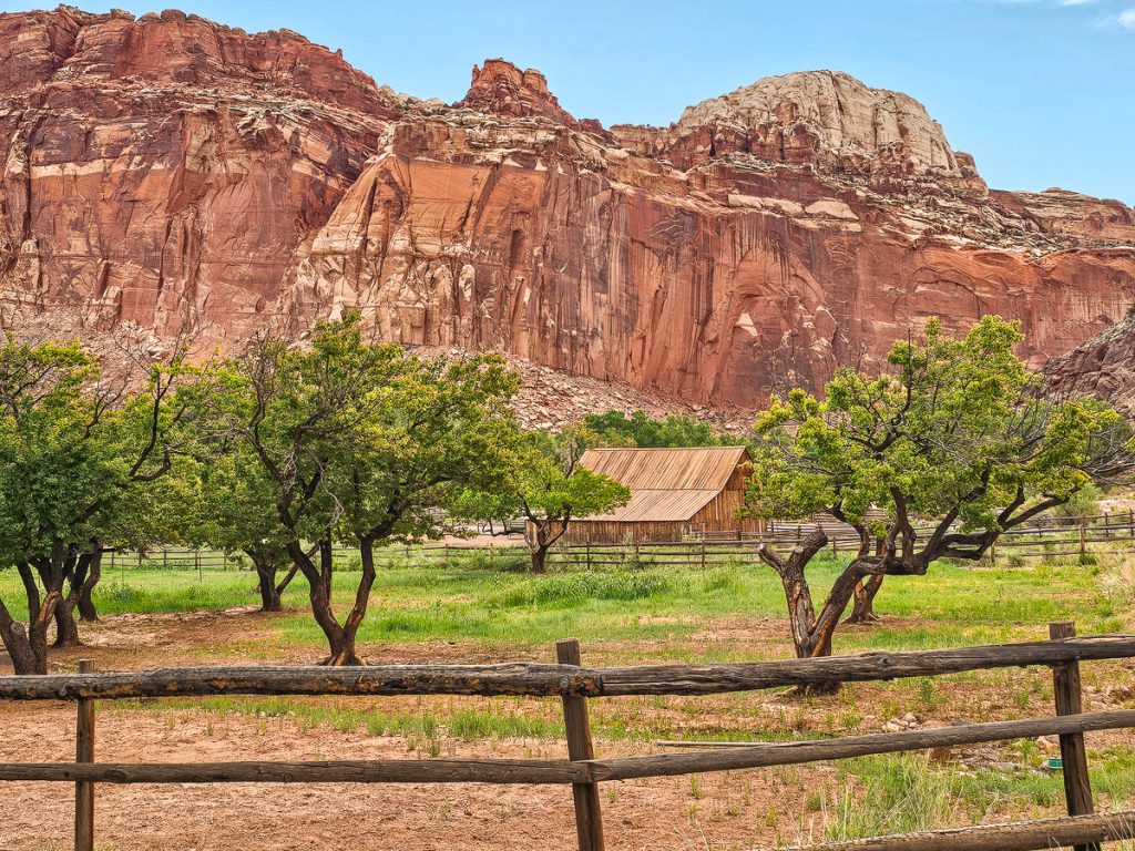
Pendleton-Jorgenson-Gifford Barn
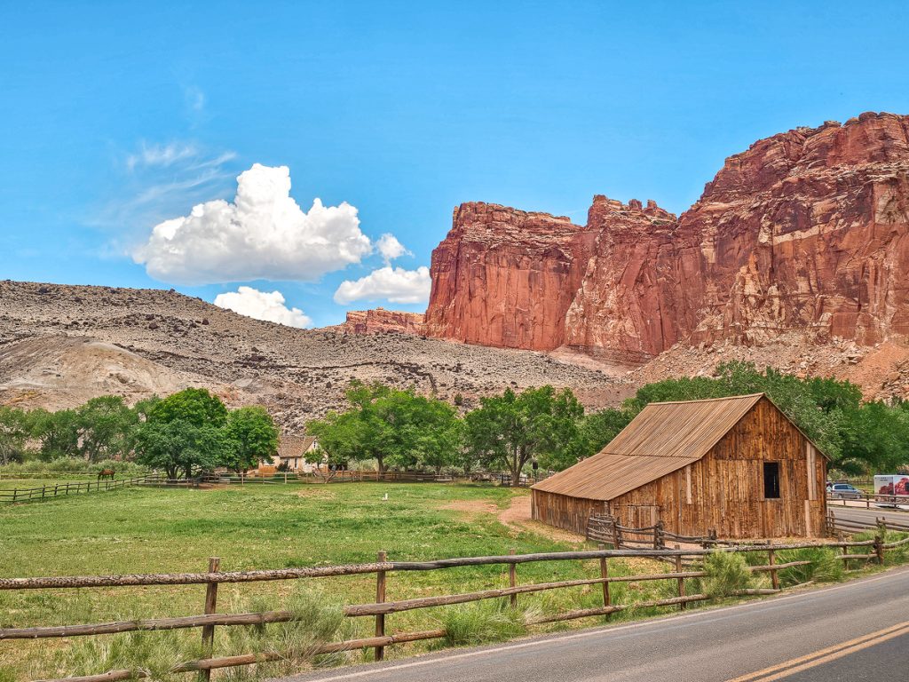
Built at the very end of the 1800s, traded ownership several times over the years (thus the long name), and was primarily used to store hay. A horse pasture is still right next to the barn, and horses are often in the field.
Orchards

Early settlers planted orchards in Fruita, and today 14 orchards are still in operation and bonus—they are open to the public to pick fruits in season! Check at the Visitors Center to find out which ones are open when you visit (as different orchards have different fruits, which are ripe and available to pick at different times of the year).
Whatever fruit you eat in the orchard is free of charge, and anything that you take out with you is just $2/lb.
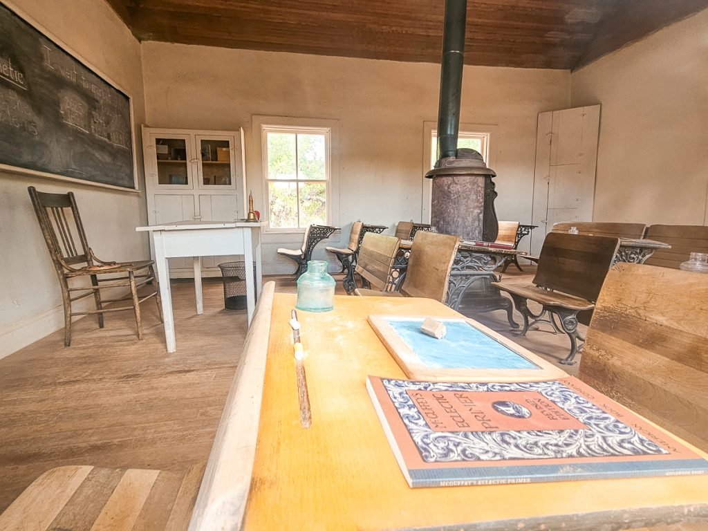
Schoolhouse
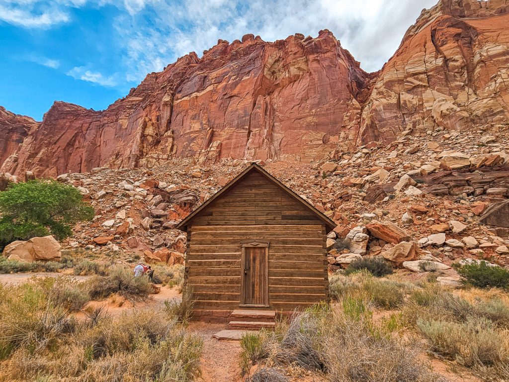
The schoolhouse is not in the historic district, but is just a few minutes away on Highway 24. This one-room schoolhouse was used from 1896-1941. It was the only public building in Fruita during that time, and also served as a church, and a community center for dances, meetings, etc.
You can’t go inside, but you can peek in through the windows.
Become a Junior Ranger
If you’re traveling with kids between the ages of 5-12, you’ll definitely want to stop at the Visitor Center to pick up a Junior Ranger booklet.
Kids need to complete a certain number of activities in the booklet (the number is based on age), that are all centered on Capitol Reef National Park, and then turn the booklet back in to receive a cute, wooden Capitol Reef Junior Ranger badge.

Just make sure that you pick up a booklet and turn it back in during the Visitor’s Center opening hours, which are 8am-4:30pm
Viewpoints in Capitol Reef
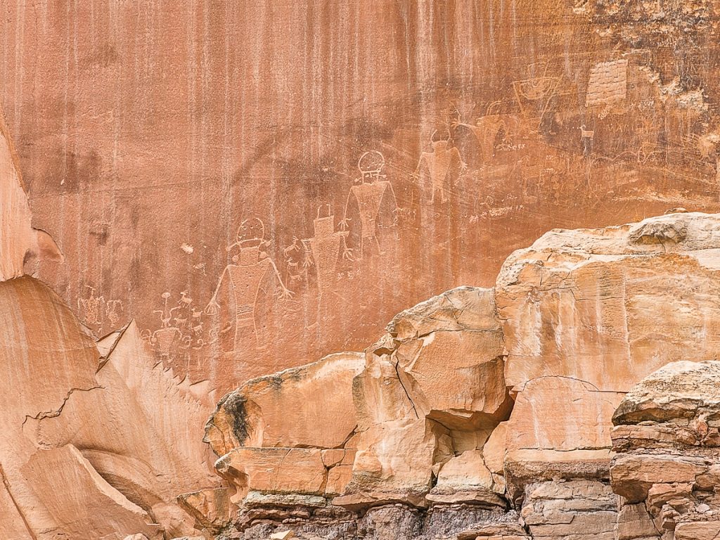
1. Petroglyph Trail
This short but scenic trail is located just off Highway 24, and takes you to petroglyphs created between 300 and 1300 AD by the ancestors of the Hopi, Zuni, and Paiute Tribes who once lived in the region.
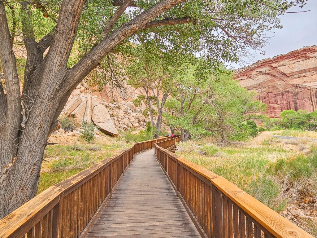
A 0.25-mile round-trip boardwalk winds alongside a babbling stream and under the shade of trees, leading you right up to the cliff face where several petroglyphs are visible. You’ll spot one carving about halfway down the boardwalk and a few more at the end.
A second, very short boardwalk heads directly up to the cliff, with views of the best set of petroglyphs: a small group of figures, almost resembling a family., etched into the rock.
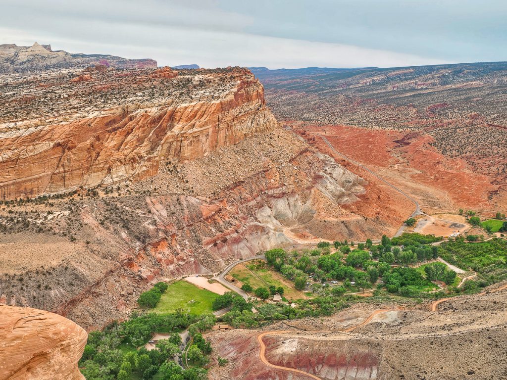
2. Panorama Point

Panorama Point, as well as the next two viewpoints, are all located very close to each other and are the perfect place to come just before sunset.
Panorama Point gives you a fantastic 360 view of the Waterpocket Fold and surrounding valley.
While you can see some great views just from the parking area, walk up the path to the top of the small hill for the best views.

3. Gooseneck Point

Gooseneck Point is a short, 600-foot walk from the parking area, and offers a great view down into a deep, winding canyon created by Sulphur Creek. The canyon makes a sharp “gooseneck” turn, and there are multiple places to sit and enjoy the view. I loved this incredible viewpoint!
4. Sunset Point

Sunset Point is a quick and easy 0.3-mile trail that winds along the rim of a small ridge, ending in incredible distant views of the Waterpocket Fold as it runs north to south along the Scenic Drive. It offers a broader perspective compared to the up-close views you get from Panorama Point along Highway 24.
While the sunset sets in the opposite direction of the Fold, the glow on the rocks at sunset is really magical!
Panorama Point, Gooseneck Point, and Sunset Point are all accessed off the same short road off of Highway 24. Goosenecks and Sunset Trails start from the same parking area. All three spots are great locations for sunset, but would also be really great at sunrise.
Practical Information
Hotels near Capitol Reef
There are no hotels or accommodations within Capitol Reef itself (aside from campgrounds). If you’re looking for a hotel, the closest options are in the town of Torrey—about 15 minutes from the Visitor Center.
These are a couple great options for where to stay in Torrey:
Broken Spur Inn
–This adorable hotel offers lovely, updated rooms
–You can also stay in a Conestoga Wagon (these fill up quickly!)
–An indoor pool, outdoor hot tub, and fire pit are available
–There’s a restaurant for breakfast & dinner
Check rates and availability here
Red Sands Hotel
–Modern, updated decor and design
–Indoor swimming pool (with a wall that opens to the outdoors)
–Outdoor firepit
–Laundry facilities
–Beautiful views
Check rates and availability here
Camping at Capitol Reef
The campgrounds at Capitol Reef are located in the Fruita historic district, just off the Scenic Drive. The campground is very nice, with many shaded campsites. And because Capitol Reef isn’t the most famous park in Utah, it’s not too difficult to get a site here.
Restaurants Near Capitol Reef
Outside of the pies at the Gifford House and the fresh fruit in the orchards, there is no food available for purchase in Capitol Reef. We’d recommend bringing in food for picnics during the day.
The nearest town is Torrey, Utah, about 15 minutes from the Visitor Center, which has several restaurants (go to Slackers for an excellent burger) and a general store.
For something a little bit different and a lot of fun, drive another 15 minutes past Torrey to the even tinier town of Bicknell. Sunglow Restaurant has an impressive pie display, but you need to order their pie sampler, which includes pickle pie and pinto bean pie.
I know, I know—it sounds terrible, but trust me!! The pinto bean pie is life-changing (in a good way, ha!)

How Long Do You Need in Capitol Reef?
You could easily spend a full 3 days doing all the hikes, viewpoints, and experiences on this list. If you don’t have that much time, this is the one day itinerary I recommend.
Best Time to Visit Capitol Reef
The best time to visit Capitol Reef is during the spring and fall, when the weather is mild and pleasant. Winter can see cool to cold temperatures, and sometimes even snow. Summers can be blistering hot, although mornings and evenings do cool down quite a bit.
The Wrap Up
It’s easy to overlook Capitol Reef National Park, and many do just drive through it on their way to other adventures. But it has some truly incredible hikes and views, as well as some interesting history behind it. You won’t regret taking some time to explore this incredible park.