10 Best Hikes in Goblin Valley State Park
Planning to do some hiking in Goblin Valley? Read on for my guide to the best 10 hikes in Goblin Valley State Park
Most known for its “bucket list” worthy national parks (aka the “Mighty 5”), Utah also has multiple incredible state parks that tend to fly under the radar of many visitors. And one of the absolute funnest parks is Goblin Valley State Park.
This park, tucked away in the middle of nowhere in central Utah, is filled with short, squat, mushroom-like rock formations called “goblins” creating some of the most alien-like landscapes.
The goblins are formed through the gradual and uneven erosion of the sandstone and siltstone in the rock bed. It creates quite the vista.
Officially, these goblins are actually hoodoos, the same type of formations you can find in Bryce Canyon National Park in southern Utah, and also at the Toadstool Hoodoos near Page, Arizona. However, they vary in color, size, and what types of rocks they are made up of.
But there is more to visiting than just admiring the goblin formations from afar. Despite being a relatively small park, there are ample opportunities for hiking in Goblin Valley State Park. In this post, we’re diving into the best trails in and around the valley, which offer a wide variety of views and destinations.
No time to read now? Pin it to read later! ⬇️

Quick Tip: If you’re planning a Southwest US road trip, I recommend reserving a rental car ASAP for the best prices and availability. I always book my car with this rental car aggregate site to find the best deals.
10 Best Hikes in Goblin Valley State Park
1. Valley of the Goblins: Valley 1

The Valley of the Goblins is the main area of Goblin Valley State Park, where you’ll find the characteristic clusters of goblin formations. It is directly adjacent to the main parking lot and the easiest to explore.
There are actually three different valleys in Goblin Valley, all filled with goblins and surrounded by ridges of tall pinnacles. These different valleys are simply called Valley 1, Valley 2, and Valley 3.

One reason that Goblin Valley (specifically Valleys 1, 2, and 3) is SO fun is that there really are no trails – you can walk wherever you want, and even climb on and explore any part of the structures and formations. In fact, many of the hoodoos are clumped together and have little passageways and “rooms” in the clumps, which are really fun for kids to climb through and explore.

It’s THE best “hike” in Goblin Valley, although in many ways, it just feels like one, giant playground!

Valley 1 is what people think of when they say Goblin Valley – it’s the main section of the state park, the biggest valley, and the area that sees the most visitors, by far.
Valley 1 is a large, flat valley with mostly squat, mushroom-shaped goblins, which are anywhere from 5-10 feet tall in the valley. The valley is surrounded by a large ridge that is covered with stone structures resembling the hoodoos in Bryce Canyon– they were much taller, knobby, and shaped more like pinnacles. It offered a beautiful contrast between the pinnacles on the cliffside and the squat goblins in the valleys, with the goblins along the ridge soaring up to 30-50 feet high.

Sometimes the goblins were on a mound of dirt, so the goblin itself was a bit shorter, but the whole section was fairly tall.

The main parking lot for Goblin Valley is just adjacent to Valley 1, and there are both vault and flush toilets here, as well as a running water spigot, and a covered pavilion. It’s a large parking lot with a lot of space.
2. Valley of the Goblins -Valley 2
From the parking lot, if you’re overlooking Goblin Valley, you can look to the right and see a large gray-white rock that looks dome in the distance.

That rock marks the entrance to Valley 2, and it is very very quick and easy to get here from Valley One. This area is particularly fun as well, as you’re climbing up through a maze of pinnacles and spires and through a “mountain pass.”

The goblins in Valley 2 are a little bit taller and a little bit less squat. There are also more “rolling hills” in Valley 2, instead of being completely flat like in Valley 1. There also tends to be fewer people in Valley 2.


Although there are some trails that take you up and over the hills from Valley 1 to Valley 2, once you’re here, there aren’t any trails to follow, you can just wander around and explore.

3. Valley of the Goblins – Valley 3
The final valley, Valley 3, is even beyond Valley 2. In contrast to Valley 1 and 2, which are directly adjacent to each other, there’s a little bit of an open area between Valley 2 and 3, separated by some bluffs. You can either just walk straight across the bluffs between the two valleys, but the easier way is to hop on Red Canyon Trail.
Red Canyon Trail actually starts at the very southern end of the parking lot, and runs alongside all three valleys. You can pick it up at any point along the valleys.

Red Canyon Trail runs through a wash, and is sometimes bordered by rock walls, and sometimes completely exposed.
There’s actually not any signage marking where the turnoff to Valley 3 is – you just have to watch the map and pay attention. We actually went way too far and went down into the more southern part of the valley and then had to work our way back up to the main section of Valley 3 (I do not recommend doing this, ha!)
We dropped a pin, though, at the best turnoff point we found coming back out, I’d recommend saving this pin on your phone (turn your map to satellite mode to be able to see the terrain and for the pin to actually be helpful) and looking for these little “stairs” in the side of the wash.
Alternatively, you can also follow along on our Alltrails route we created on this hike. You’ll see that we went way past Valley 3, but we also marked a waypoint on the map for Valley 3 and the turnoff point.

Valley 3 has some taller hoodoos goblins as well as a tall line of spindly rocks around the perimeter of the valley. The main part of Valley 3 is also pretty densely packed with goblins that are right up against the edge of the cliff.

We also were able to walk and climb up the tall spindly edges around the exterior to get some incredible views into and across Valley 3.
Hiking to and around Valley 3 is very fun – you are very deep in the park, away from just about everyone else, and the views at Valley 3 are really beautiful!

4. The 3 Sisters Trail

The 3 Sisters is a unique rock formation located just off the main road, after the visitor center but before you get to the main parking lot in Goblin Valley. This tall goblin formation is composed of three rock pillars ascending up from a single rocky base, plunked right in the middle of the desert brush.
You can admire it from a little pull-off spot on the main road or do the very short 250-meter hike to get an up-close view.
- Distance: 0.6 miles round trip
- Elevation Gain: minimal
- Difficulty: Very easy
5. Goblin’s Lair

Goblin’s Lair, also known as “Chamber of the Basilisk” is an exciting hike to a “cave” located on the backside of the Goblin Valley ridge. This hike starts from the north end of the main parking lot. You’ll descend through some of the “foothills” around Goblin Valley, while admiring the tall, knobby brown pinnacles surrounding the valley.

After about 1/2 mile, you’ll reach the sandy wash, and continue walking in or along the wash (a dry creek) until you finally turn south and walk along hard-packed, flat ground along the cliffs. This section can get pretty blazing in the heat of summer, so bring more water than you think.

At the end, you’ll cross some sand dunes, and then climb up a very steep pile of boulders to reach the entrance to Goblin’s Lair. The mouth of the cave is actually pretty high above the cave floor, so you’ll also climb down another pile of rocks to reach the interior.
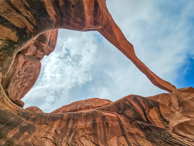
This is an extremely cool, tall cave – that’s actually a slot canyon! Rocks have just covered the top of the canyon, creating a cave-like atmosphere, but you can still see openings between the rocks where shafts of light stream in.

And actually, those openings at the top serve a very fun purpose. Instead of hiking into the cave from the bottom, you can actually go on a rappelling adventure and rappel down into the cave from the top! This top-rated excursion is good for rappelling novices and gives you a unique and exciting look at Goblin’s Valley and Goblin’s Lair.
>>Check rates and availability for this Goblin Valley Rappelling Tour here
Whether you just hit the regular trail or do the rappelling excursion, the Goblin’s Lair is definitely one of the best hikes in Goblin Valley State Park.
- Distance: 2.5 miles round trip
- Elevation Gain: 164 feet
- Difficulty: Moderate
6. Goblette Lair
Goblette’s Lair is just another 0.25 miles beyond Goblin Lair, on the same trail. You’ll continue up along the side of the ridge wall and scramble down in this similar, yet much smaller cave.
- Distance: 0.25 miles beyond Goblin Lair
- Difficulty: Moderate
7. Carmel Canyon Loop

The Carmel Canyon Loop Trail starts at the north end of the parking lot, at the same trailhead as the Goblin’s Lair trail. About 50 feet into the trail, there’s a side trail on the left hand side that starts the Carmel Canyon Loop.
Take this left trail, which will immediately descend into the hills around the exterior of the Valley of the Goblins.

These hills quickly turn into a true slot canyon experience, with tall walls and a narrow path only a few feet wide through them. There are a few drops on the trail, but they are easy enough to slide down.
After about ¼ to ⅓ of a mile, you’ll reach the junction with the 3 Sisters Loop Trail. Make you take a look back on this section of the trail to admire the 3 Sisters rock formation from behind.

The trail then opens up into a wider canyon, and you’ll be walking in a sandy wash between some hills. After walking for ¾ mile, the trail junctions with the Goblin’s Lair Trail, and you can either continue on to Goblin’s Lair, or take a hard right and complete the loop back to the parking lot.

Heading back to the lot, you’ll climb some hills that are next to the outside edge of Goblin’s Valley, with a view of the tall, spindly columns of hoodoos right next to you – they are breathtaking! Finish an easy climb up the “foothills” of Goblin Valley to reach the parking lot.
It’s recommended to go clockwise on the Carmel Canyon Loop (the way described here) because the drops in the slot canyon are easy to slide down, but are much harder to climb up. Every time it rains there is more erosion and the drops become just a little bit more pronounced.
I really enjoyed this hike and think it’s one of the top easy trails in Goblin Valley.
- Distance: 1.2 miles
- Elevation Gain: 95 feet
- Difficulty: Easy
8. Curtis Bench Trail
The Curtis Bench Trail takes you up to the top of the butte near the campsite, and you can walk along the top of the butte to the end of the plateau, where you have a nice overlook of Goblin Valley. This trail is particularly nice in the late afternoon and for sunset.
- Distance: 2 miles round trip
- Elevation Gain: 108 feet
- Difficulty: Easy
9. Entrada Canyon
The Entrada Canyon trail connects the campsite to the Valley of the Goblins, and mostly functions as just a connector trail. A winding path through the dried river wash takes you through a small, short ravine, sometimes surrounded by hills or little goblins.
It’s fine, but not the most awesome trail in Goblin Valley, so I would use it mainly if you need to get between the campground and Valley 1.
- Distance: 0.9 miles one way
- Elevation Gain: 180 feet
- Difficulty: Easy-moderate
10. Little Wild Horse Canyon
Little Wild Horse Canyon is a fun slot canyon trail located on the San Rafael Swell, a mass of land that was pushed up from underneath (known as an anticline). The trailhead for Little Wild Horse Canyon is about a 5-minute drive outside of Goblin Valley, and it is outside the fee area for the state park.
From the parking lot, you’ll walk about ½ mile on a wide, sandy wash before you get to the start of the canyon. The first part of the canyon is fairly wide, with sloping walls and a path that’s about 10-15 feet wide.

The canyon is very dynamic visually and exciting to hike in, as there are a lot of horizontal layers in the rock walls, with different ledges to climb on, and small “caves” to sit in. You’ll also notice lots of “pocked” holes in the walls from where pockets of softer sediment eroded.

The farther in you hike, the taller and straighter the walls become, and the narrower the path becomes. Eventually, you’ll be hiking along a path only a couple of feet wide – so pretty narrow, but plenty wide to fit almost any size body without having to turn sideways.
One big perk of the narrow canyons is that you have a lot of shade and cooler temps, which feel amazing on a hot summer day.
We hiked this in the middle of the day in July – it was approaching 100 F, but the hike was actually pretty pleasant thanks to the fairly abundant shade once we got into the tighter slot canyon areas.
When we did this hike with our whole family, we decided to just go to the section of the trail that was the “most slotty”, so we went in about 1.5 miles and then turned around (for a round trip total of just under 3 miles).

Important: You can check the weather report on the outside of the Visitor’s Center at Goblin Valley (without paying), or online here. This is extremely important, as it tells you the danger of flash floods for the day. Flash floods can and have killed hikers in slot canyons, so it’s very important to check for and heed any warnings.
Remember, leave no trace. This includes packing out all garbage from the canyon, and not making marks of any kind on the rocks.
- Distance: You can either do an out-and-back hike in Little Wild Horse Canyon, which is 3.6 miles one way. Alternatively, you can do a loop hike, by hiking through Little Wild Horse, walking down behind the Reef Road, and then back out neighboring Bell Canyon. This loop is 8 miles total.
- Elevation Gain: We gained 328 feet in our 2.8 mile round trip hike
- Difficulty: Easy
Goblin Valley State Park FAQs
Where is Goblin Valley State Park Located?
Goblin Valley is just south of the I-70 interstate down State Hwy 24, and is about 1.5 hours from Moab (the town by Arches National Park and Canyonlands National Park). The nearest town to Goblin Valley is Hanksville.
Hours and Entrance Fees
The entrance fee is $20 per vehicle. Because this is a state park, National Parks Passes are not valid here. It is open 24 hours.
Observing the Night Sky
Goblin Valley is a certified dark sky park and has one of the darkest skies on Earth. The park is in the middle of nowhere and super isolated so there is virtually no light pollution. Staying at the park until after dark and then star gazing from one of the trails or in the middle of the Valley of the Goblins is a fantastic activity.
Can You Fly a Drone in Goblin Valley State Park?
You can fly your drone in Goblin Valley as long as you obtain a permit from the visitor center, which costs $10.
Are Dogs Allowed in Goblin Valley State Park
Yes, dogs are allowed in Goblin Valley State Park and on the trails, as long as they stay on a leash.
Camping at Goblin Valley State Park

There’s a campground not far from the valley in the state park. You can camp in tents or RVs or even rent two yurts that are set up in the campground.
Hiking in Goblin Valley – The Wrap Up
There are plenty of opportunities to go hiking in Goblin Valley State Park, and enjoy one of the best state parks in the US. Even with just a half day, you can enjoy some of these best hikes in Goblin Valley and enjoy the crazy views and landscapes that the park has to offer!